
-
0:50

Beautiful weekend starts this morning
-
2:32

Gus Macker Three-on-Three Basketball Tournament is taking over...
-
1:44

Feeling like a sauna next week
-
3:12

How to keep yourself and others protected during firework season
-
0:49

Showers creeping into Michiana
-
1:32

Judge approves $25 million water lawsuit settlement in Benton...
-
1:00

Scattered showers through the day
-
1:53

Hispanic Community Child Safety Meeting: A Call To Action
-
2:51

Obama Presidential Center features work of South Bend company
-
1:54

This week’s ABC57 Cub Reporter is Isaac Knefely
-
1:16

Real summer heat returns next week
-
2:28

South Bend storm drain mural project complete

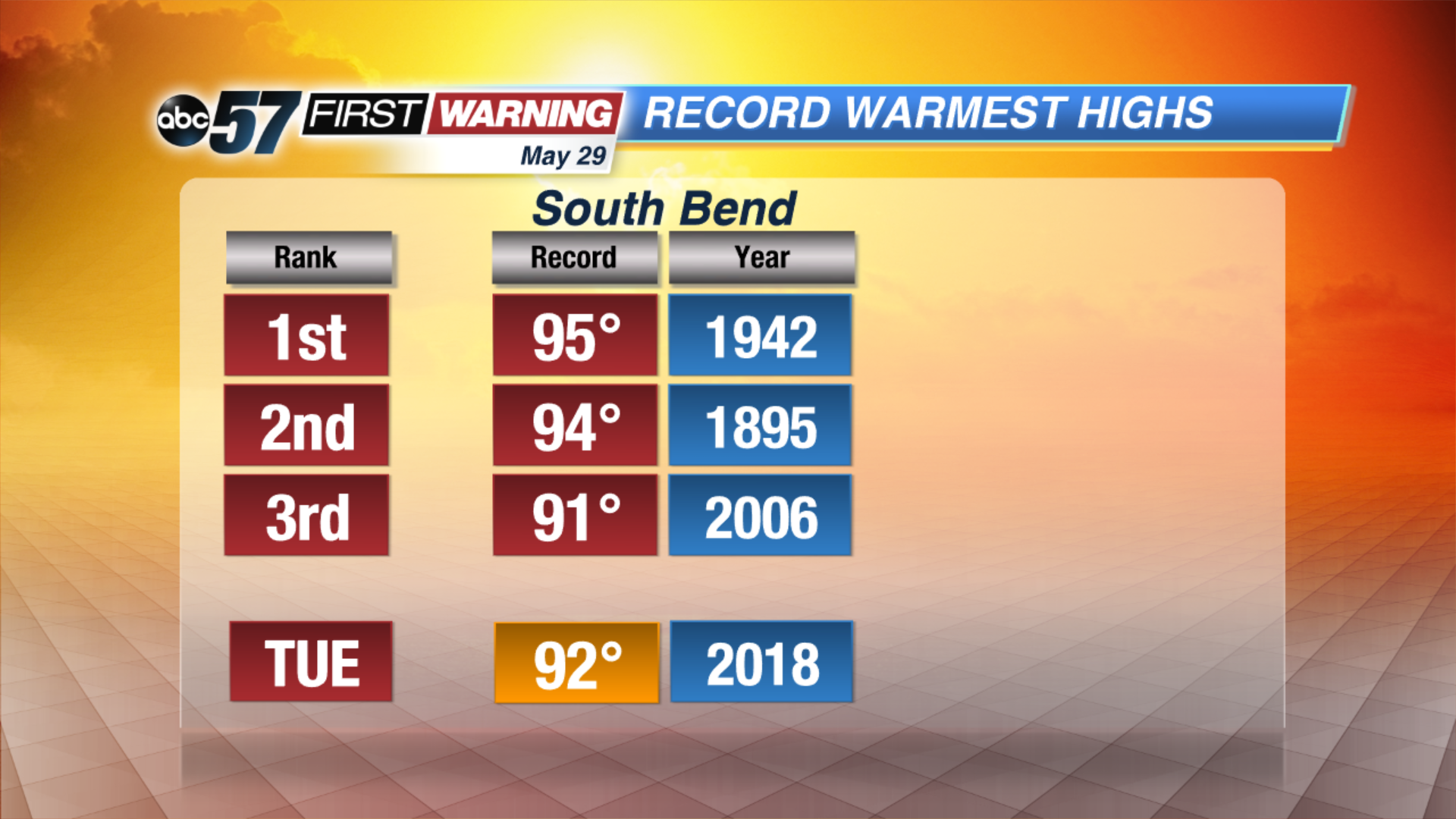
The mini heat wave continues through Tuesday, highs will near record levels once again, peaking in the low 90s. The heat breaks Wednesday with showers and thunderstorms, as the remnants the tropical system Alberto swings into the Midwest.
The humidity will drop to end the week, the coming weekend is drier and more comfortable.
Tonight: Mostly clear, steamy, low 70.
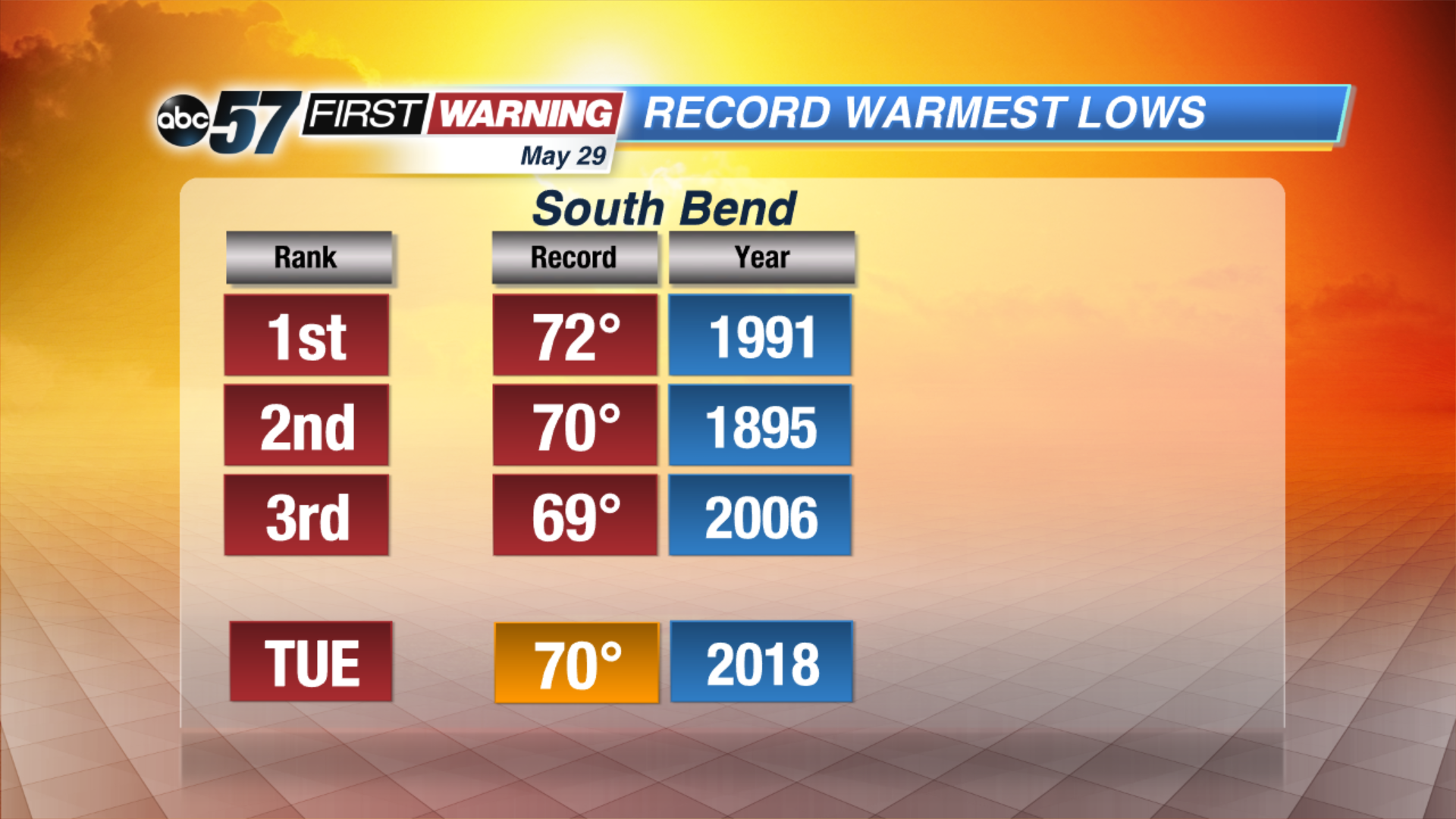
Tuesday: Partly sunny with a slight chance of a PM shower, high of 92.
Wednesday: Cloudy with scattered showers and storms, high of 82.
Thursday: AM showers, partly cloudy, high of 84
Sign up for the ABC 57 Newsletter