The track matters: A look at Monday's snow potential

-
2:13
Sticky out the door, stormy afternoon
-
1:56
South Bend community letting their inner child shine at VPA’s...
-
1:12
The Links at Four Winds Field kicked off Friday
-
1:40
Road construction brings difficult times to not only travel but...
-
3:43
People need to stop dumping in District 2,’ Ride-along with...
-
1:30
Severe storm chances trending down for Michiana Friday and Saturday
-
0:51
Groundbreaking at new Elkhart apartments Thursday
-
0:49
One dead after hit and run with motorcycle in Elkhart Thursday...
-
1:12
Marshall County Historical Society & Museum holds annual fundraiser
-
5:48
Local author’s new book makes reading fun
-
1:39
Severe weather possible amidst several rounds of showers and...
-
2:23
Pulaski County Historical Society giving history a new home
Little change in the weather through Friday. Saturday the region will be brushed by a stronger system to the east, bringing a chance of drizzle or flurries, damp and dreary either way. Sunday is cooler, a lull before a storm moves into the Ohio Valley Monday. Confidence is growing there will be some snow. The track of the low will dictate how big of a snow factor the area receives.

Tonight: Mostly cloudy. Low of 32.
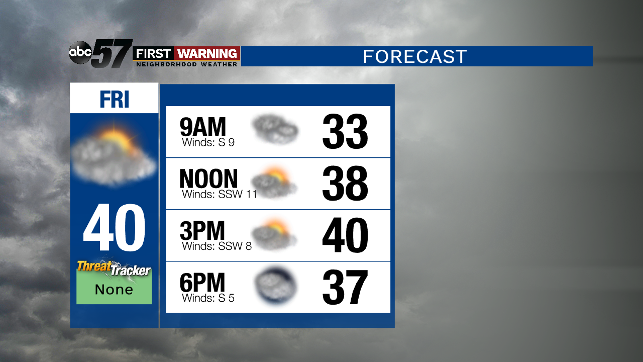
Friday: Mostly cloudy. High of 40.
Saturday: Cloudy. Chance of light rain and/or snow. High of 38.
Sunday: Mostly cloudy. High of 30.

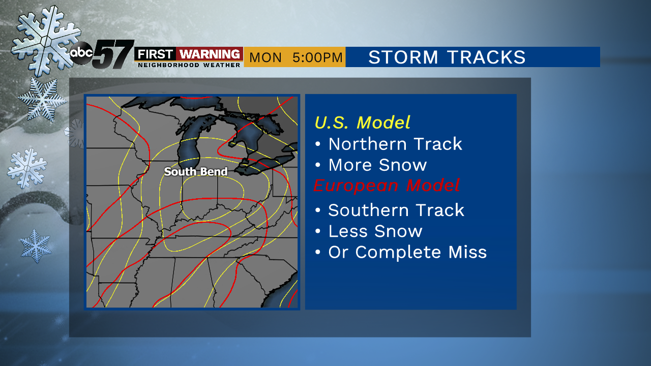
Models are showing more agreement of an Ohio Valley storm track, this would likely bring snow to Michiana.

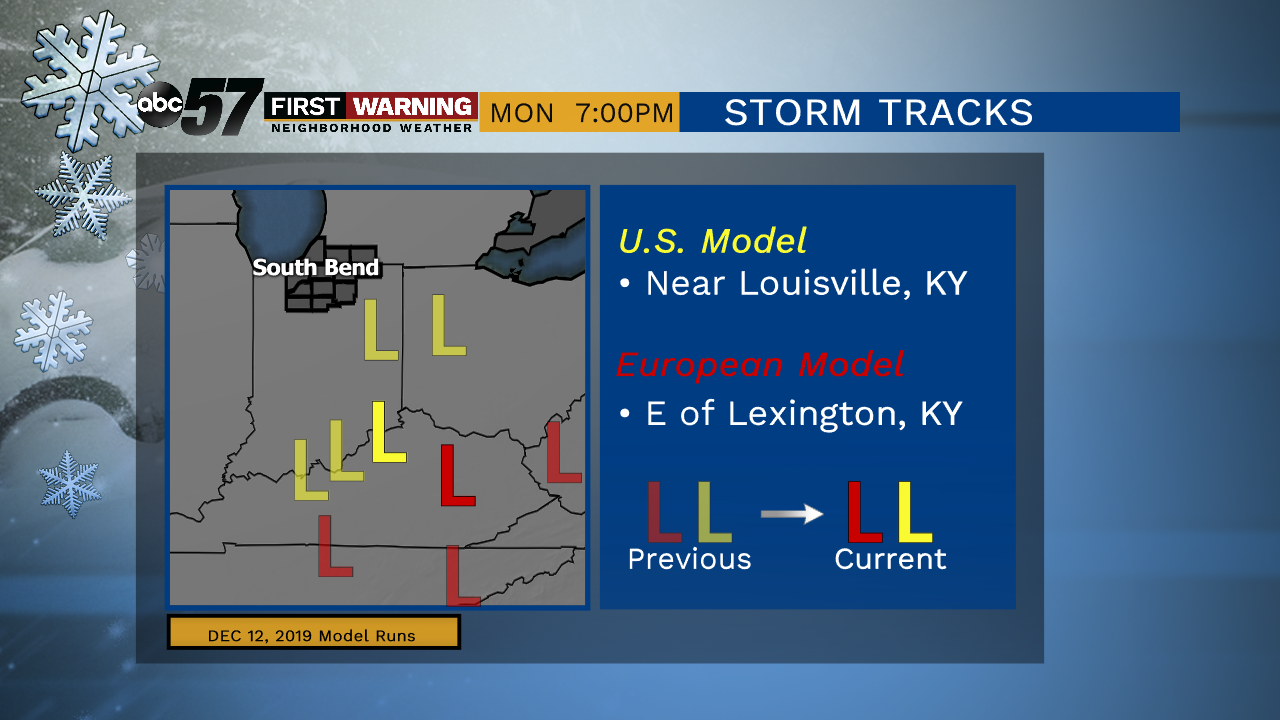
The European model has been most consistent with its performance to date. We are currently favoring 'EURO' but not ignoring the U.S. GFS model.