Tracking rain and the chance of strong to severe storms


Thursday, March 19th, 2020
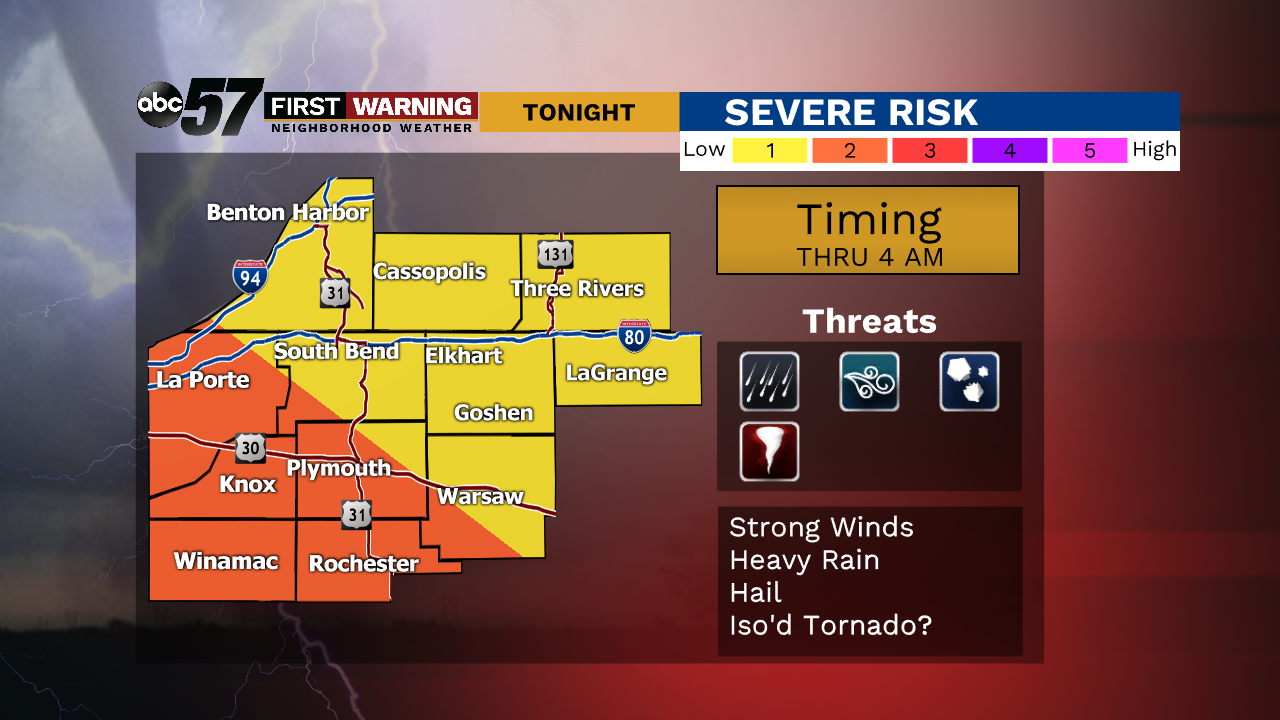
The next round of rain moves in this afternoon. There will be two rounds of it today. The first will mainly be rain, maybe a rumble of thunder, the second round late this evening into the night. The second round brings our first concern of the year for stronger thunderstorms and an isolated severe storm cannot be ruled out. Make sure you’re staying weather aware.
Behind this system, temperatures will drop drastically for Friday with breezy conditions. It’s quiet and brighter over the weekend. Just a bit on the chilly side with upper 30s to low 40s for daytime highs.
Today: Rain showers, especially in afternoon and evening. Thunder possible. High 63.
Tonight: Thunderstorms early, strong to severe possible. Low 56.
Friday: A few AM showers then partial clearing. Breezy with temperatures falling from 56.
Saturday: Mostly sunny. High 38.