Tracking wet snow Wednesday into Thursday
By: Emily Kennedy
Posted: Feb 4, 2020 3:12 AM EDT

-
0:58

Cooler out the door
-
1:27

Updated Tornado Survey- June 1, 2026
-
1:13

Severe Weather possible midweek
-
1:07

Quiet Monday, Stormy Midweek
-
2:52

GhostLight Theater presents Next to Normal Performance for Benton...
-
2:40

Car Show raises funds for Deputy Jon Samuelson
-
0:47

Nappanee became Candyland Saturday
-
2:01

The Juneteenth Cultural Alliance hosts Juneteenth celebrations...
-
1:11

Morning rain, breezy afternoon
-
0:53

Showers out the door
-
0:38

Two injured in overnight shooting
-
2:52

Cleanup efforts continue in Kouts after EF-3 Tornado
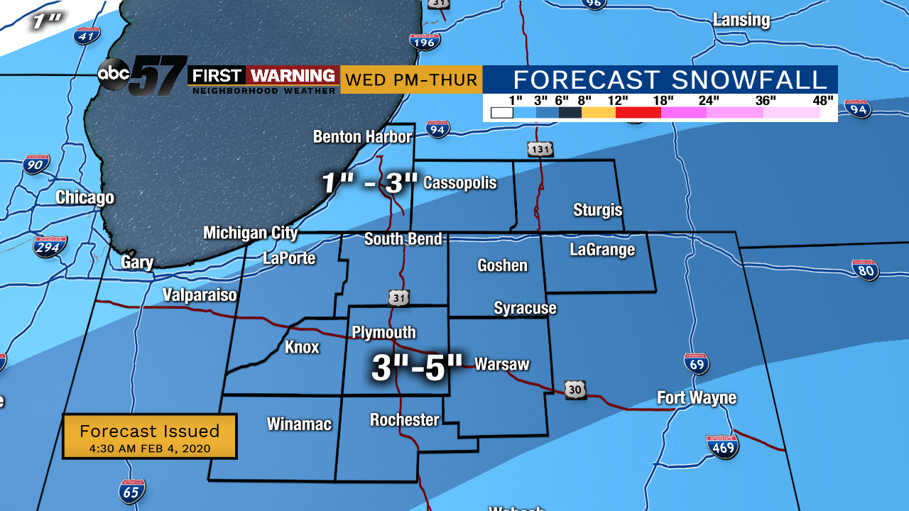
Tuesday, February 4th, 2020
Colder air begins to move back in today, keeping our temperatures in the 30s. We could see a quick chance of rain/snow mix, mainly after midday. The higher impacting system moves in Wednesday evening, bringing wet snow. The heaviest snow is expected Wednesday night into Thursday morning. Snow could add up over 3” along and south of US-30. This will likely lead to slow commutes Thursday morning. A slight chance of snow again on Friday. We’ll finally see some sunshine again on Sunday.
Today: Mostly cloudy with a chance of rain/snow mix. High of 38.
Tonight: Cloudy. Low of 25.
Wednesday: Cloudy, PM snow showers. High 32.
Thursday: Snow showers, especially in the morning. High 32.
Sign up for the ABC 57 Newsletter