As you're probably well-aware, this year has featured plenty of rainfall in Michiana. May was especially wet with 24 of 31 days seeing at least some rain. Unfortunately, more rain is the forecast over the next week.
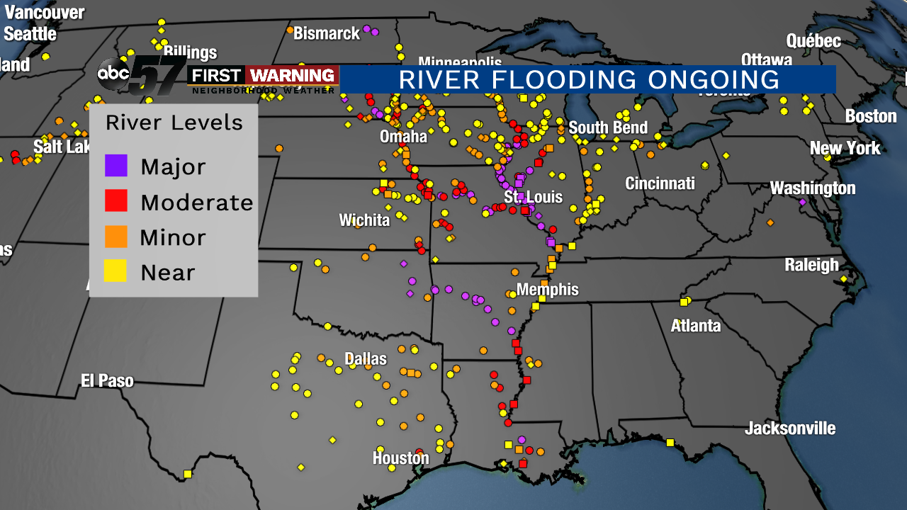 All river gauges in near-flood stage and flood stage as of 12 p.m. Tuesday.
NWS
All river gauges in near-flood stage and flood stage as of 12 p.m. Tuesday.
NWS
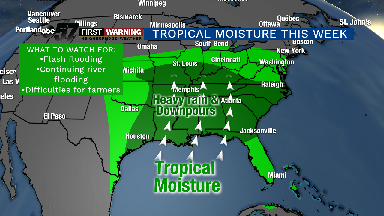
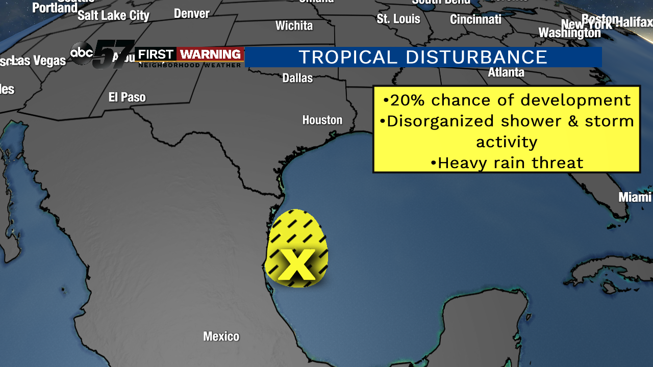
It won't just be us seeing additional rain, though. Millions east of the Rocky Mountains are in line to see rain add up quite a bit over the next week or so. And it's rain that most locations simply do NOT need as flooding and river flooding are still ongoing. What's different this time around, though, is most of the rain set to fall across the Plains, Deep South, Southeast, Mississippi Valley, and Ohio Valley will be tropical in nature. That's because a tropical disturbance off the coast of Mexico will move north-northeast into the Southeast through this weekend.
 NHC
NHC
That area of low pressure will work its way into Texas, Arkansas, Tennessee, and Kentucky through the weekend and into early next week. As it does so, it will be accompanied by plenty of Gulf of Mexico moisture. The result? Plenty of rain and a tropical feel to the air to areas mainly south of I-80/90.
Some of the rain will be heavy and downpours are likely. Fortunately, most of the heavier rain and tropical air will stay just to our south. That doesn't mean we won't see rain from that system, but the heaviest rain and flooding should stay south of the Michiana area. Any rain that we do see will likely fall late Saturday into Sunday and Monday.
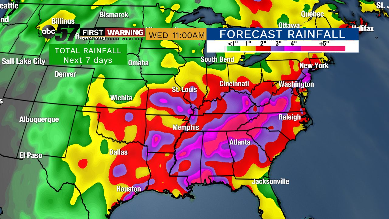 Potential rainfall thru Wednesday, June 12th, at 11 a.m.
Total rainfall through June 12th will add up considerably across parts of the Southern Plains, Deep South, Southeast, Mississippi Valley, Ohio Valley, and Tennessee Valley. A solid 1-3" of rain is likely for everyone in those geographical regions with the potential for 3-6"+ depending on where the heaviest rain winds up falling. Instances of flooding and river flooding are likely, flash flooding is a real threat and agricultural difficulties will continue for many.
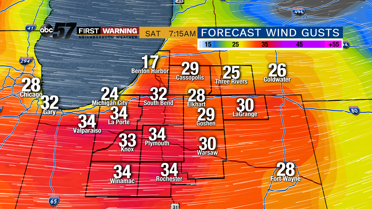 Breezy winds are likely at times Friday thru Monday.
For us, the next 7 days will likely feature 0.5" to 1.5" of rain. Some of that will fall tonight into tomorrow; the rest will fall late this weekend into early next week with moisture from the tropical disturbance arriving. The other impact that the system will have on us locally this weekend will be breezy winds. It won't be overly windy, but periodic wind gusts of 20-35 mph are expected Friday thru Monday as the area of low pressure slowly passes just to our south.