Tropical downpours tonight, heat wave begins Wednesday

-
2:10

Notre Dame men’s basketball embracing urgency as Shrewsberry...
-
2:37

Local Beef-A-Roo employees still owed paychecks as private equity...
-
1:42

More storms through 8:00 p.m.
-
1:06

2nd annual Inclusive Art Fair
-
2:20

Tracking severe weather through the mid-afternoon
-
3:17

Applications open for Fall Citizens Police Academy in South Bend
-
2:23

Elkhart County 4H Fair food vendors celebrate 50th year of business
-
2:16

Young football athletes learn about protecting their bodies,...
-
1:24

Storm track timing could be shifting
-
0:57

Unity Gardens brings music, food, and crafts for Westside BBQ...
-
1:50

Quiet evening, Storms after Midnight
-
0:57

Deer Creek Hunt Club throws a skeet shoot event for Deputy Jon...

Scattered showers and storms continue through tonight, localized downpours of +1” are possible.
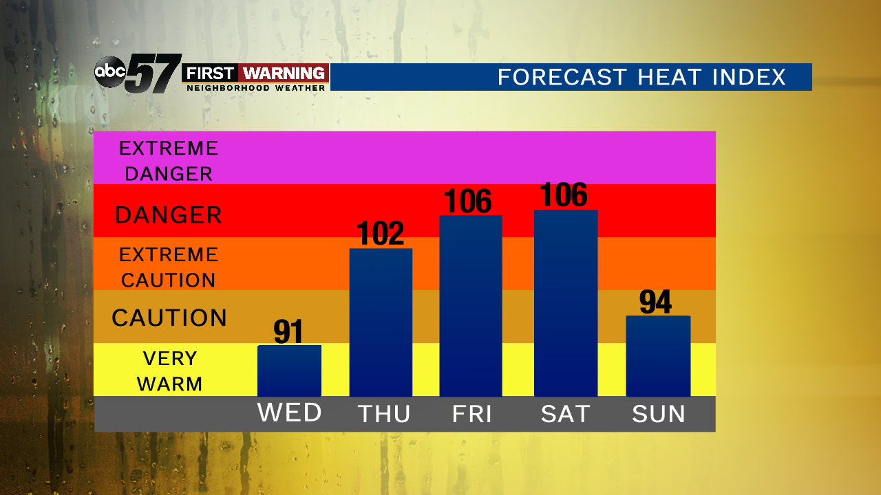
The heat wave begins Wednesday as highs will make a run towards 90, the heat index will reach the mid-90s thanks to sweltering humidity. A few pop-up showers are still possible but as ‘Barry’ exits the more sunshine will only make it hotter.
Extreme heat and humidity will last from Thursday through Sunday with Friday and Saturday being the hottest days, the heat index could peak as high as 110. Be proactive in keeping cool and hydrated, heat is the number one weather killer.
Tonight: Scattered showers/storms, low of 72.
Wednesday: Partly cloudy, chance of a shower, high of 90.
Thursday: Hot and very humid, slight chance of storms, high of 92.
Friday: Extreme heat, high of 95.