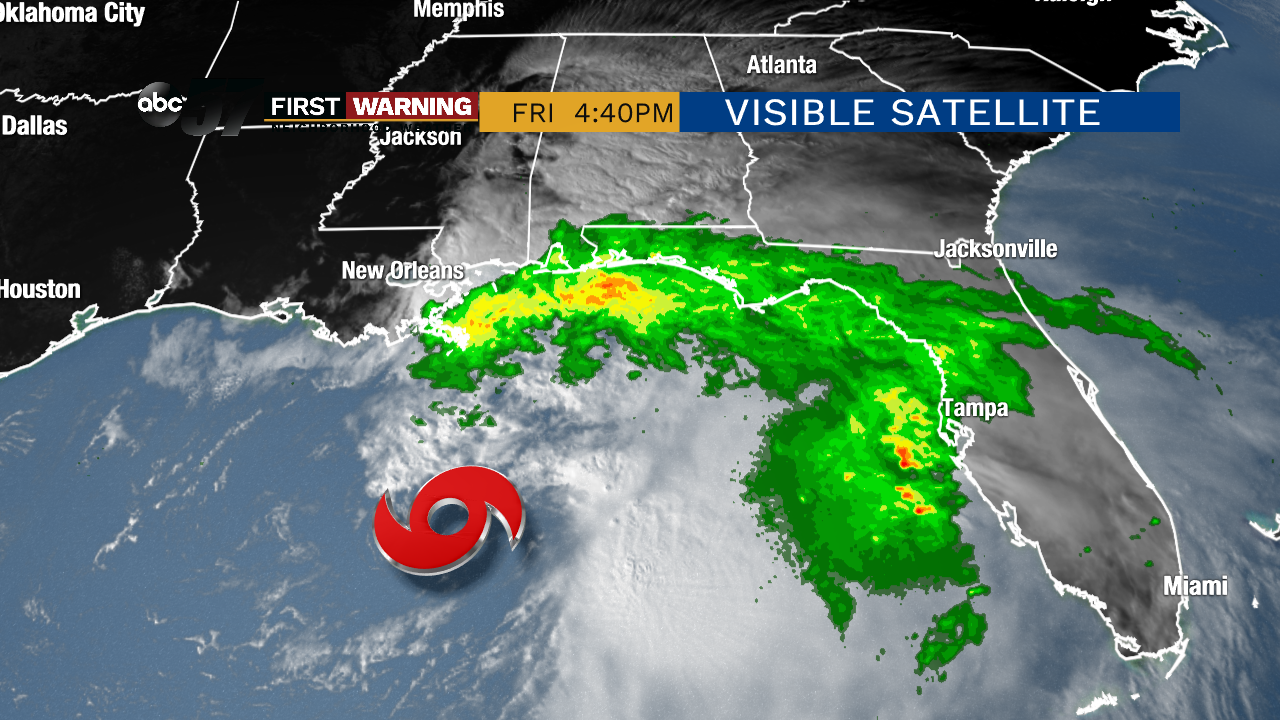
Tropical Storm Nestor forms in Gulf; heading right for Florida and Southeast
That makes Nestor a rather strong tropical storm with additional minor strengthening not impossible before landfall occurs.
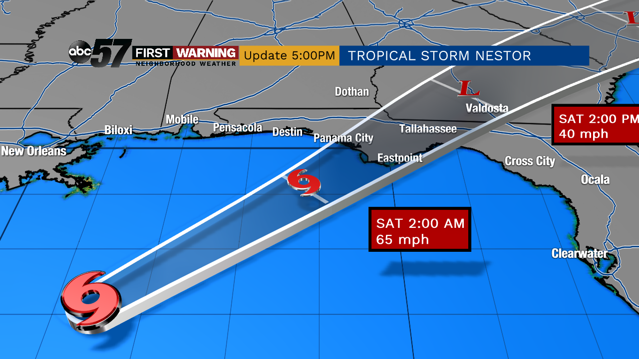
At landfall, maximum winds are expected to be around 65 mph or so with higher gusts not out of the question.
Potential Tropical Cyclone Sixteen has been mentioned as not likely to develop into "a classical tropical cyclone" but that it will have "some tropical characteristics". Such systems are sometimes referred to as "hybrid cyclones". But what is a "hybrid cyclone"? pic.twitter.com/FKawUE5G8m
— NWS WPC (@NWSWPC) October 18, 2019
While that may sound like a good thing, it could wind up being bad because hybrid cyclones don't really weaken as they move over land.
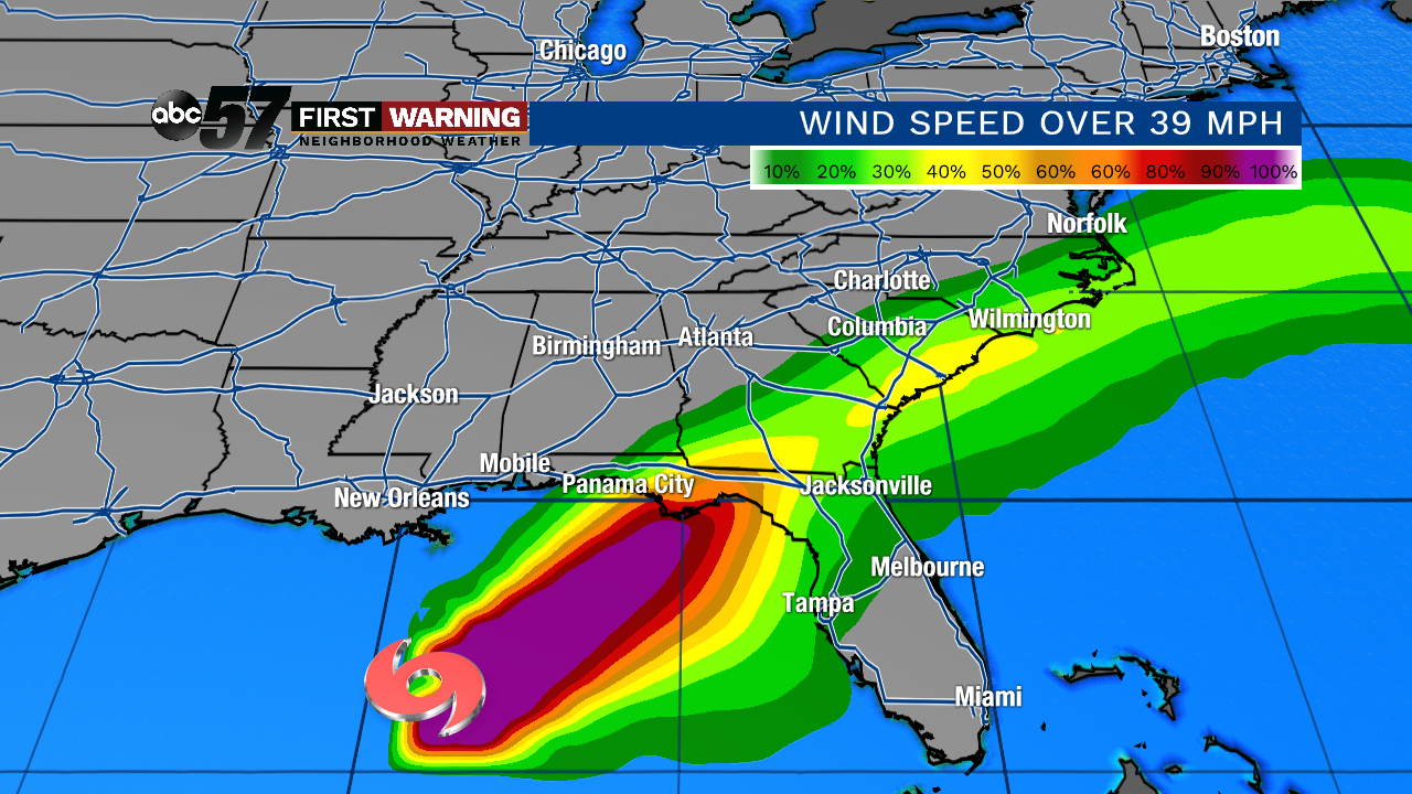 Probability of winds of at least 39 mph thru the weekend.
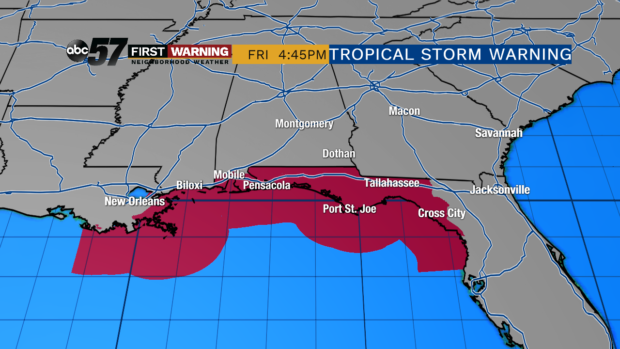 Tropical Storm Warning in effect from the central Louisiana coast to Clearwater, Florida.
Fortunately, this will be a very quick-mover, so flooding rainfall is not expected to be a significant threat for anybody from Florida to Virginia.
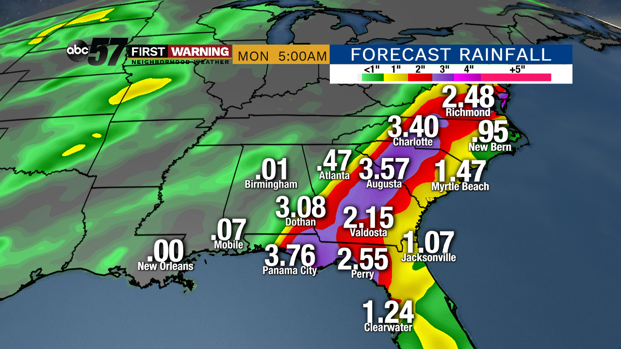
Totals of 2-5" are expected by the end of the weekend. Some flooding is certainly possible, but widespread and extensive flooding is not anticipated.
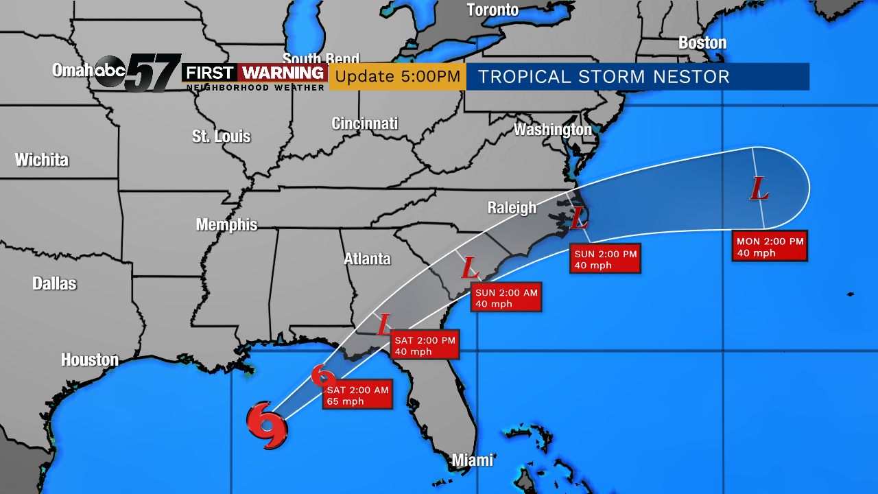
By Monday, Nestor will be history as it pushes out into the Atlantic Ocean.
If you'd like to read the description of the impacts expected for those in Nestor's path, click on the location you want to view by clicking here.
