
-
1:44

Feeling like a sauna next week
-
3:12

How to keep yourself and others protected during firework season
-
0:49

Showers creeping into Michiana
-
1:32

Judge approves $25 million water lawsuit settlement in Benton...
-
1:00

Scattered showers through the day
-
1:53

Hispanic Community Child Safety Meeting: A Call To Action
-
2:51

Obama Presidential Center features work of South Bend company
-
1:54

This week’s ABC57 Cub Reporter is Isaac Knefely
-
1:16

Real summer heat returns next week
-
2:28

South Bend storm drain mural project complete
-
5:17

Three local students return as national powerlifting champions
-
1:09

Rain showers to end the work week

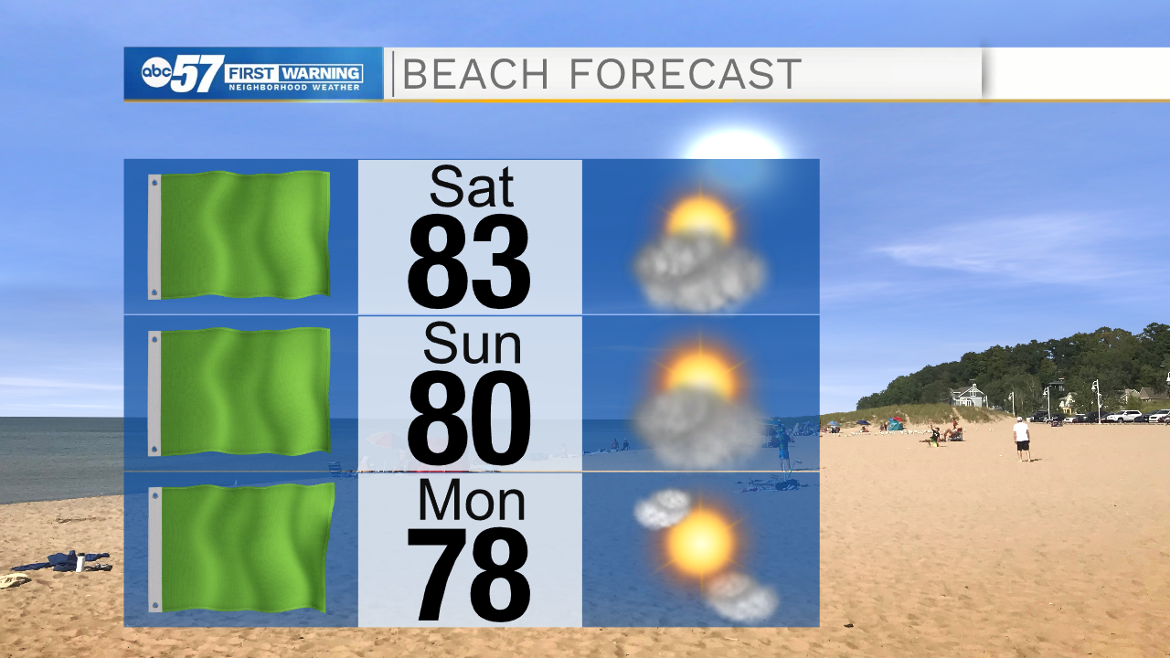
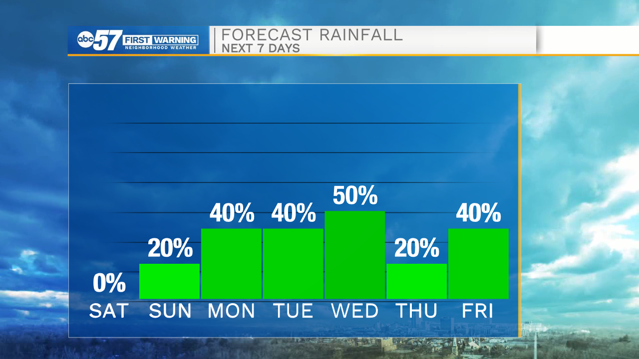
Temperatures warm into the mid-to-upper 80s this weekend. The latest trend has high temperatures falling just shy of 90, the biggest issue being cloud cover, that will keep temperatures slightly cooler. The weekend is also likely dry, a stray show is possible but not likely. The chance of rain increases next week, from isolated storms Monday to scattered Tuesday and Wednesday, Wednesday the most likely day for rain. If we don't see more than a half inch of rain, dry conditions likely worsen.
Tonight: Mostly cloudy. Low 66.
Saturday: Morning clouds / afternoon clearing. High 88.
Sunday: Partly cloudy. High 86.
Monday: Isolated thunderstorms. High 86.
Sign up for the ABC 57 Newsletter