


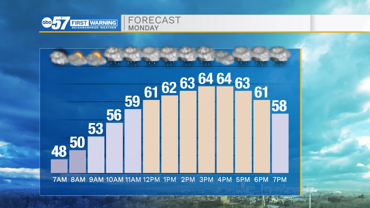
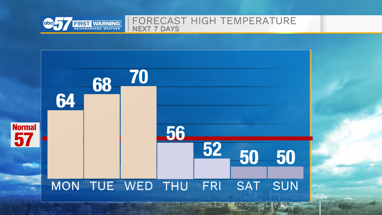
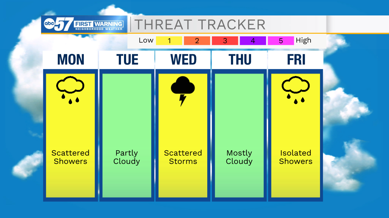
This evening will remain nice and quiet with temperatures holding in the 50s through 10pm. Cloud cover will increase during the overnight helping to keep temperatures in the 40s for Monday morning. Late tonight a few isolated showers are possible as well, but those should clear before your Monday morning commute. A round of scattered rain showers will move in around lunchtime tomorrow and stick with us into the evening hours. We will stay mostly dry on Tuesday with a low rain and storm chance possible during the evening. Our second round of scattered shower will arrive on Wednesday. Wednesday afternoon and evening a line of showers and potentially strong to severe storms will roll through Michiana. High temperatures through the middle of the week will hit the upper 60s and lower 70s. After the cold front clears quieter weather is in store for Thursday with highs dropping back into the 50s. We will stay in the 50s heading into next weekend. Rain chances return to the forecast for next Saturday evening and Sunday.
Tonight: Partly cloudy. Low 48.
Tomorrow: Scattered showers. High 64.
Tuesday: Partly cloudy. High 68.
Wednesday: Showers/storms. High 70.