
-
0:49

Gas leak at remains of Zimmy’s Tavern leads to temporary evacuation...
-
2:12

South Bend City Council passes resolution urging pause on Midwest...
-
0:46

Niles City Council vote yes on putting marijuana question on...
-
0:29

Multiple Fire Departments battle residential fire in Berrien...
-
2:10

Notre Dame men’s basketball embracing urgency as Shrewsberry...
-
2:37

Local Beef-A-Roo employees still owed paychecks as private equity...
-
1:42

More storms through 8:00 p.m.
-
1:06

2nd annual Inclusive Art Fair
-
2:20

Tracking severe weather through the mid-afternoon
-
3:17

Applications open for Fall Citizens Police Academy in South Bend
-
2:23

Elkhart County 4H Fair food vendors celebrate 50th year of business
-
2:16

Young football athletes learn about protecting their bodies,...

Active weather through the weekend, the forecast is not a complete washout but rain will be in the forecast through Saturday and into early Sunday. Scattered showers and storms during the day Saturday, then a widespread line of rain Saturday night into early Sunday. Sunday, temperatures fall with a blustery northwest wind, gusting up to 30 mph. Next week starts cool and sunny.
Tonight: Increasing clouds, low 58.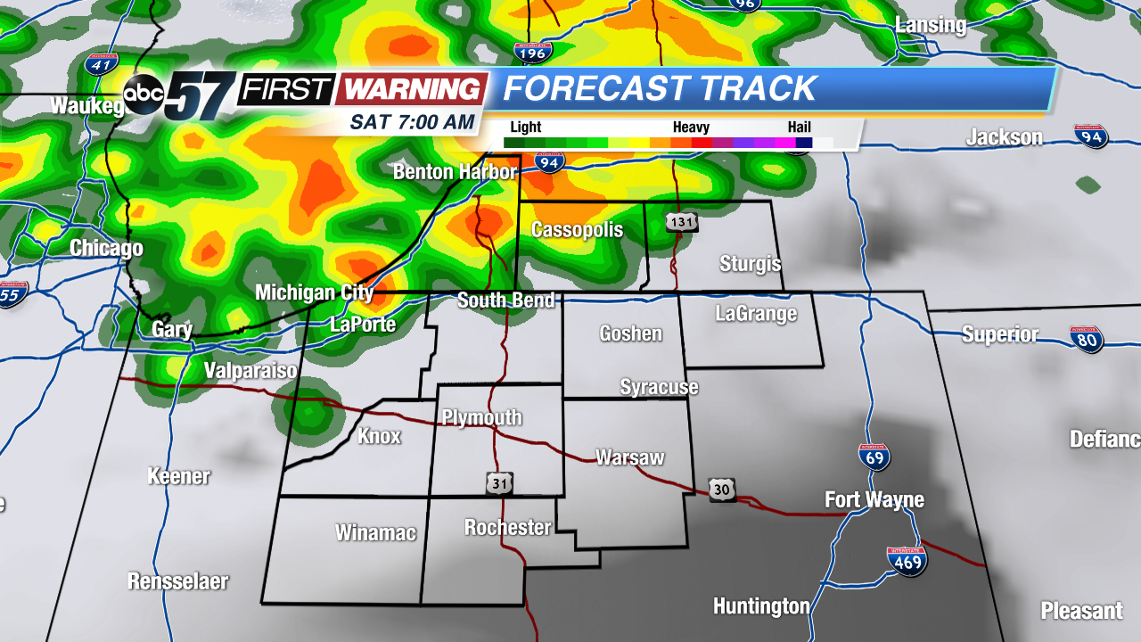 Scattered storms mostly across our north Saturday.
Saturday: Scattered showers and storms, high 74.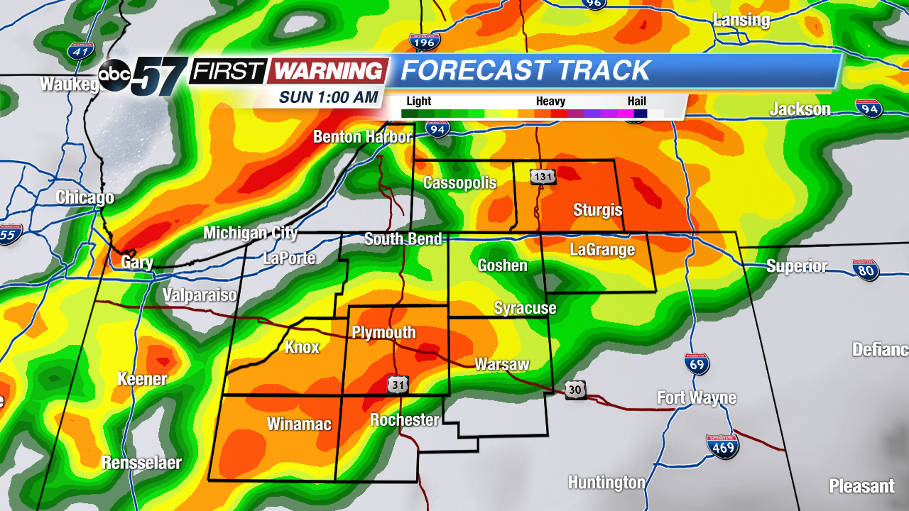 Widespread rain Saturday night
Sunday: Morning showers, temperatures fall from 60 and breezy.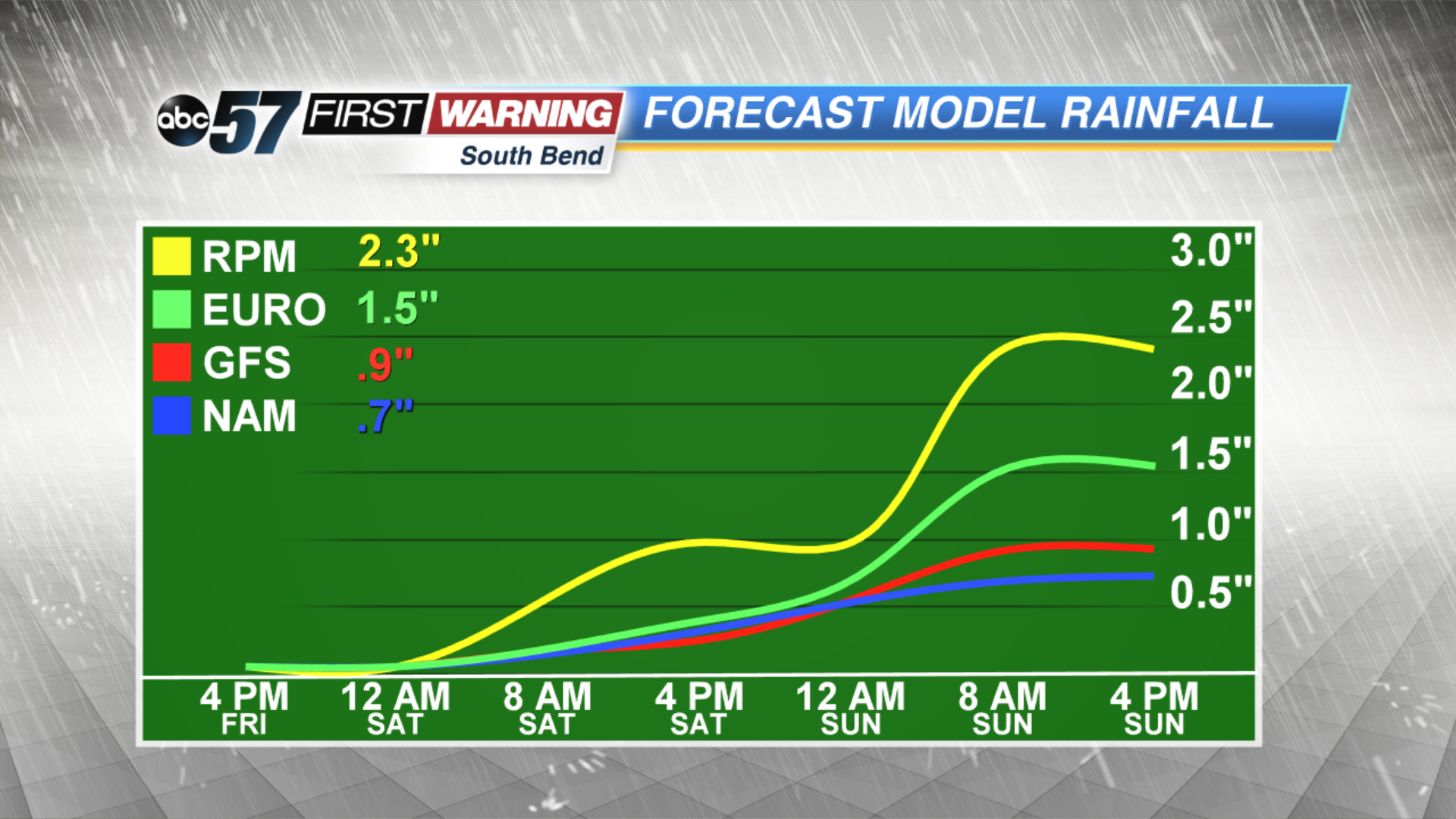 Rainfall estimates of over an inch likely through Sunday AM
Monday: Sunny, highs near 60.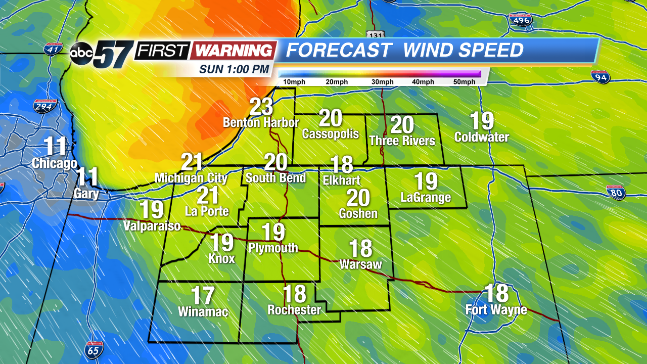 Blustery Sunday, gusts topping 30 mph.