
-
1:38

Weather delay doesn’t stop Lakeville’s Fourth of July celebration...
-
1:41

Rain is ending, Fireworks are just beginning
-
2:01

6th annual Pickle Festival concludes in Berrien Springs
-
2:15

Localized flooding possible tonight
-
1:59

Storms to impact Chicagoland race and local Fireworks
-
1:54

Lightning may be the only thing lighting up the sky tonight
-
2:02

More storms this evening
-
0:57

Michigan family turns backyard into enormous slip ’n’ slide...
-
1:53

America’s Birthday Celebration at Howard Park
-
2:03

More storms tonight
-
3:39

RedBud Weekend, America 250 Edition
-
49:01

An ABC57 News special

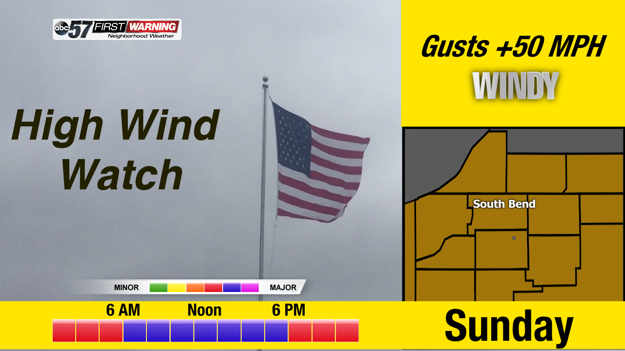
The weather only gets worse through Sunday. Temperatures warm into the 40s Saturday, spiking near 50 before plummeting after midnight. Rain is likely Saturday afternoon through early Sunday before changing to sleet and snow. The big story however is wind. Sunday’s weather is a high impact wind storm. A sustained wind of 30 and gusts of more than 50 mph will last all day. The wind will start to calm into Monday morning.
Tonight: Mostly cloud, low of 32.
Saturday: Rain likely by the afternoon, low 40s spiking to 50 around midnight.
Sunday: Extremely windy, temperatures falling from 40, rain and snow showers.
Monday: Partly cloudy, breezy, high of 28.
Sign up for the ABC 57 Newsletter