
-
2:10

Notre Dame men’s basketball embracing urgency as Shrewsberry...
-
2:37

Local Beef-A-Roo employees still owed paychecks as private equity...
-
1:42

More storms through 8:00 p.m.
-
1:06

2nd annual Inclusive Art Fair
-
2:20

Tracking severe weather through the mid-afternoon
-
3:17

Applications open for Fall Citizens Police Academy in South Bend
-
2:23

Elkhart County 4H Fair food vendors celebrate 50th year of business
-
2:16

Young football athletes learn about protecting their bodies,...
-
1:24

Storm track timing could be shifting
-
0:57

Unity Gardens brings music, food, and crafts for Westside BBQ...
-
1:50

Quiet evening, Storms after Midnight
-
0:57

Deer Creek Hunt Club throws a skeet shoot event for Deputy Jon...

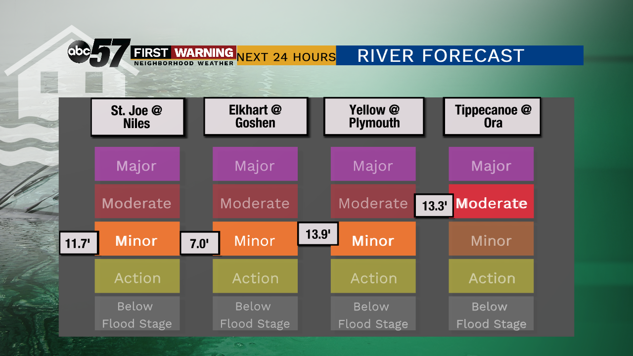
Much needed dry weather is in the forecast through at least Monday morning. There is a slight chance of rain Saturday but additional rainfall would be minimal. This will allow flood waters to recede before another round of wet weather for the middle of next week. Temperatures are slow to warm until Sunday, when highs peak near 70 with sunshine.
Most rivers have reached their peak or will peak through Friday and start to recede.
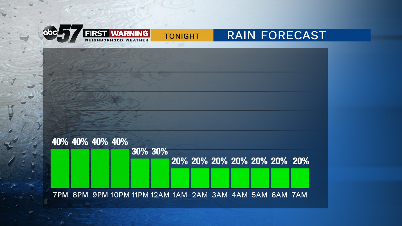
Tonight: A few showers, low of 46.
Friday: Mostly to partly cloudy, high of 60.
Saturday: Chance of an early morning shower, mostly cloudy, high of 62.
Sunday: Mostly sunny, high of 68.
Sign up for the ABC 57 Newsletter