

-
6:43

Alabama couple alleges Elkhart County RV dealer scammed them...
-
1:36

Cheering on the Irish, rain or shine
-
2:45

Salem Haunted House gets ready for opening weekend
-
2:49

Buchanan police warn about ’Cat in the Hat’ social media...
-
3:05

The “If You Believe“ Hope & Healing Movement is happening...
-
1:32

A near perfect Fall-like Friday
-
1:46

Soggy morning, Rain ends before daybreak
-
2:28

Bucks aim to return to win column against Bremen
-
2:33

Lions ramping up the intensity as postseason nears
-
3:10

South Bend resident voices safety concerns amid Potawatomi Park...
-
3:30

Progress in Bissel Street shooting investigation, Mayor Mueller...
-
1:55

Bobo Brazil Center reopens, gym still waiting on funds

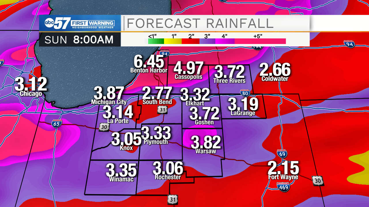
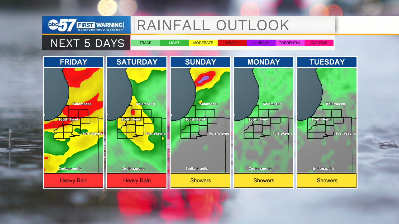
A wet weekend is in the forecast, fain is likely and at times will be heavy. There is the potential for up to four inches of rain through Saturday, with more rain Sunday through the middle of next week. The heaviest rain is most likely Friday with morning showers that could produce downpours, a lull and then scattered thunderstorms by the evening that will bring more heavy rain. The cycle repeats Saturday. Sunday through Wednesday storms become more scattered, mostly in the afternoon.
Tonight: Showers. Low 68.
Friday: Thundershowers. High 78.
Saturday: Thundershowers. High 82.
Sunday: Scattered showers. High 80.
Sign up for the ABC 57 Newsletter