


Isolated severe thunderstorms impacted areas like Niles, Edwardsburg and Elkhart during the evening of July 10th, 2019.
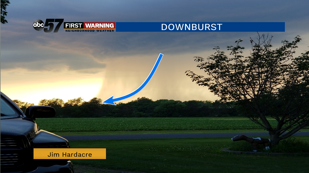
Views like this one above where captured from the storms. You can see the defined rain shaft coming down from the cloud where the downburst/microbust is located.
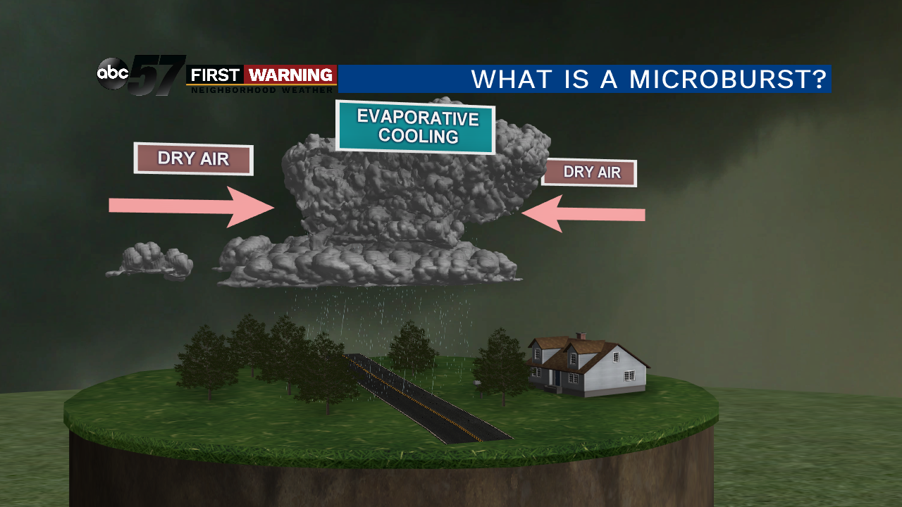
So what is a microburst?
It is a localized area of sinking air (which is also called a downdraft), that is moving with so much force it hits the ground and spreads out. This creates very strong wind at the surface as it pushes out; the wind can be up to 150 mph. It is called a microburst because only a small area is impacted, no larger than 2.5 miles wide.
How does a microburst happen?
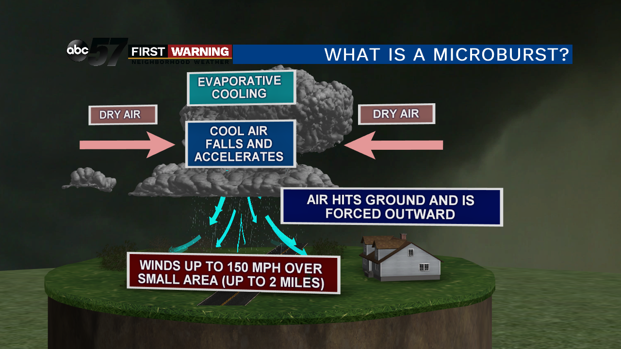
In a strong or severe thunderstorm, you will have a strong updraft where water droplets and hailstones are suspended. As evaporational cooling takes place in the cloud, the updraft will start to weaken, no longer being able to hold all of those water droplets or hail high in the cloud.
It then all crashes to the ground with a great force. As the air hits the ground it is forced outward and those winds can reach up to 150 mph. This creates significant damage but is very localized because of the size of a microburst.
This can knock down trees, power lines and even do damage to a home. The photo below is from one that hit Niles, MI.
 Tree damage
For more photos of the storms and the damage done by them, click here.