When does the fire danger subside?
Posted: May 1, 2018 4:37 PM EDT
Unusually dry conditions, both in the air and ground, have led to heightened fire dangers across parts of Michigan, Ohio, Indiana, and Illinois this week. That includes all of Michiana. The fire threat jumped Monday, but was even higher Tuesday afternoon courtesy of the dry soil, blustery winds, hot temperatures, and low relative humidity values. Fortunately, conditions are set to improve Tuesday night and Wednesday.
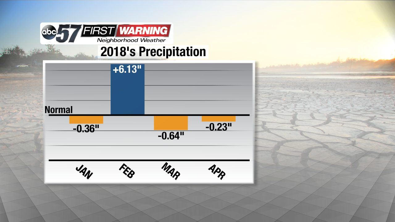
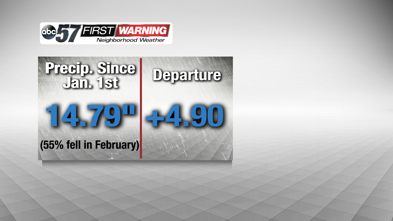
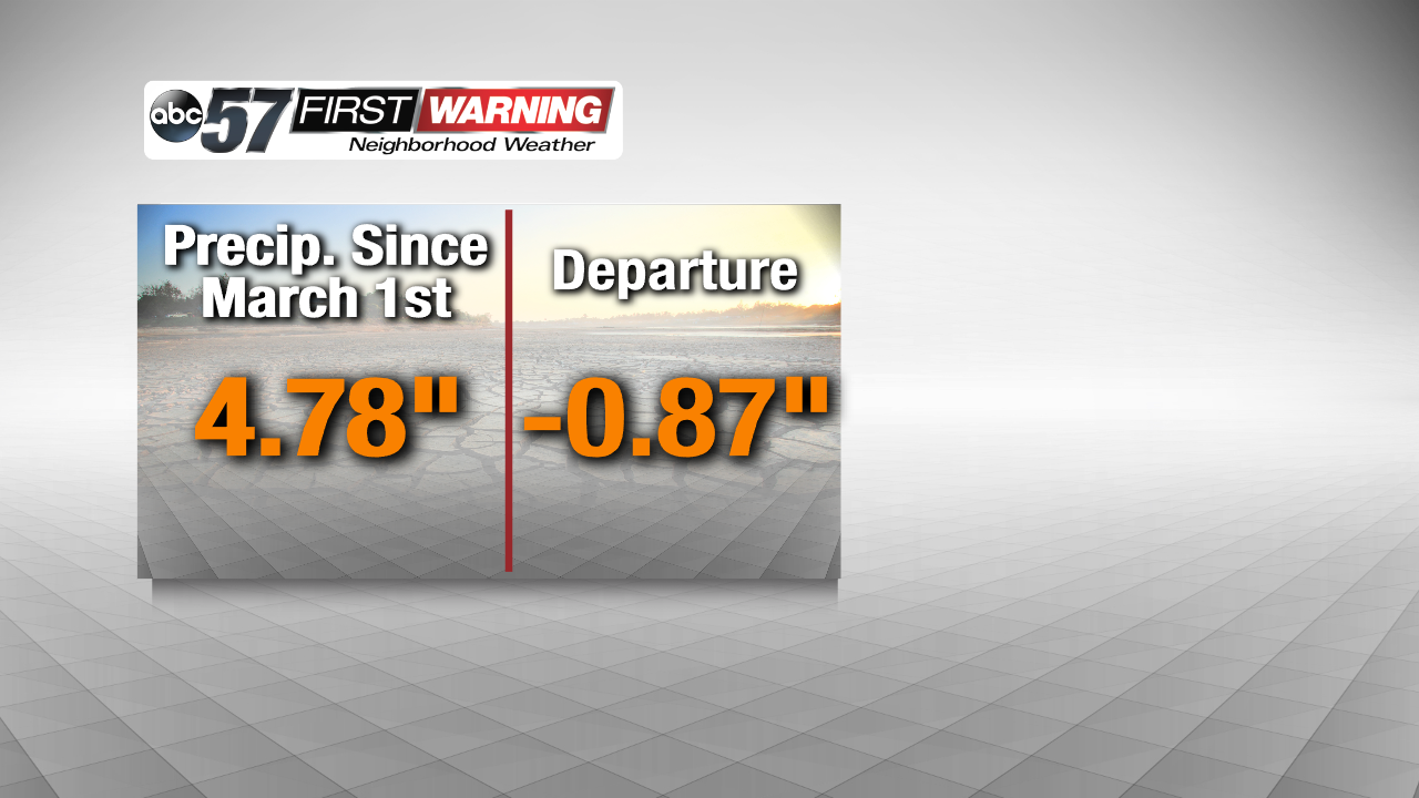
The reason behind the very dry conditions is simple: a drier-than-usual year thus far. That, of course, seems odd because of the historical flooding we saw in February. But that's the problem. A good portion of our 2018 precipitation fell in February. Since then, we have been below normal in the precipitation department. In addition, all of the rain that fell in February fell onto a frozen and cold ground. That means the ground didn't absorb much. In turn, the ground stayed relatively dry considering how much precipitation actually fell.
Even more, 2018 has been very cold compared to average. Winter seemingly went on forever. That has disallowed bushes, shrubs, grass, trees, and plants to green up efficiently. That has combined with plenty of dead and dry fuels like leaves and twigs from last year's growing season to further heighten the fire concern in northern Indiana and southern Michigan. In fact, one has to go back to April 19th to get to the last day when more than a tenth of an inch of rain actually fell in South Bend.
The good news is a moist air mass will arrive by Wednesday afternoon as a cold front slowly approaches from the west. The rain chances on Wednesday don't look overwhelming, but the moisture content will rise substantially. That will decrease the fire weather risk despite the winds staying breezy and the temperatures staying very warm. As a result, you can return to recreational burning without a concern by late in the day Wednesday. Rain then looks likely Wednesday night and Thursday night.


