Why this winter will be quite snowy
Posted: Nov 27, 2018 12:11 PM EDT
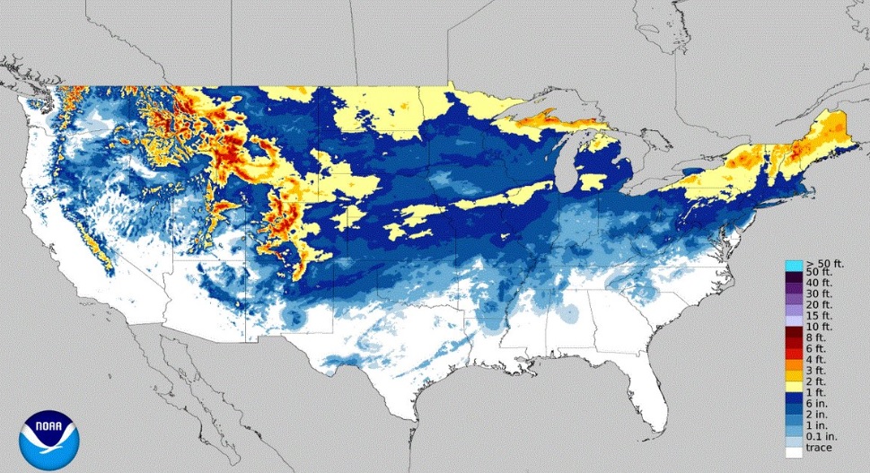
This year's winter season has gotten off to a fast start with South Bend recording 8.6" of snow as of November 27th. Typically, we see a little more than half of that in November. Just one year ago we went nearly snow-less in November and saw nearly three feet of the white stuff in December. Of course, that was just the beginning of what would wind up being a very snowy winter in Michiana. But, does seeing above average snow in November and/or December mean the rest of the winter season will be snowy? There's no direct answer, but it could. Through late November, South Bend isn't the only location that has seen an above normal amount of snow. Snow has fallen in places like Oklahoma, Arkansas, Louisiana, Tennessee, Missouri, and Texas. This is due to more cold air being in place across the U.S. this month than normal. There are several contributing factors to why November has been so cold, but one of them is the amount of snow on the ground across Canada and Russia.
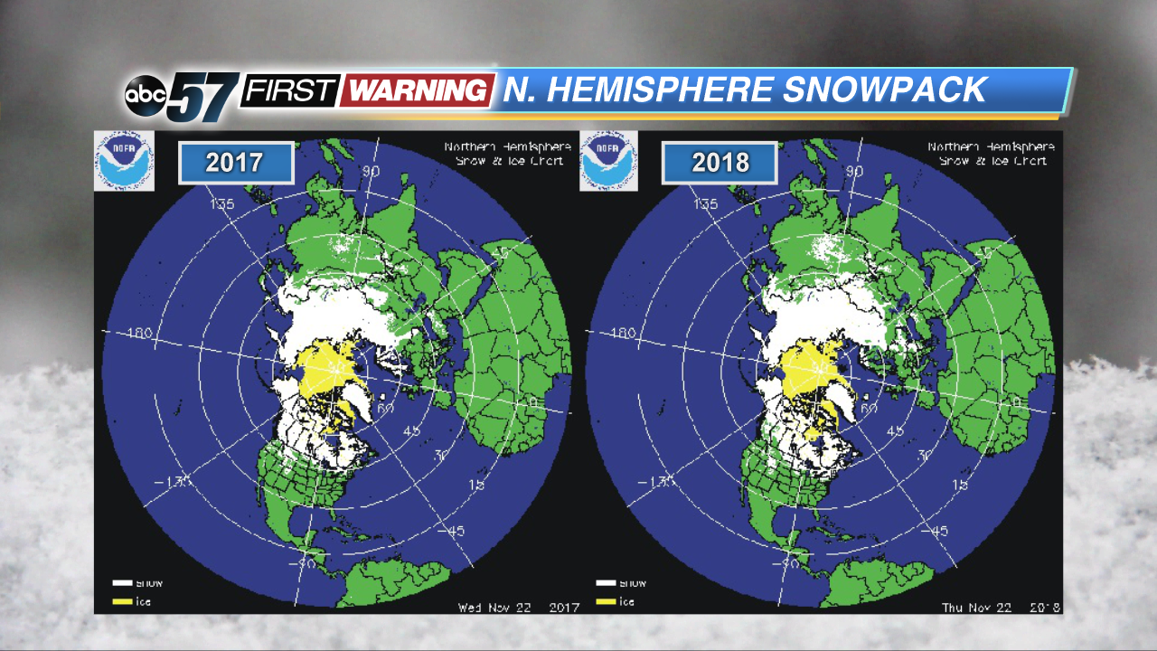
So, let's take a look at snowpack in those countries, both this year and last year. As of November 22nd of this year, snow was covering nearly all of both Canada and Russia. As of November 22nd, 2017, snow was also covering essentially all of Canada and Russia as well. In fact, when looking at the two images side-by-side, they look identical to one another.
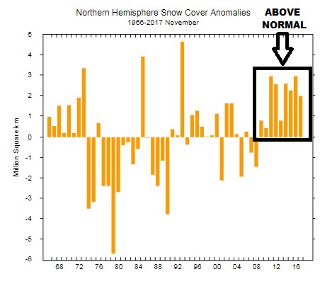
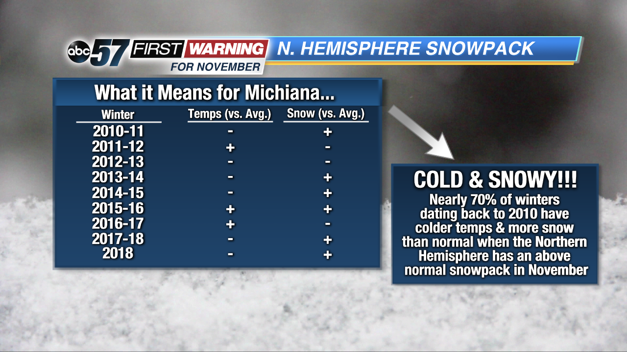
But it isn't just this year and last year that saw extensive snow cover across the Northern Hemisphere during the month of November. Every single November dating back to 2009 has featured above-normal snow cover in the Northern Hemisphere. To see whether or not there is a correlation between that extensive snow cover in the Northern Hemisphere and snowy, cold winters here in Michiana, we looked back at every winter season since 2010.
And, wouldn't you know it, almost 70% of winter seasons since 2010 saw more snow than normal and colder temperatures than a normal winter season. It's important to note that there are numerous factors and variables that go into dictating how much snow and cold we will see in a given winter. The extent of Northern Hemisphere snowpack is just one of them, albeit a significant one. And, the explanation behind this is quite simple: when there's extensive snowpack in Canada and Russia, it keeps the air over those countries much colder. This allows colder air to filter into the Midwest and Great Lakes more often because the "cold air supply" to our north is plentiful. With more cold days throughout the winter, the likelihood of seeing more snow rises significantly. The takeaway point here is that a cold, snowy winter appears more likely than a mild, rainy one in Michiana. Will it be snowier and colder than last winter? That remains to be seen, but there will likely be plenty of cold and snow thru April as it looks now!


