
-
2:23

La Porte community rallies for Sammy Strong Benefit, raising...
-
1:57

The Potawatomi Zoo opens its gates to Zoo Nights Live
-
2:50

Carson Kvapil wins his first O’Reilly Auto Parts Series win...
-
1:10

William Tuffs honored as the only Indiana man who took part of...
-
0:50

Beacon Health held a Health and Wellness fair for the community
-
1:03

Warm conditions start overnight
-
1:02

Another pleasant day
-
0:42

Still cooler out the door
-
2:00

New Carlisle celebrates annual Hometown Days
-
1:40

Ross Chastain leads NASCAR O’Reilly Auto Parts Series practice...
-
2:27

Backpacks for Berrien hosts their Stuff-a-Bus event, ultimate...
-
2:59

Ludacris Opens Elkhart County 4-H Fair Concert Series Amid Ticket...

Windy and rainy Saturday. Wind gusts could top 40 mph and rain amounts may be over an inch. There will be a brief lull in the wind Saturday morning, before it turns northwesterly and gusts through the afternoon. Temperatures will crash form near 50 mid-morning, to the low 40s by evening and 30s by early Sunday. Lake effect snow showers are also possible Sunday morning but accumulation is unlikely.
Tonight: Windy and rainy, temperatures hold or rise through the 40s. 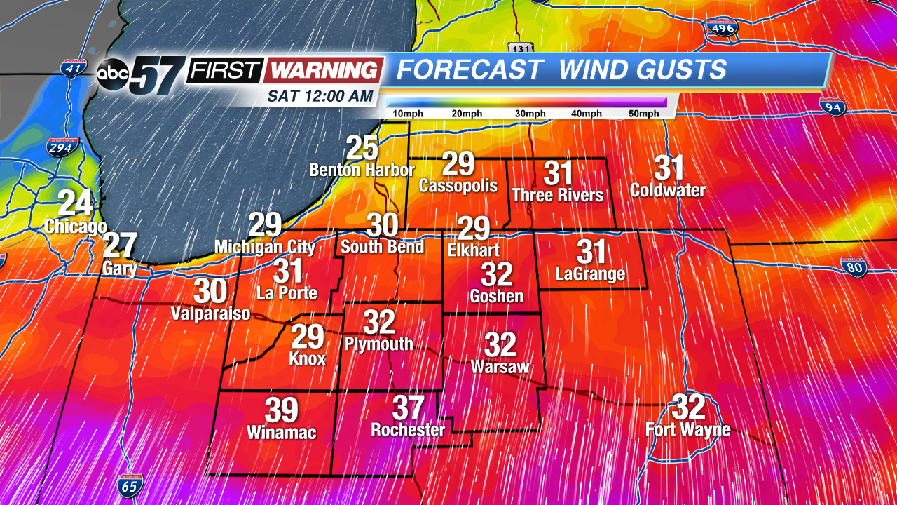 Wind gust forecast early Saturday
Saturday: Wind and rainy, highs near 52 but falling through the afternoon.
Sunday: Mostly cloudy with chance of lake effect snow showers early. High of 34.
Monday: Mostly sunny, highs in the mid-40s.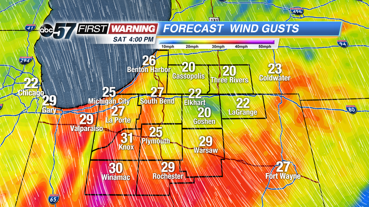 Wind gust forecast Saturday afternoon