Winter Storm bringing heavy, wet snow


Click here for list of Warnings and Advisories.
Snow showers have already started falling across Michiana. Snow picks up in intensity around 7-8 am. Heavy, wet snow continues through today. South Bend and Elkhart out to LaGrange could see up to a foot of snow but over a foot is possible in our southern Michigan counties. Snowfall accumulations quickly drop off as you go south. Those south of US-30 will likely see 3” or less of snow. IF you need to be out on the roads today, make sure you’re taking your time. Visibility will be low at times and roads will be snow packed. More snow is likely over the weekend.
For a full list of school closings, click here.
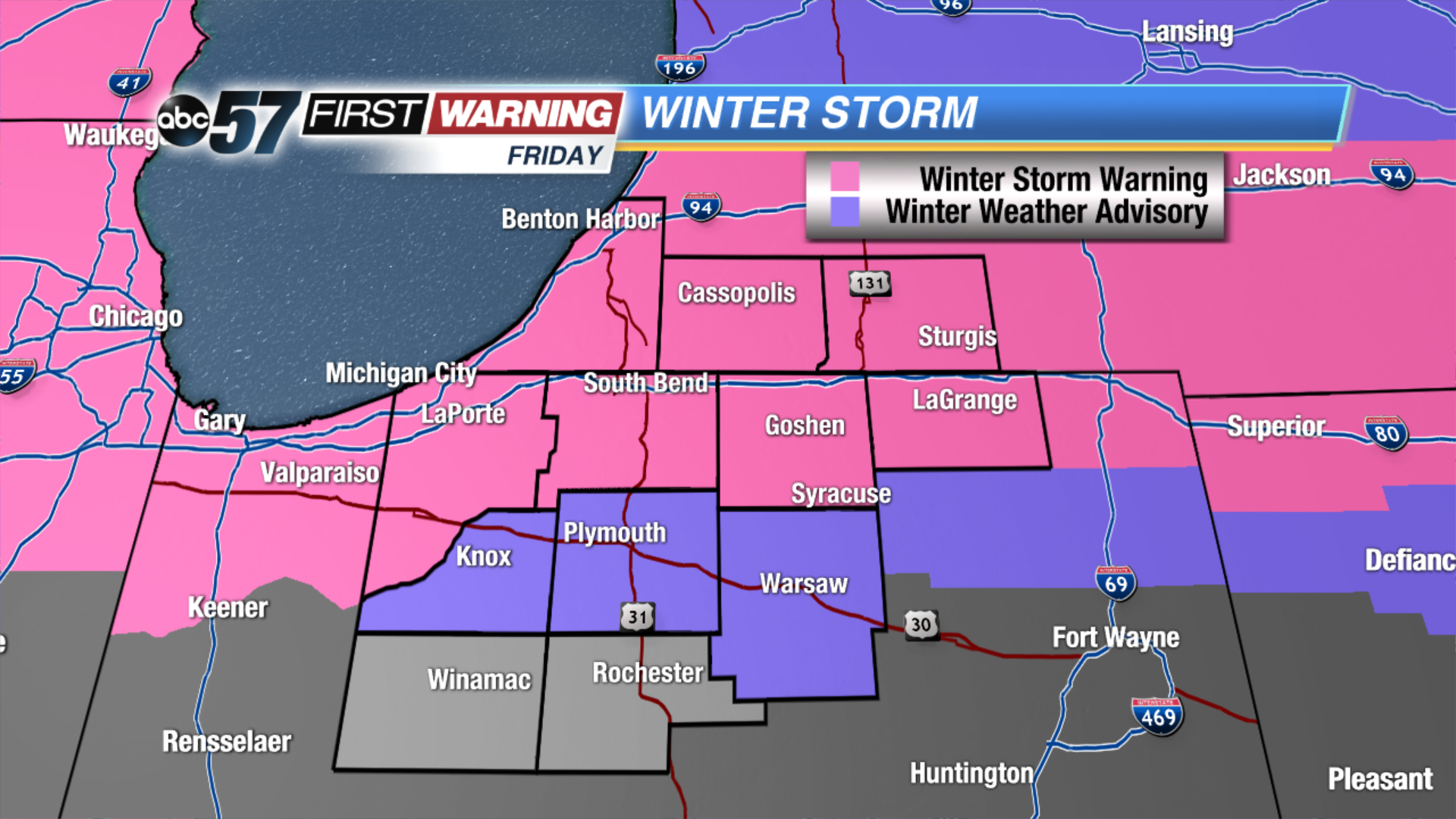 Winter Storm Warnings and Advisories for Friday.
Today: Heavy snow, highs near 30.
Tonight: Scattered snow showers, low of 18.
Saturday: Scattered snow showers, high of 27.
Sunday: AM snow showers, highs in the middle 20s.
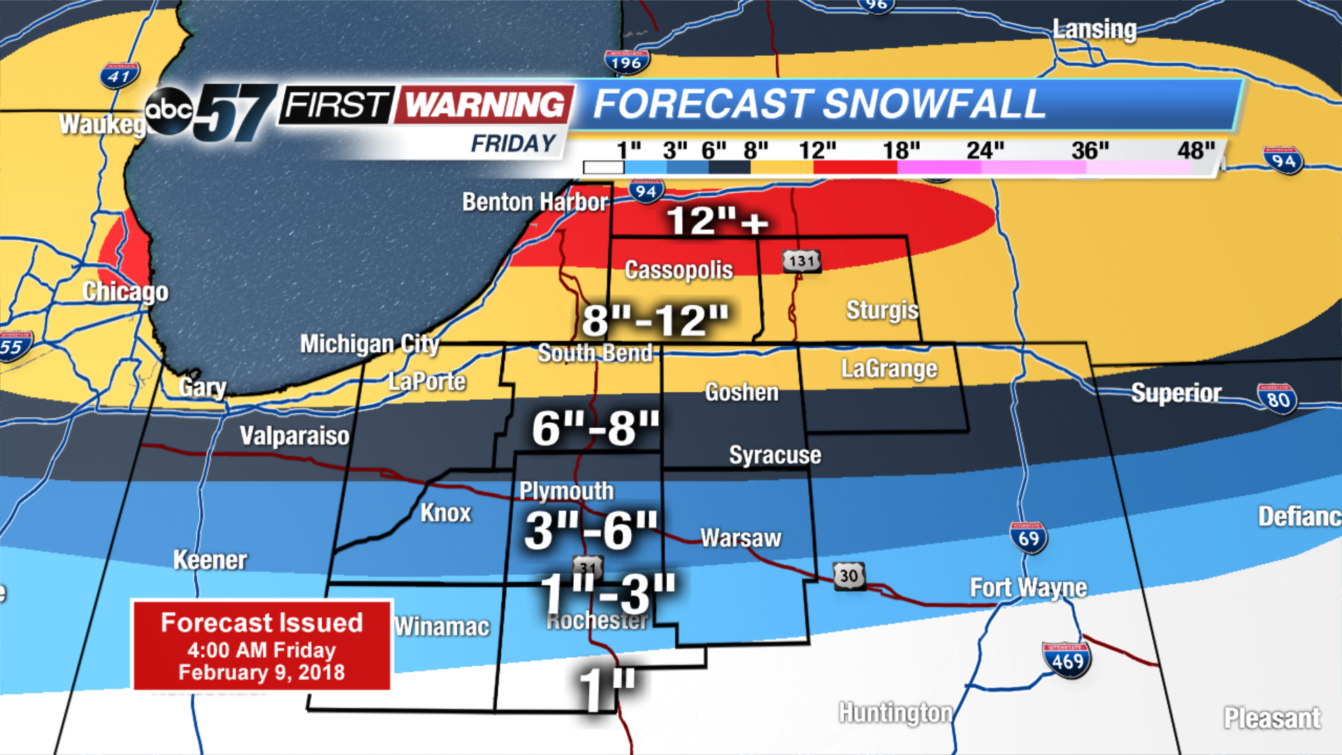 Updated forecast snowfall totals