


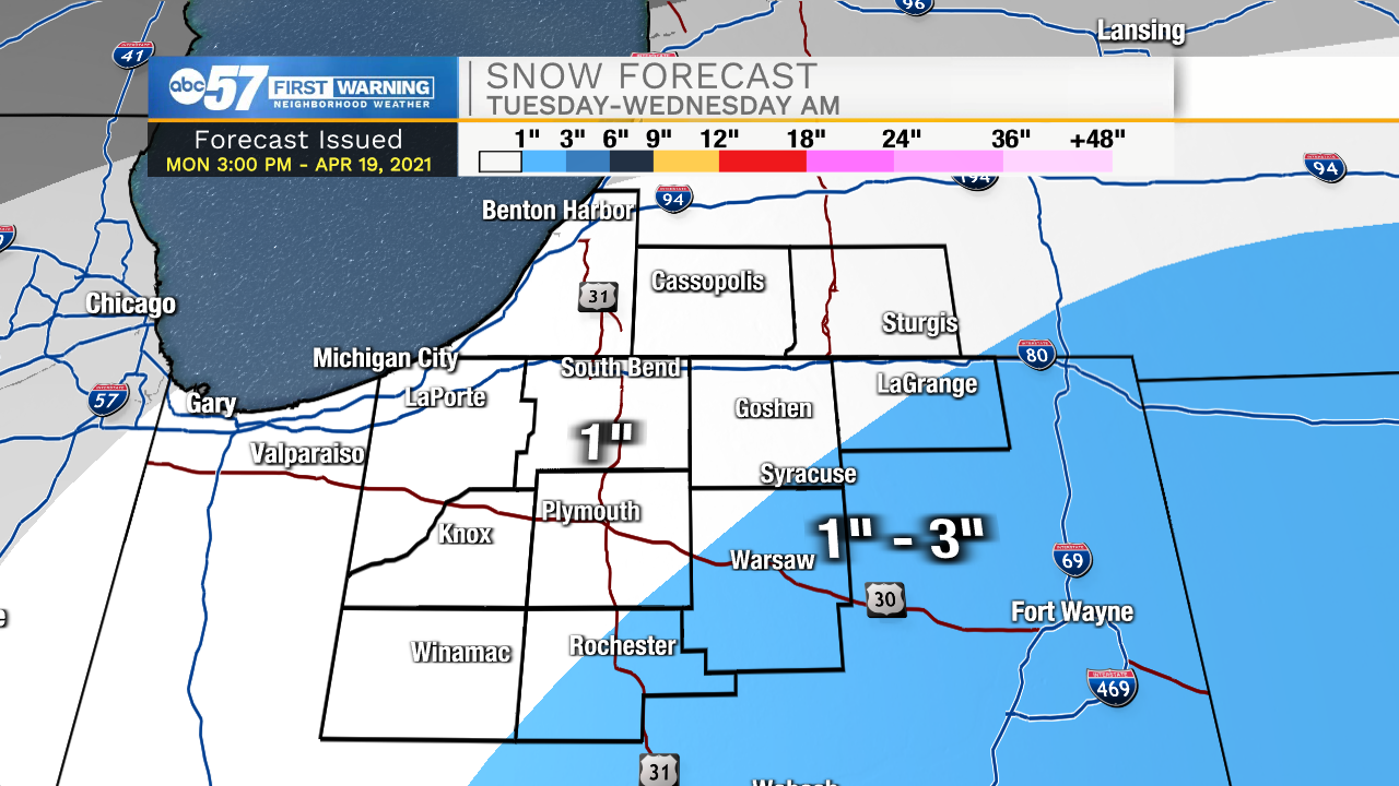
Tuesday is a harsh reminder that cold weather is still normal in April, in Michiana. A sloppy, wintry mix, rain changes to snow Tuesday afternoon. Lasting accumulation is questionable, as the pavement and ground will likely be warm enough most the day to melt snow. As temperatures drop into the evening, snow could accumulate on the grass, especially towards Warsaw and Fort Wane, where precipitation lasts later. In total over an inch may fall officially but may not accumulate at once. More than an inch would-be record-breaking for the day, but not for the month.
A killing freeze is the real concern, as lows dip into the 20s Wednesday morning. This will most likely severely damage tree buds and flowers, and the fruit crop in the area. Also, anything wet could freeze creating slick spots Wednesday morning.
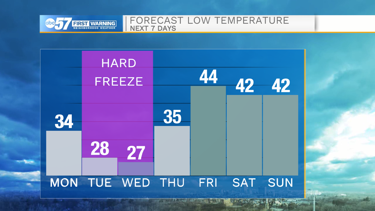
Tonight: Evening rain showers, cloudy. Low 34.
Tuesday: Wintry mix. High 38.
Wednesday: Clearing. High 44.
Thursday: Sunny. High 54.