


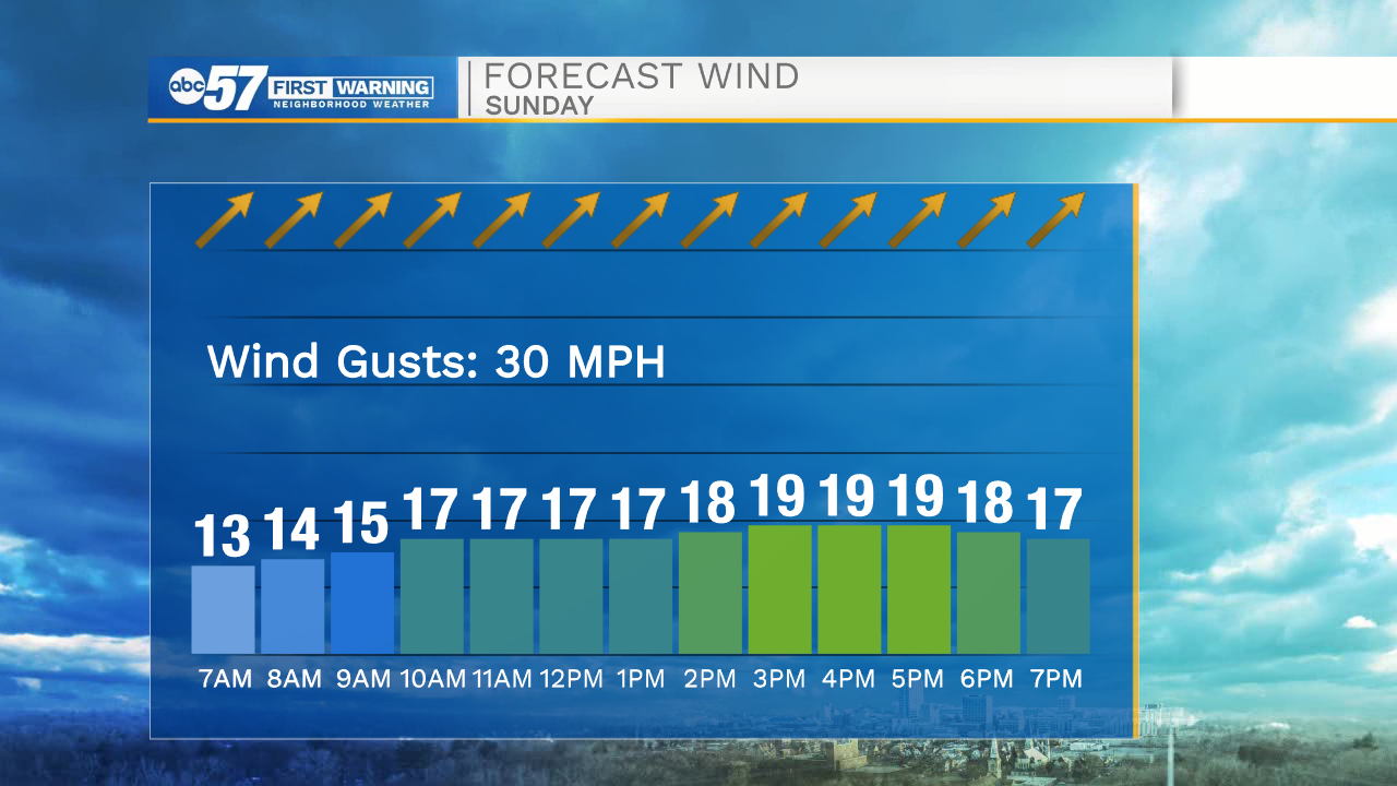
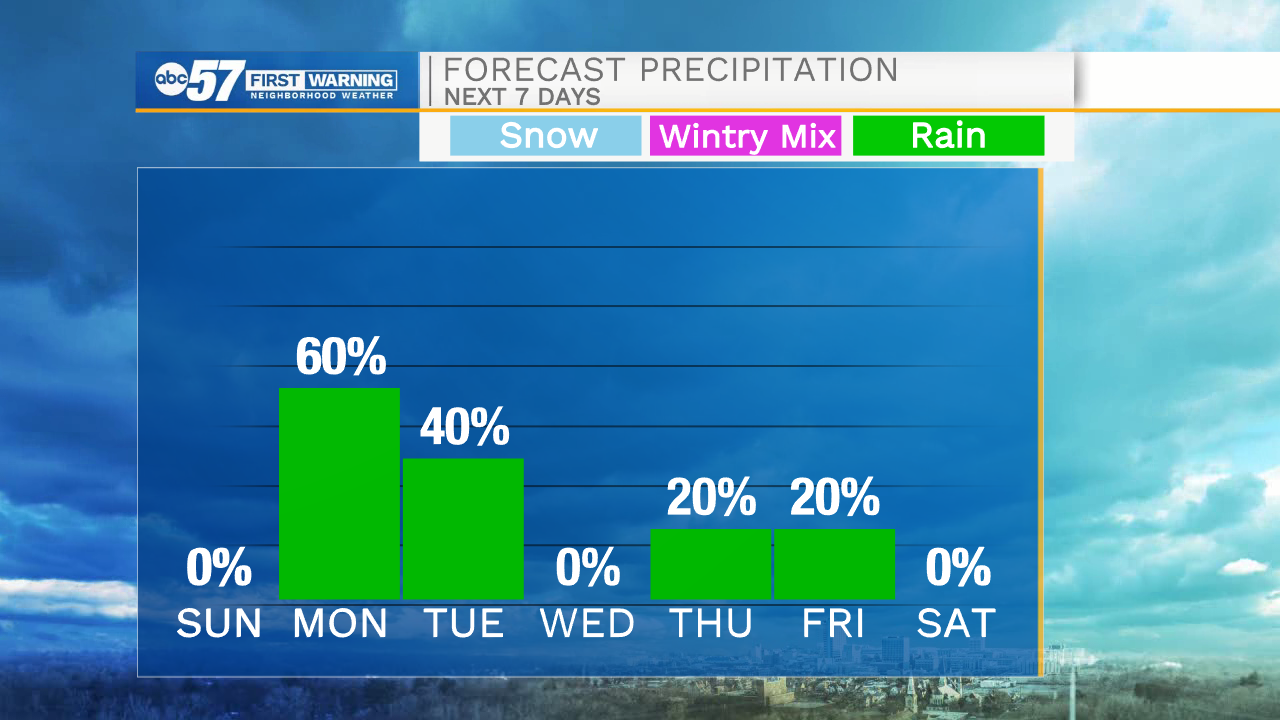
Clear skies and strong winds will stick around through the overnight hours. Temperatures tomorrow morning will only drop to around 60. Highs tomorrow afternoon will top out in the lower 80s under mostly sunny skies. Wind gusts again tomorrow afternoon could top out to around 30mph. Cloud cover will increase tomorrow evening, and then rain showers move in after midnight. Isolated rain chances will remain in the forecast through Tuesday afternoon. High temperatures into Tuesday will drop back into the upper 50s and lower 60s. There is a small chance for a few late week rain showers, but then we should dry out heading into next Saturday. Highs next weekend will be in the lower 60s.
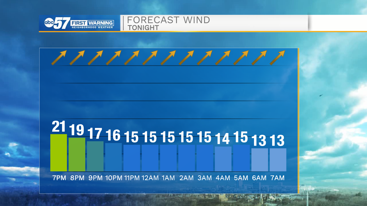
Tonight: Mostly clear. Low 60.
Tomorrow: Mostly sunny/windy. High 80.
Monday: Scattered showers. High 72.
Tuesday: Isolated showers. High 58.