
-
0:49

Gas leak at remains of Zimmy’s Tavern leads to temporary evacuation...
-
2:12

South Bend City Council passes resolution urging pause on Midwest...
-
0:46

Niles City Council vote yes on putting marijuana question on...
-
0:29

Multiple Fire Departments battle residential fire in Berrien...
-
2:10

Notre Dame men’s basketball embracing urgency as Shrewsberry...
-
2:37

Local Beef-A-Roo employees still owed paychecks as private equity...
-
1:42

More storms through 8:00 p.m.
-
1:06

2nd annual Inclusive Art Fair
-
2:20

Tracking severe weather through the mid-afternoon
-
3:17

Applications open for Fall Citizens Police Academy in South Bend
-
2:23

Elkhart County 4H Fair food vendors celebrate 50th year of business
-
2:16

Young football athletes learn about protecting their bodies,...

The wet weather ends this this evening and skies become partly cloudy to even mostly sunny for Friday with comfortable temps in the low 50s.
Temps stay in the 50s for Saturday with a chance of scattered rain. Even warmer air arrives Sunday with 60s looking likely under mostly cloudy skies. A cold front will bring a chance of rain and storms Sunday afternoon and evening.
If all ingredients come together just right, the threat is there for strong or severe storms Sunday, especially later in the day.
Tonight: Rain ending during the evening, turning mostly cloudy, low 44. 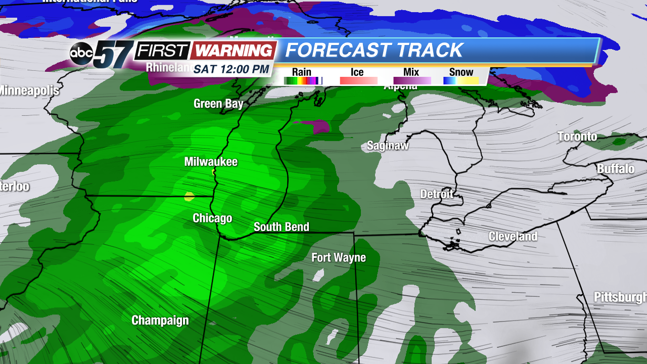 Rain starts around noon Saturday.
Friday: Mostly sunny to partly cloudy, high 53. 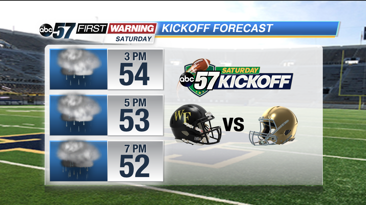 Plan on rain for the Wake Forrest vs ND Game
Saturday: Mostly cloudy, scattered rain, highs in the mid 50s.
Sunday: Mostly cloudy, storms late, highs in the upper 60s.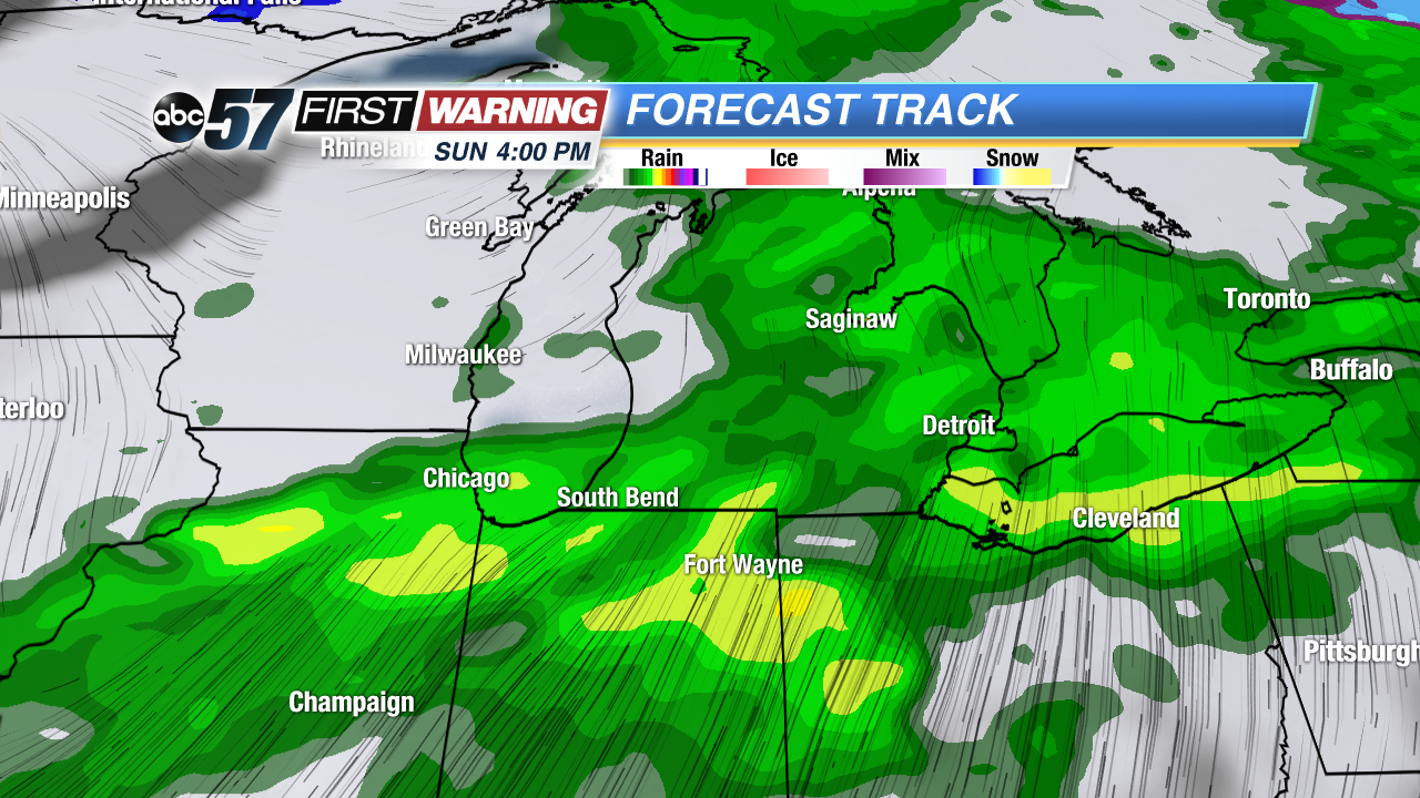 Storms, possible severe threat Sunday afternoon / evening.