


It’ll be a great day for football with mostly sunny skies and cooler highs in the upper 70s this afternoon! More clouds will build in late tonight as scattered showers look possible, especially for NW Michiana, for the first half of Sunday. By the afternoon, rain and clouds will start to break up, leading to more sunshine to wrap up the weekend. Highs will still stay warmer than normal Sunday and for the rest of the forecast. Much of the new work week stays dry as well with little rain in sight until Friday.
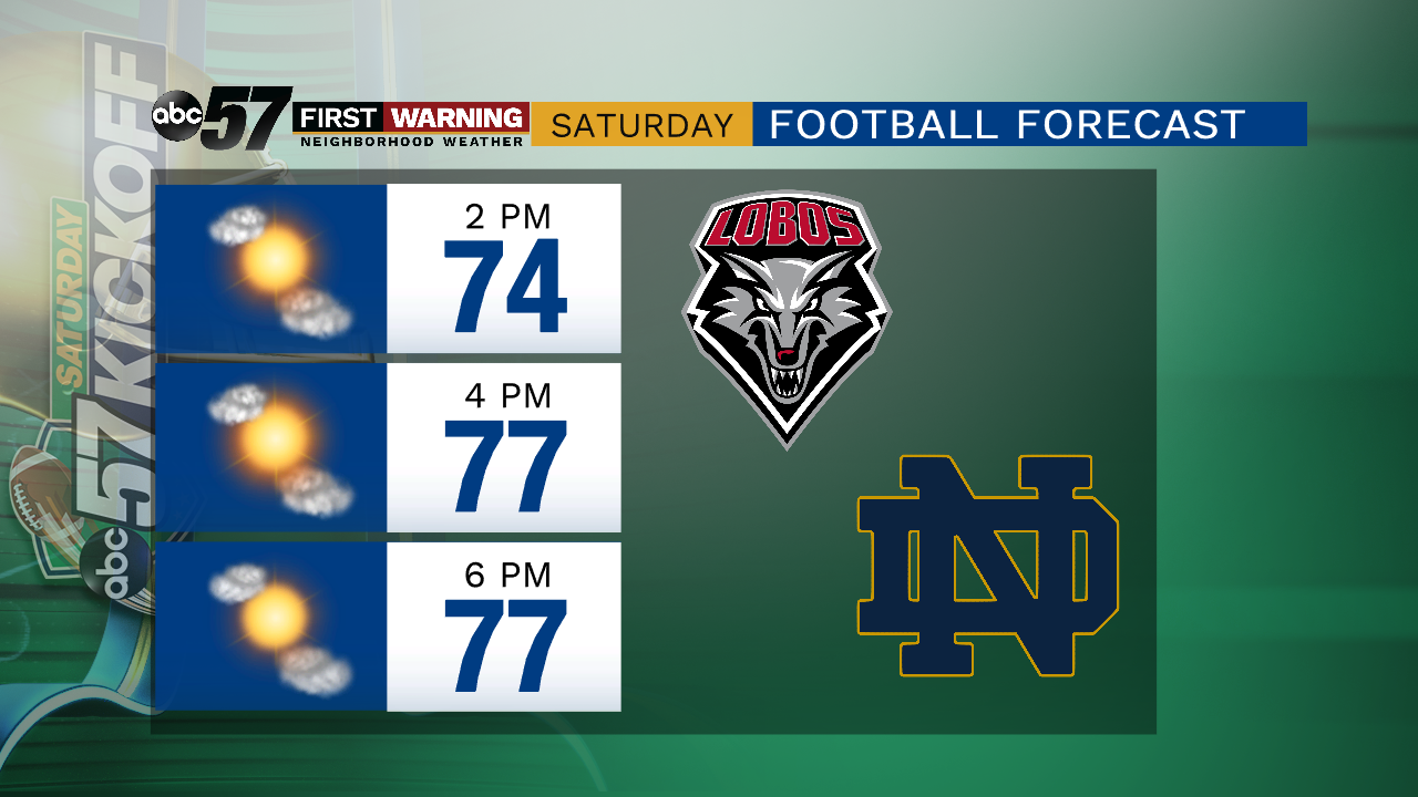 Expect sunny skies, cooler temps, and lower humidity at Notre Dame Stadium today!
Today: Sunny with a few PM clouds. High of 78.
Tonight: Mostly clear to mostly cloudy with showers arriving late. Low of 60.
Sunday: Mostly cloudy with a chance of AM and midday showers, then partly sunny late. High of 81.
Monday: Mostly to partly sunny. Highs near 80.