A rainy and cool start to the week but temperatures warm up


ABC57 First Warning Neighborhood Weather Forecast
Monday, October 19th, 2020
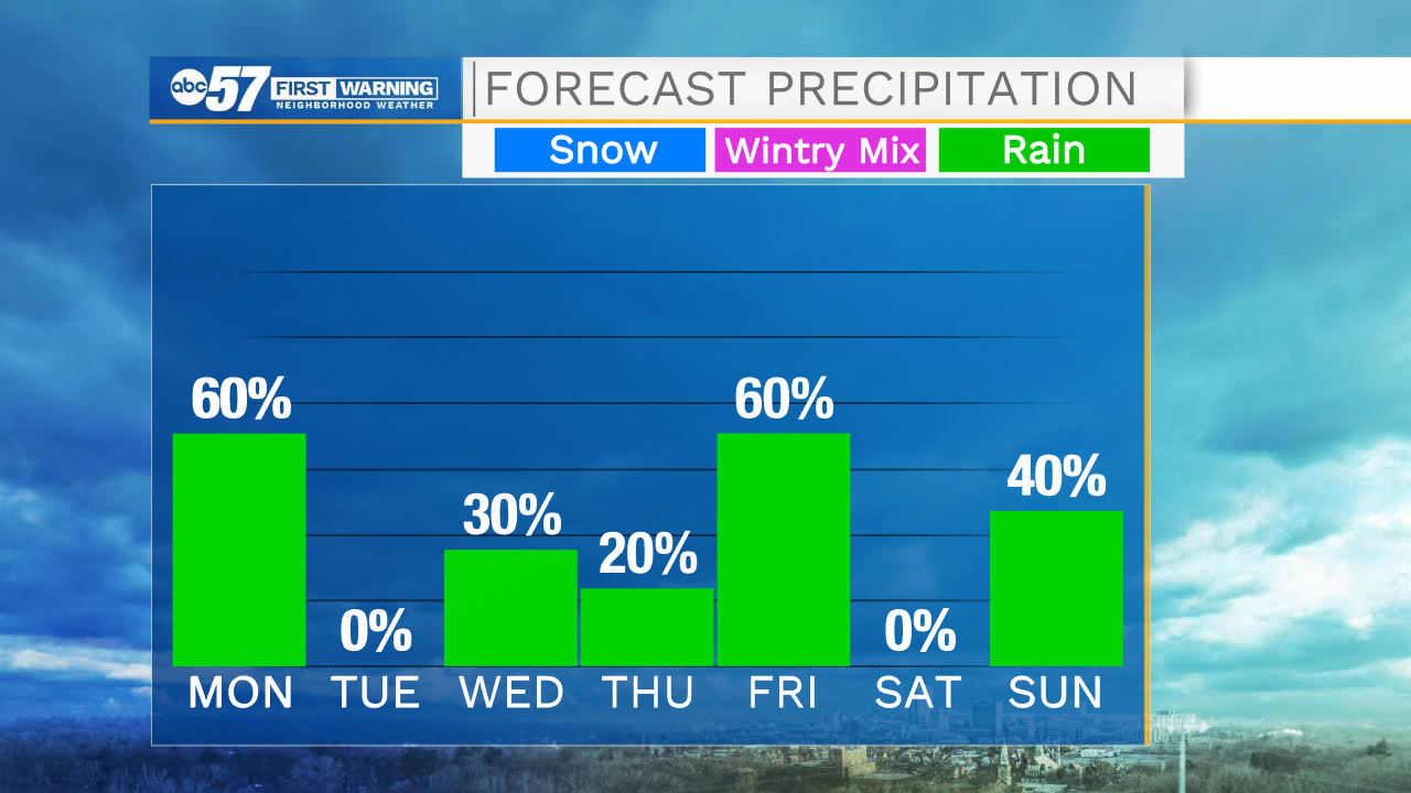
Scattered light rain showers last on and off this morning with more rain developing after midday. Skies dry late this evening and clouds break up overnight. A few peeks of sunshine are possible Tuesday morning but most of the day is mostly cloudy and cool. Temperatures start to warm up Wednesday as a warm front moves in Wednesday night. This will bring another round of showers and possible thunder. This pushes daytime highs into the 70s Thursday with some sunshine to go along with it. Another cold front slides in Friday bringing more rain. Temperatures fall back into the 50s this weekend.
Today: Scattered showers, cloudy. High 47.
Tonight: Mostly to partly cloudy. Low 36.
Tuesday: Mostly cloudy. Rain chance late. High 55.
Wednesday:Early shower possible then breaks of sun. High 62.