After a rainy start, Friday turns sunny and windy (again)

-
1:33

Cool out the door, Mild by afternoon
-
1:50

Top Ten Snow Year 2025-26
-
1:17

South Bend Cubs unveil fan-focused upgrades ahead of Opening...
-
2:21

Notre Dame Fighting Irish ready for spring football
-
2:06

Fighting Irish using time off to refocus ahead of spring practice
-
2:35

What are the privacy implications of SBPD’s ’Drone as First...
-
1:22

Expert discusses Wednesday’s Fed decision
-
3:19

New legislation could make Michigan the 30th constitutional carry...
-
2:15

SBPD using drones to help improve response time
-
1:20

The March roller coaster ride continues
-
1:52

Snow today, rain tomorrow, and warm this weekend
-
0:49

Celebrating St. Patrick’s Day at Corby’s Irish Pub

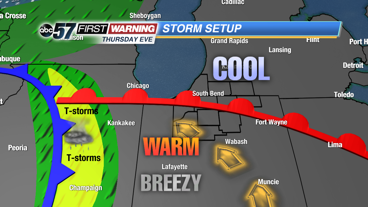
A sharp divide in temperatures, the split between the 70s in the south and 50s and 60s in the north. The surge of warm air will collapse as a front move through overnight. Rain and rumbles of thunder are likely into early Friday morning.
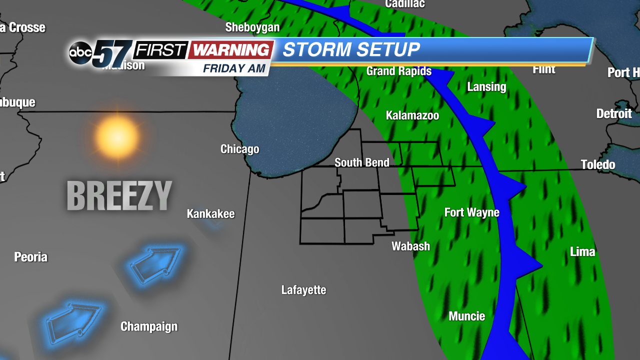
Friday starts rainy then as clouds clear into the afternoon the wind will gust again near 40 mph. The wind calms into Saturday, the nicest day of the weekend, sunny with highs in the mid-50s. Sunday will be soggy and damp with more rain and highs in the 40s. The rain clears into early Monday but there’s more wet weather next week.
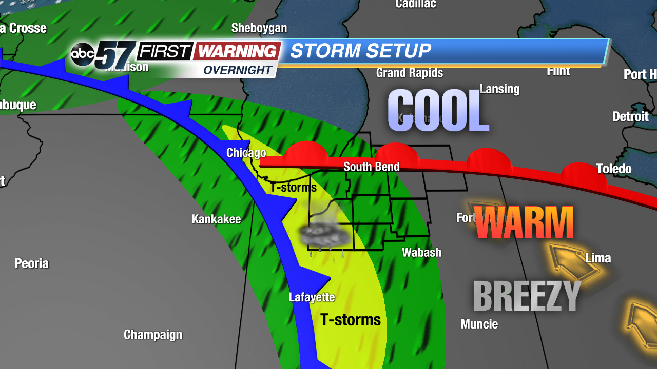
Tonight: Mild and breezy evening, showers and storms after midnight, low 50.
Friday: Morning showers, clearing and winy afternoon, high of 58.
Saturday: Sunny, high of 56.
Sunday: Rainy, high of 48.