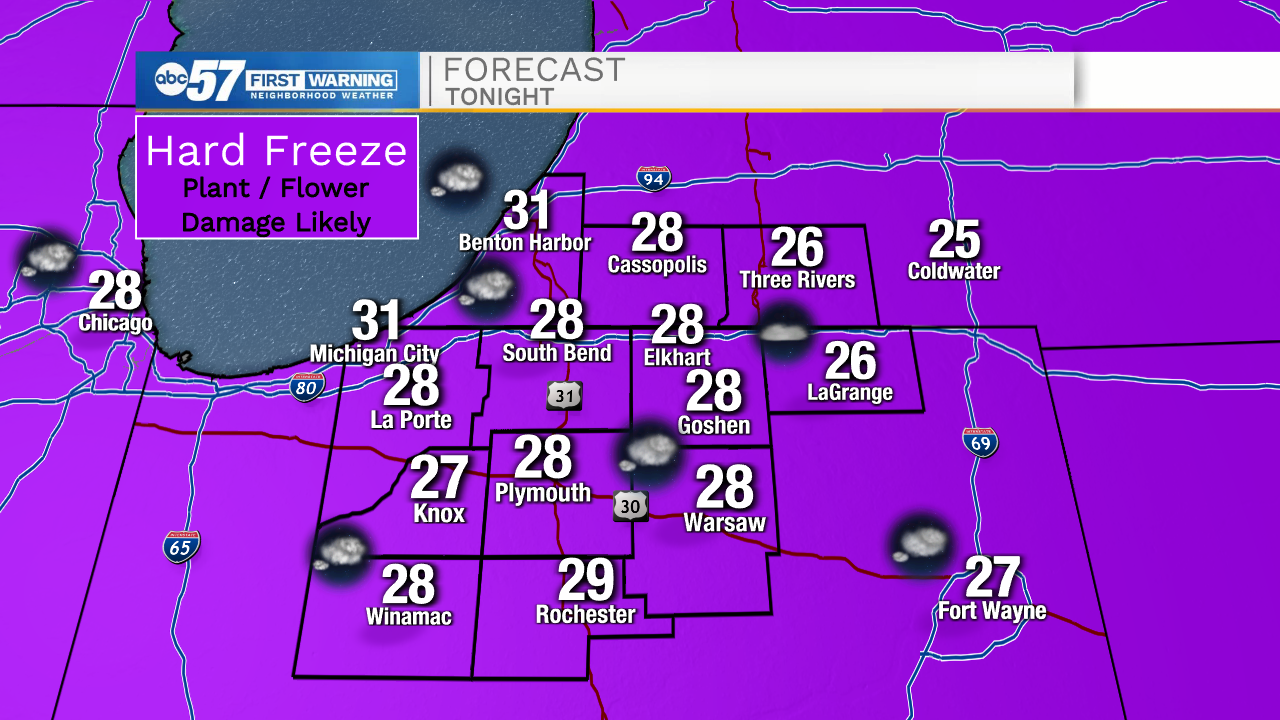
Another hard freeze tonight then improving temperatures


ABC57 First Warning Neighborhood Weather Forecast
Wednesday, April 21st, 2021
It remains chilly on today with a chance of an isolated rain/snow showers this afternoon. Temperatures tonight will likely lead to another hard freeze across Michiana. This will likely kill any uncovered sensitive vegetation and be a big impact to local fruit farmers.
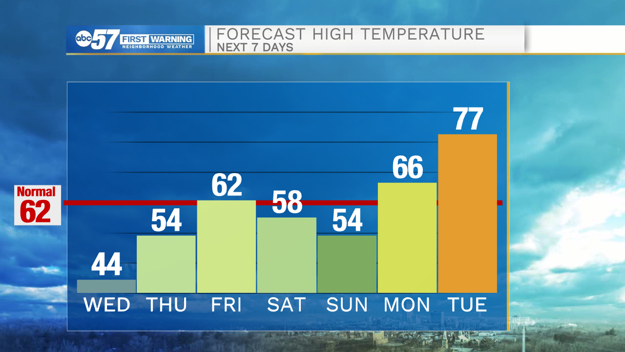
The rest of the work week is fairly bright as temperatures rise back near 60F on Friday. There is a chance of rain on Saturday but Sunday is nicer with a high in the mid 50s. Next week looks much warmer. It warms up quickly next week with 70s returning into our forecast!
Today: Mix of sun and clouds, isolated shower possible. High 44.
Tonight: Partly cloudy. Low 28.
Thursday: Sunny. High 54.
Friday: Increasing clouds, chance late. High 62.