
-
1:43

Pleasant to start the weekend
-
3:06

Pulaski County weighs stricter solar rules amid resident concerns
-
0:40

Marian High School hosts World Down Syndrome Awareness Walk
-
2:33

South Bend leaders call for an end to gun violence
-
2:01

Tae Johnson, Notre Dame secondary stands out as Irish open spring...
-
2:21

Backup quarterback competition, position battles highlight Notre...
-
2:25

A new Pathway to the Golden Dome
-
2:33

Howard Park aims to install bandshell
-
1:37

March Madness and gambling responsibly
-
1:19

There are two big temperatures drops next week
-
1:48

Longer days for the first day of Spring
-
1:30

Country music star Jake Owen to play at Blue Gate Performing...

Nearly as cold or colder tonight, clouds will break, which will mean lows plummeting to or below zero, except closer to Lake Michigan.
There is a slight warm-up to end the week but high temperatures are unlikely to break 20. Light snow showers also stay in the forecast, accumulation of more than one inch each day is unlikely. A reinforcing punch of arctic air is set to impact the central and eastern U.S. for New Year’s Day, temperature will likely dive below zero to start 2018. A break from this frigid pattern still shows up in the models for mid-January.
Tonight: Partly cloudy, flurries, lows near or below zero.
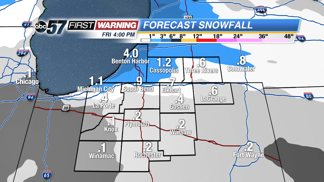 Only minor snowfall through Friday, mostly off Lake Michigan.
Thursday: Partly cloudy, chance of snow late, high of 12.
Friday: Light snow showers, high of 18.
Saturday: Light show showers, highs in the mid-teens.