**Storm System's Impact Regionally and Locally on Sunday**
This weekend will be very active for millions across the country as yet another potent storm system is set to develop. It will bring rain, wind, cold temperatures, and even snow to Northern Indiana, Illinois and Michigan beginning Saturday night. Accumulation of a half-inch of snow can't be ruled out in Michiana, but impacts are not expected. A few to several inches of wet snow are possible in Chicago, Rockford, Milwaukee, Grand Rapids, and Saginaw.
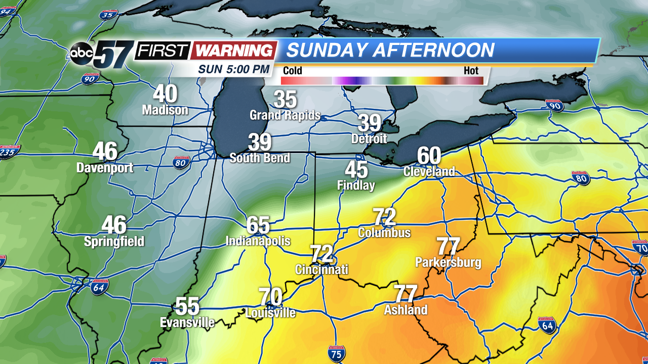 Significant temperature difference Sunday as the system moves through Indiana.
High temperatures will struggle to exceed 40° north of U.S. 30 on Sunday, making for a significantly colder-than-average day. Meanwhile, a surge of warm air will push cities like Indianapolis, Cincinnati, Columbus, and Pittsburgh well into the 60s and 70s.
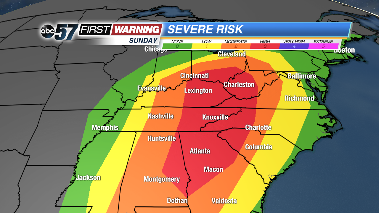 Severe weather outlook for Sunday.
SPC
Severe weather outlook for Sunday.
SPC
Strong to severe thunderstorms are possible to even likely on Sunday in the warm sector of the system from the Gulf of Mexico northward into Kentucky, Indiana, Ohio, and West Virginia. Fortunately, we will stay cold enough to avoid any dangerous thunderstorm activity, but folks in just to our south and east won't be so lucky. There could be damaging winds, hail and isolated tornadoes as close as Indianapolis, Cincinnati and Columbus, Ohio, on Sunday. A level 3-of-5 ("Enhanced") severe risk has already been issued by the Storm Prediction Center in red on the map above.
**Significant Severe Weather and Tornado Outbreak to the South on Saturday**
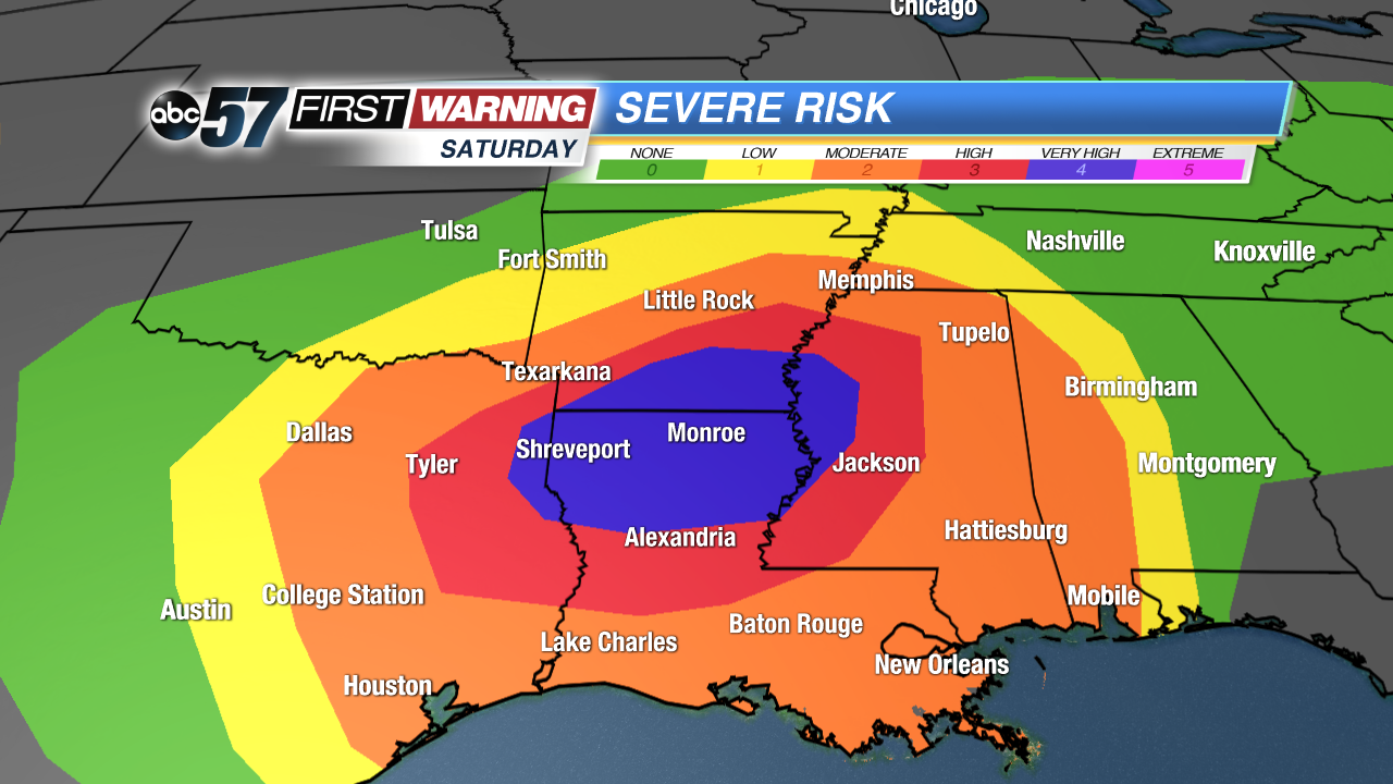 Severe weather threat for Saturday.
SPC
Severe weather threat for Saturday.
SPC
Before we get to Sunday's rain, wind, snow, and thunderstorms across the Great Lakes, Ohio Valley and Tennessee Valley, we have to get by Saturday's expected severe weather outbreak in the Deep South. The Storm Prediction Center has already drawn a level 4-of-5 ("Moderate") zone across parts of Texas, Louisiana, Arkansas, and Mississippi.
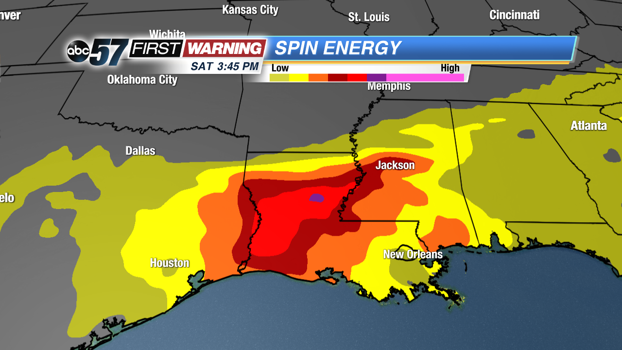 Spin energy in place Saturday is extremely impressive and high.
Ingredients will be very supportive of strong to severe thunderstorms all day Saturday in parts of those states, especially in the red and purple zones. That includes the following cities:
•Louisiana: Shreveport, Monroe, Alexandria
•Texas: Tyler, Longview, Texarkana
•Arkansas: Little Rock, El Dorado, Pine Bluff
•Mississippi: Jackson, Yazoo City, Oxford
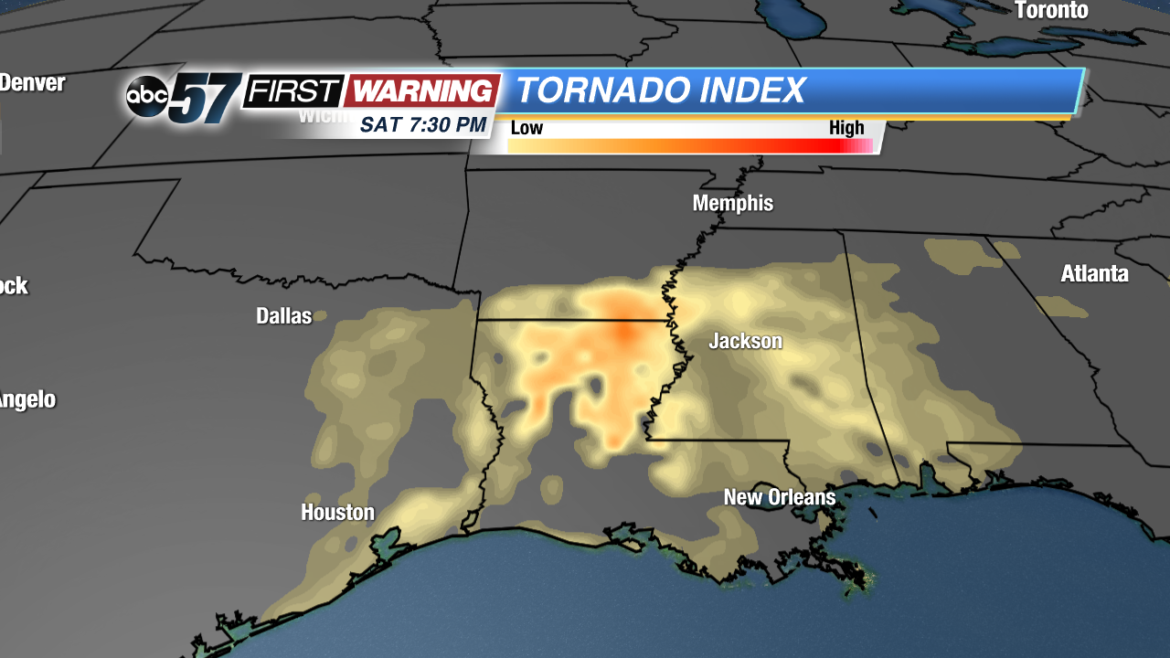 Tornado Index Saturday evening.
There will be plenty of instability (storm energy), wind shear (spin), moisture, warmth, and a strong cold front charging through the area. Everything in place will support numerous thunderstorms capable of large hail, damaging winds and multiple tornadoes. In fact, the Storm Prediction Center is mentioning the risk of several "strong" and "long-lived" tornadoes across parts of Northern Louisiana. Those are the ones that have winds of at least 111 mph, but can have winds upwards of 200 mph. Similar set-ups to the one expected on Saturday have produced significant tornadoes that went on to cause substantial damage. It will be a dangerous day for those across parts of the Deep South.
