
-
1:33

Cool out the door, Mild by afternoon
-
1:50

Top Ten Snow Year 2025-26
-
1:17

South Bend Cubs unveil fan-focused upgrades ahead of Opening...
-
2:21

Notre Dame Fighting Irish ready for spring football
-
2:06

Fighting Irish using time off to refocus ahead of spring practice
-
2:35

What are the privacy implications of SBPD’s ’Drone as First...
-
1:22

Expert discusses Wednesday’s Fed decision
-
3:19

New legislation could make Michigan the 30th constitutional carry...
-
2:15

SBPD using drones to help improve response time
-
1:20

The March roller coaster ride continues
-
1:52

Snow today, rain tomorrow, and warm this weekend
-
0:49

Celebrating St. Patrick’s Day at Corby’s Irish Pub

Scattered showers and thunderstorms will last through late Tuesday afternoon and into the evening. The intensity of storms is not expected to be as strong as Monday night but heavy downpours and gusty wind are still a possibility. Storm activity fades after 10 PM.
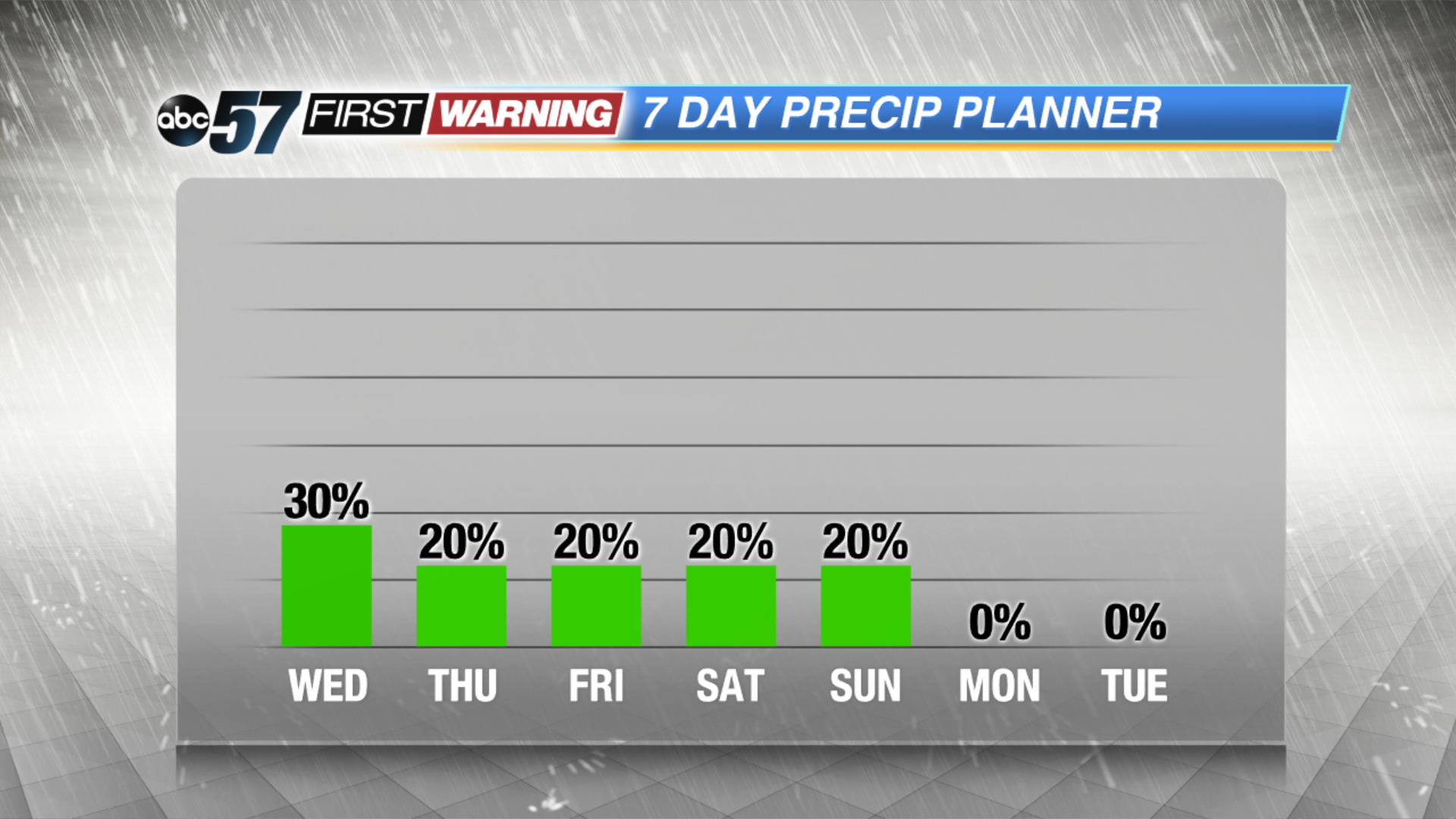
Wednesday will start a bit gloomy with patchy fog and drizzle. The pattern for the next seven days is very August-like. High warm into the low to mid 80s, muggy with a chance of pop-up showers and storms in the afternoon. The forecast does trend slightly cooler and drier into early next week.
Tonight: Mostly cloudy, lingering shower, low of 66.
Wednesday: AM fog and drizzle, highs near 80.
Thursday: Partly cloudy, isolated PM storms, high of 84.
Friday: Partly cloudy, isolated PM storms, high of 86.