Another round of storms tonight, heat breaks this weekend
By:
Tom Coomes
Posted: Aug 28, 2020 4:24 PM EDT

-
1:43

Pleasant to start the weekend
-
3:06

Pulaski County weighs stricter solar rules amid resident concerns
-
0:40

Marian High School hosts World Down Syndrome Awareness Walk
-
2:33

South Bend leaders call for an end to gun violence
-
2:01

Tae Johnson, Notre Dame secondary stands out as Irish open spring...
-
2:21

Backup quarterback competition, position battles highlight Notre...
-
2:25

A new Pathway to the Golden Dome
-
2:33

Howard Park aims to install bandshell
-
1:37

March Madness and gambling responsibly
-
1:19

There are two big temperatures drops next week
-
1:48

Longer days for the first day of Spring
-
1:30

Country music star Jake Owen to play at Blue Gate Performing...

The best chance for widespread rain is Friday night. A lull in thunderstorm activity will re-fire by late evening as the cold front approaches. A line or broken line of showers / storms is possible around midnight. The severe threat remains relatively low.
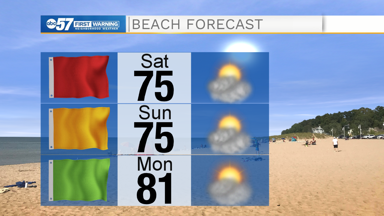
The heat and humidity break this weekend. Saturday is breezy, the northwest wind will cause rough surf on Lake Michigan, this is not the safest weekend for swimmers. The forecast stays fair through the weekend and the chance of rain remains low through next week. A weak system may bring some showers by Wednesday.
Tonight: Scattered thunderstorms, possibly severe. Low 66.
Saturday: Mostly sunny. Breezy. High 76.
Sunday: Sunny. High 76.
Monday: Partly cloudy. High 80
Sign up for the ABC 57 Newsletter