Thursday evening and night brought strong to even severe thunderstorms to parts of Michiana. Hail, strong winds, lightning, and heavy rain were all seen. We will get a break from stronger storms until Sunday.
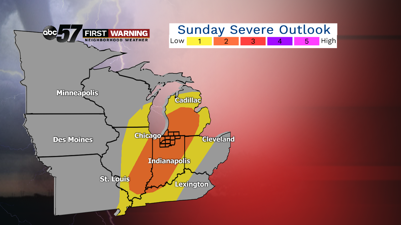 Severe outlook for Sunday.
SPC
Severe outlook for Sunday.
SPC
That's when a powerful area of low pressure and its associated cold front will swing through the Great Lakes. There will be warmth, humidity, moisture, and other supportive ingredients in place to allow thunderstorms to develop across Illinois, Indiana and Michigan. Any of the storms that wind up developing could certainly become strong to severe.
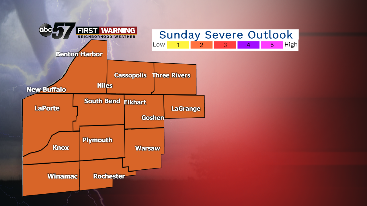 Sunday severe weather outlook.
SPC
Sunday severe weather outlook.
SPC
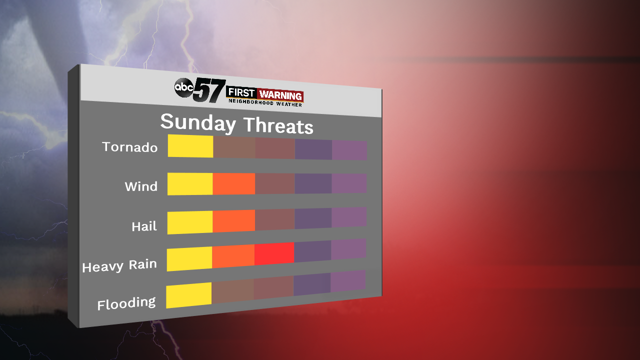
The Storm Prediction Center has already highlighted the entire Michiana viewing area in their level 2 of 5 "Slight Risk" for severe weather. For perspective, that's the same threat level we were under for Thursday and Thursday night.
The threats are mainly heavy rain, strong to damaging wind gusts and spotty hail. A tornado cannot be completely ruled out courtesy of the ingredients that will be in place. One thing we will be watching closely is the amount, if any, of sunshine we see during the morning and early afternoon hours on Sunday.
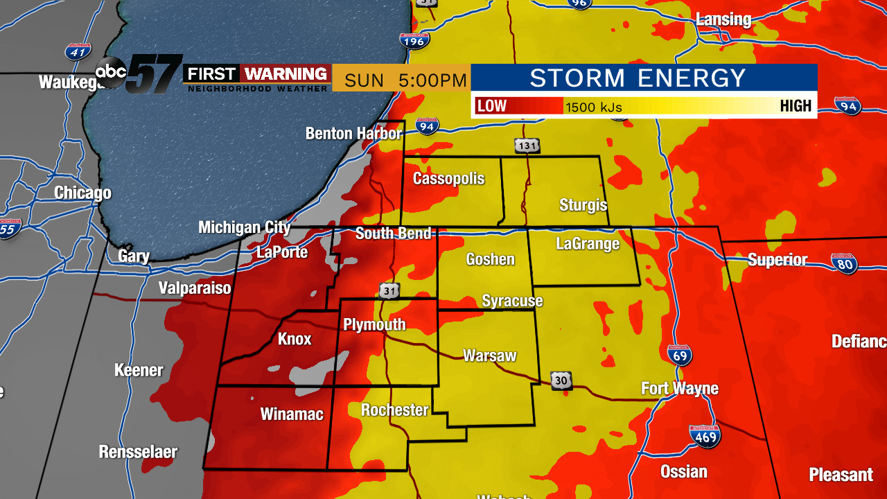 Storm fuel (
Storm fuel (
Storm fuel (
The more sun that shines during the first half of the day will dictate how much destabilization occurs. In other words, the more sun we see, the more "energy" there will be in the atmosphere to support the stronger thunderstorms. However, it is important to note that there will be a severe threat even if we don't see much sun. The threat is just higher and more substantial when the sun is out before storms roll in.
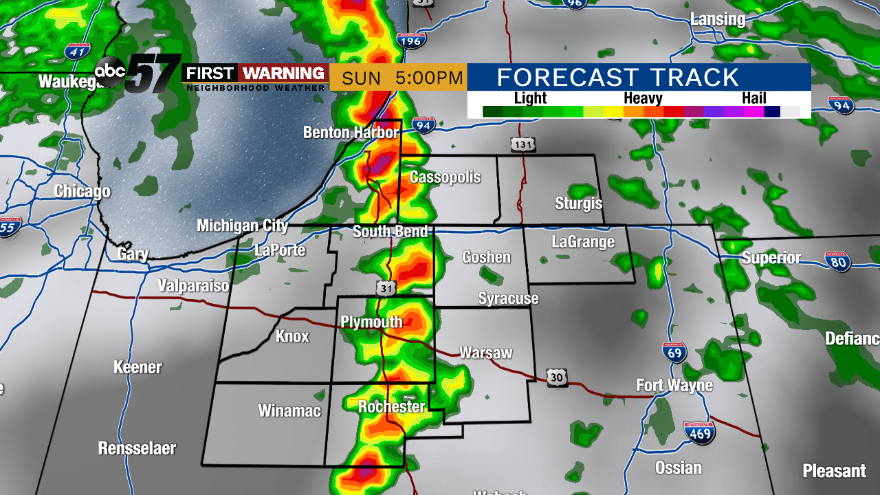 Potential radar Sunday afternoon/early evening.
It's plausible that we see scattered showers and storms through the morning, afternoon and early evening with breaks in-between. It won't rain constantly all day, but showers and storms could occur or develop at any moment throughout the day. The best chance for seeing strong to severe storms will come after 2 p.m. into the early evening as the potent cold front sweeps through. Just be sure you have a way to receive pertinent weather information on Sunday if you plan on being out and about!