
-
2:12

South Bend City Council passes resolution urging pause on Midwest...
-
0:46

Niles City Council vote yes on putting marijuana question on...
-
0:29

Multiple Fire Departments battle residential fire in Berrien...
-
2:10

Notre Dame men’s basketball embracing urgency as Shrewsberry...
-
2:37

Local Beef-A-Roo employees still owed paychecks as private equity...
-
1:42

More storms through 8:00 p.m.
-
1:06

2nd annual Inclusive Art Fair
-
2:20

Tracking severe weather through the mid-afternoon
-
3:17

Applications open for Fall Citizens Police Academy in South Bend
-
2:23

Elkhart County 4H Fair food vendors celebrate 50th year of business
-
2:16

Young football athletes learn about protecting their bodies,...
-
1:24

Storm track timing could be shifting

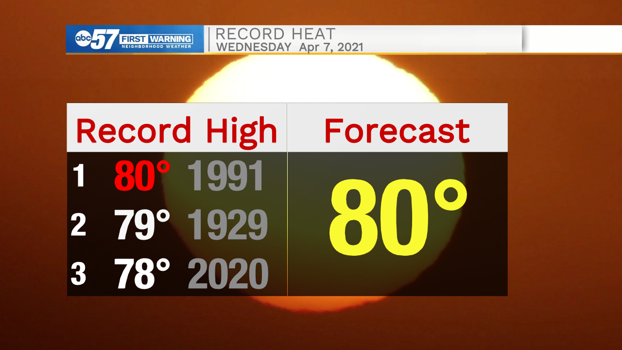
Near-record warm continues Wednesday, if we hit 80 it would tie a record high set in 1991. Clouds increase Wednesday night ahead or our best chance of rain this week, scattered showers Thursday, with more than a quarter inch of rain. There's a lull between systems Friday, with another chance of scattered showers Saturday. Temperatures cool over the next week, but it's more a return to seasonal norms, than chilly weather.

Tonight: Partly to mostly clear. Low 58.
Wednesday: Increasing clouds. High 80.
Thursday: Showers. High 70.
Friday: Partly cloudy. High 66.
Sign up for the ABC 57 Newsletter