
-
3:12

How to keep yourself and others protected during firework season
-
0:49

Showers creeping into Michiana
-
0:42

Judge approves $25M water lawsuit settlement
-
1:00

Scattered showers through the day
-
1:53

Hispanic Community Child Safety Meeting: A Call To Action
-
2:51

Obama Presidential Center features work of South Bend company
-
1:54

This week’s ABC57 Cub Reporter is Isaac Knefely
-
1:16

Real summer heat returns next week
-
2:28

South Bend storm drain mural project complete
-
5:17

Three local students return as national powerlifting champions
-
1:09

Rain showers to end the work week
-
5:36

Benefit Car Show supporting Berrien County’s first responders...

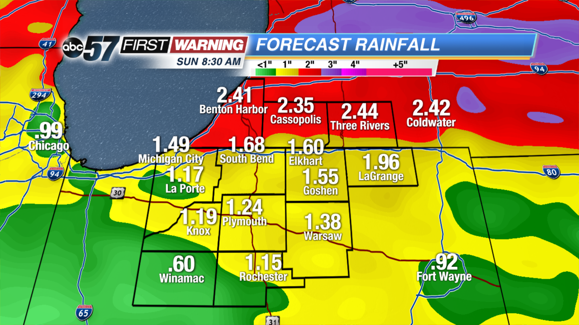
A stationary front will cut a sharp divide in temperatures across North Central Indiana. Most of Michiana will stay in the cool sector, meaning highs in the 50s and 60s but 70s and 80s will loom just to our south. Along that stalled boundary will form rounds of showers and thunderstorms that last through Saturday. These near stagnant systems can lead to excessive rainfall and flooding, more than two inches of rain could fall in the next 48 to 72 hours, minor flooding is possible.
Tonight: Mostly cloudy, chance of showers late, low of 46.
Friday: Mostly cloudy, chance of showers and storms, high of 62.
Saturday: Scattered thunderstorms, high of 62.
Sunday: Becoming partly cloudy, high of 70.
Sign up for the ABC 57 Newsletter