Big cool-down, wintry mix Tuesday


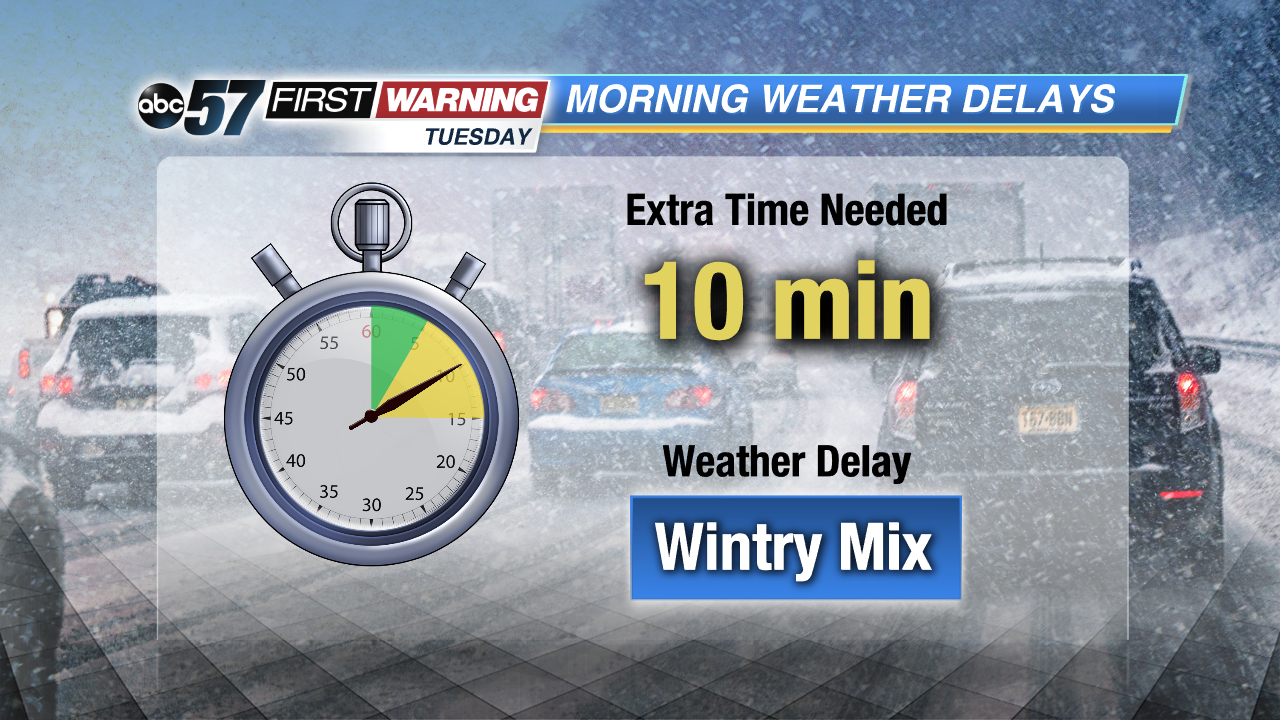
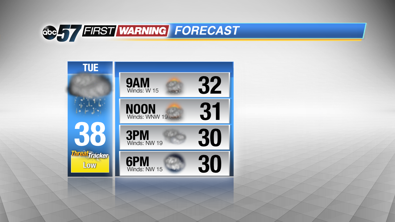
Temperatures fall overnight from the mid-40s to mid-30s by Tuesday morning. The official high for Tuesday will likely be just after midnight, forecast of 38 degrees. Rain changes to wintry mix and snow but air and ground temperatures will stay above freezing, expect mostly wet instead of slippery roads. Slick spots are still possible as temperatures drop through the day, bridges and overpasses the greatest concern.
Tuesday temperatures hold in the mid to lower 30s. Wintry mix changes to light snow but little accumulation is expected. The cold snap lasts through Wednesday, then temperatures rise again towards 50 on Friday. The pattern over the next two weeks remains more erratic with ups and downs, highs mostly above normal and more rain than snow in the forecast.
Tonight: Rain changing to snow, low of 38.
Tuesday: Wintry mix and snow, temperatures falling from 38.
Wednesday: Mostly to partly cloudy, high of 32.
Thursday: Mostly sunny, highs near 40.