 The Polar Vortex is in 2-3 pieces right now across the Northern Hemisphere. This opens up the gate to frigid air in the Great Lakes.
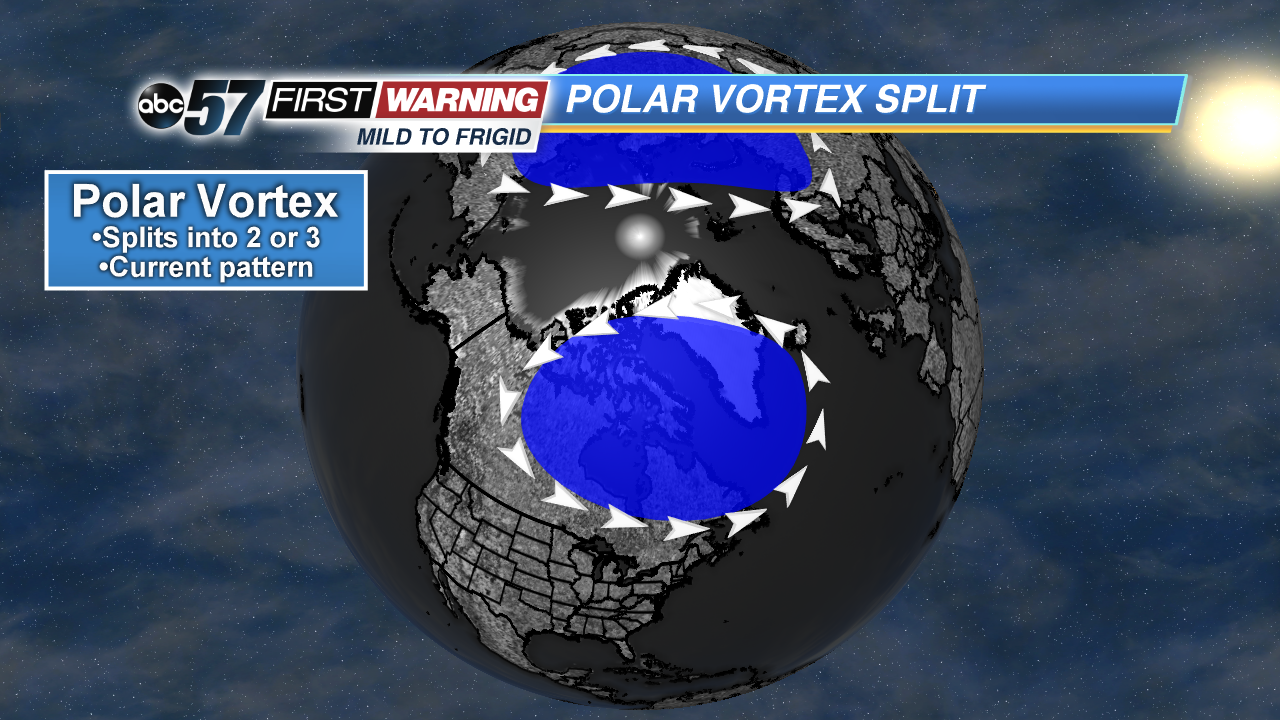
January has certainly been a cold month. We saw a low of -12° Monday morning in South Bend. That kind of cold isn't all that common around here. But that was just the beginning of a series of waves of truly arctic air. The short-lived warm-up seen Tuesday and Wednesday is history, and now we're just waiting for the next arctic blast. The reason behind the frigid to downright dangerous cold takes us back to the infamous Polar Vortex. The Polar Vortex is simply a large area of low pressure and is always present near the Poles. Occasionally, the vortex can rupture and become less organized. This leads to two or three smaller and weaker "Polar Vortexes" existing throughout the Northern Hemisphere.
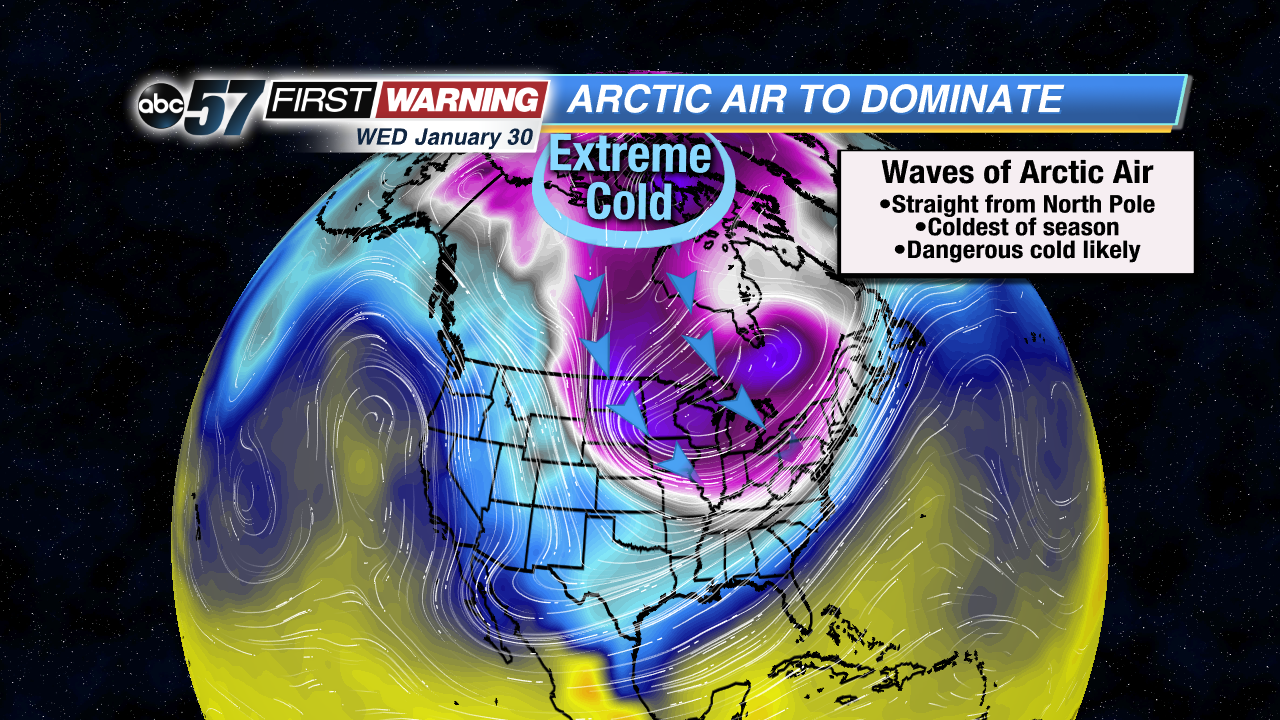 Our air for the next 7-10 days will come directly from the North Pole at times.
What does this mean for our weather in Michiana? Cold, cold, cold. And, at times, frigid to extreme cold. Unfortunately, that will be the case for the next 10 days with a couple of reinforcing shots of air straight from the Arctic Circle and North Pole heading right for the Great Lakes region. It's not something that happens often, but when it does, we typically see our coldest air of the winter season.
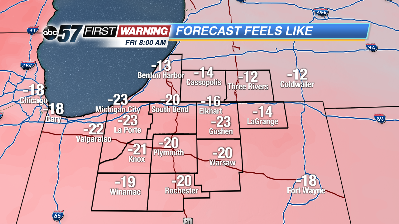 Wind chill forecast for Friday morning.
By Friday morning, actual air temperatures will be near 0° with wind chill temps as low as -15° to -25°. In fact, it would not be surprising to see actual air temperatures drop several degrees below zero if skies clear out and winds don't come from the northwest. What's worse is we won't really warm too much Friday afternoon. It'll be similar to what we saw on Monday with highs staying in the single digits.
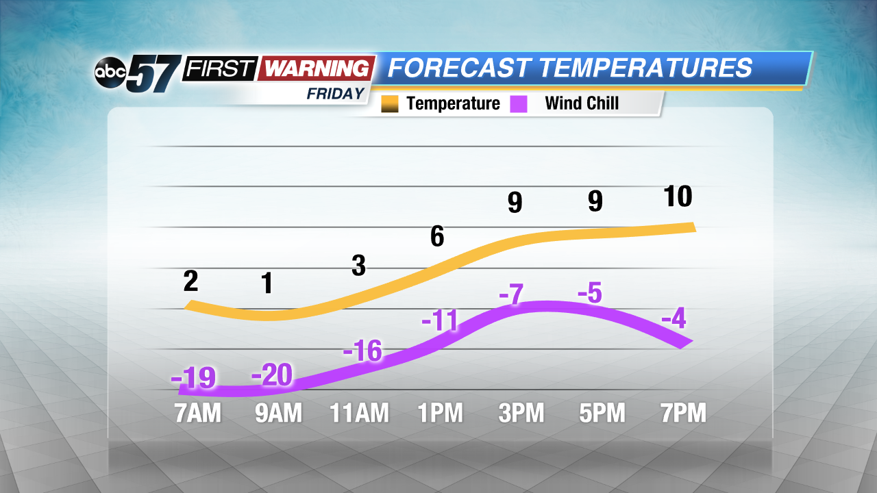 Temperature and wind chill forecast Friday.
That's when things become dangerous. It will "feel like" it's well below 0° ALL day long. With wind gusts upwards of 15-25 mph at times, frostbite and hypothermia will be real concerns. Frostbite will be especially possible on exposed skin as it could develop in 30 minutes or less if proper precautions are not taken.
Thankfully we moderate slightly into the weekend with temperatures in the upper teens and wind chills closer to 0°. It won't last, though. After possibly flirting with 30° on Monday, another shot of arctic air will arrive and last through the entire week. The coldest and most dangerous air is set to arrive Tuesday and last through Thursday or Friday, if not longer. That stretch will be the coldest of the season. Actual air temperatures will drop below zero with afternoon
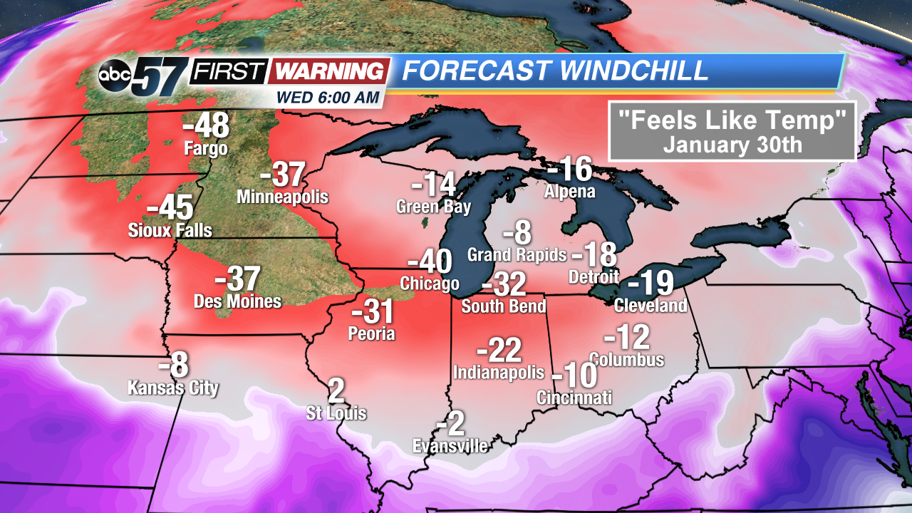
highs possibly staying near or below 0°. What is more eye-popping is the forecasted wind chill temperatures by Wednesday and Thursday mornings. Both the European and American models show wind chill temperatures falling to -20° to -40° across Indiana, Illinois and Iowa. While it's too early to forecast exact wind chill temps for next week, the trend has continued to be bitterly and dangerously cold temperatures. Wind chill alerts will likely be issued a couple of times over the next 7-10 days.