Bitter cold and a chance of light lake effect snow

-
2:43

South Bend residents see future plans for former Drewry’s Brewery
-
2:45

Damage assessment continues in Elkhart County following EF-2...
-
0:44

Indiana and Illinois set record for tornadoes
-
1:27

Community Build underway at Kathryn Park
-
2:34

Day two of searching for a missing child continues
-
3:47

The Elkhart community is searching for answers after a 2-year-old...
-
1:04

Overall pleasant for Michiana
-
1:52

South Bend Common Council issues an official apology to residents...
-
0:54

Slightly cool out the door
-
1:54

Suspect identified, charged in fatal hit-and-run of Timothy Johnson
-
0:39

Prairie Street Cemetery works to clear storm damage
-
1:36

Reaching out for support gives father a second chance in life

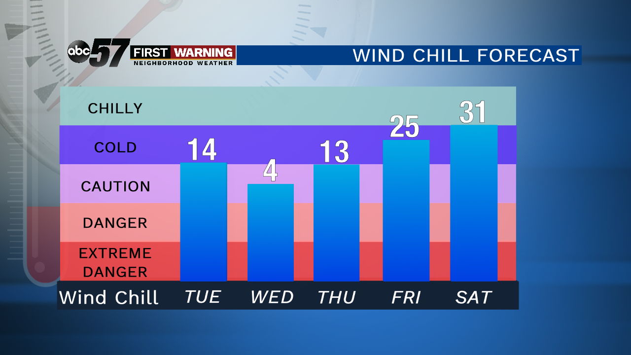
Tuesday, December 10th, 2019
Temperatures have fallen below freezing this morning so a slick spot or two is possible during your commute. A couple of light lake effect snow showers will develop, but it won't add up to much. Up to 2" possible for a couple of Michigan counties. It stays cold Wednesday with a high only in the mid-20s. A couple of flurries are possible, otherwise it's just breezy. Temperatures begin to improve Thursday with a quiet end to the work week. There is a chance of snow Saturday evening with cloudier skies through the weekend.
Today: Mostly cloudy, light lake effect snow. Breezy. Temperatures hold in the mid-20s
Tonight: Few clouds, flurries possible. Low of 14.
Wednesday: Partly cloudy, breezy. Chance of a flurry. High of 25.
Thursday: Mix of sun and clouds. High of 36.