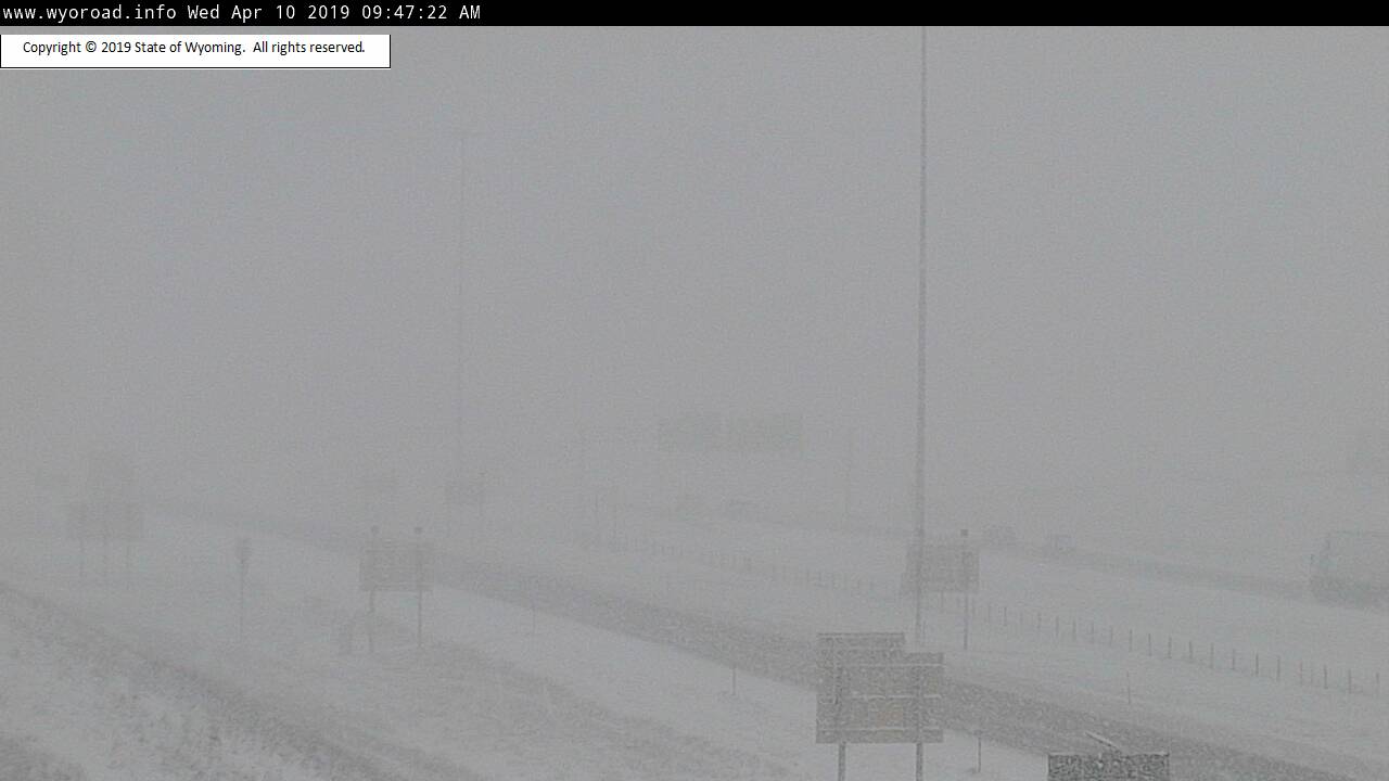
 Conditions along I-25 in Wyoming at 10 a.m. local time Wednesday.
WYDOT
Conditions along I-25 in Wyoming at 10 a.m. local time Wednesday.
WYDOT
The powerhouse springtime storm system that has been much-discussed all week has already dropped up to a foot of snow across parts of the High Plains as of Wednesday afternoon. Combined with strong winds, the snow has been creating blizzard conditions from Colorado to Minnesota. And this is only the beginning. Conditions are expected to worsen for millions as heavy snow and intense winds continue through Friday across the High Plains, Upper Midwest and eventually Northern Michigan.
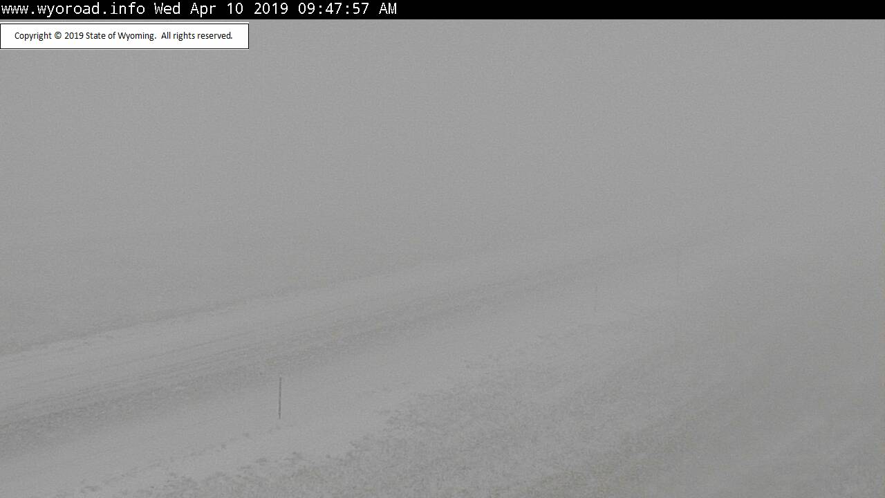
 I-80 in Wyoming as of 10 a.m. local time.
WYDOT
I-80 in Wyoming as of 10 a.m. local time.
WYDOT
By the time the system is all said and done, upwards of two feet of snow will have fallen in spots across the Northern Plains. Fortunately for us, we are on the warm side of the system.
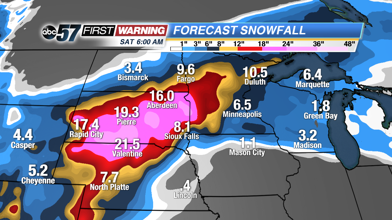 Total potential snowfall thru Saturday morning.
That means no snow or wintry weather locally. Instead, we will see strong winds, warm temperatures and a line of heavy rain and thunderstorms. Due to the impressive ingredients that are expected to be in place with this system, there could be strong to perhaps damaging thunderstorms thrown in the mix as well.
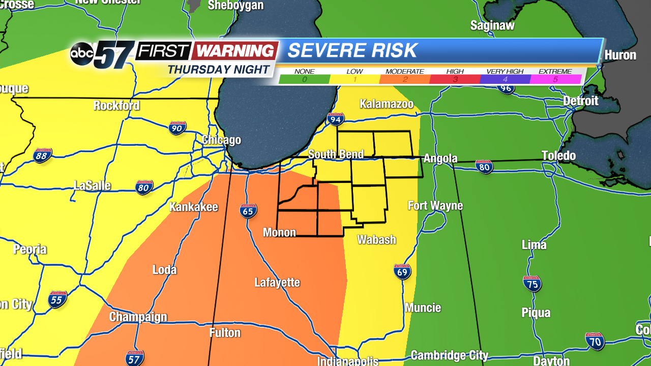 Severe weather threat for Thursday evening and night.
SPC
Severe weather threat for Thursday evening and night.
SPC
All of Michiana is in the risk zone for severe weather as of Wednesday afternoon. Areas with the highest chance of seeing severe weather will be west of U.S. 31. That is where a level 2 of 5 "Slight Risk" has been issued by the Storm Prediction Center.
The reasoning behind those areas being at a highest risk for severe weather is simple: the storms are expected to arrive there earlier in the night, meaning there will be better ingredients in place for stronger thunderstorms. Some locations in that higher risk zone include:
•Winamac, Francesville, Rochester, Plymouth, Knox, Koontz Lake
•Wanatah, La Porte, Portage, Valparaiso, Gary, Crown Point, Merrillville
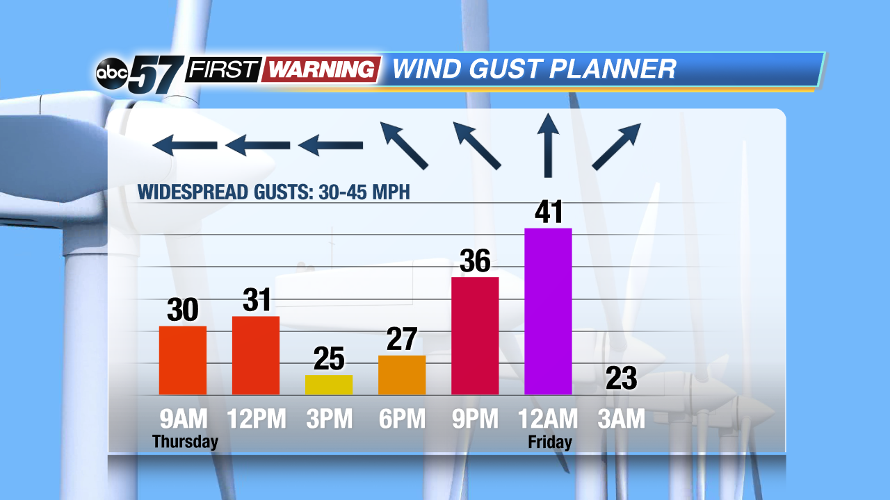
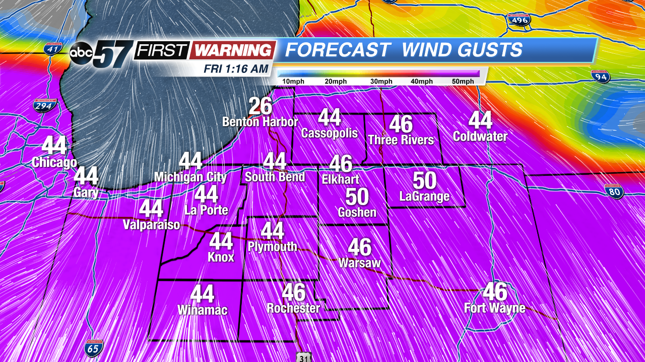 Strong wind gusts are likely Thursday into Friday, with gusts occasionally over 40 mph. These are the projected wind gust speeds late Thursday night.
A line, or lines, of rain and storms will likely develop near the Mississippi River and push eastward thru Illinois during the afternoon and evening. Eventually the chance of rain and storms will rise as the line pushes into Indiana and Michigan later into the evening. For folks west of U.S. 31, the best chance of strong storms will come before 2 a.m. Friday morning. For those east of U.S. 31, the severe risk is lower, but would exist around 2-3 a.m. Regardless of whether or not we see strong thunderstorms, there will be plenty of wind energy with this system as a whole.
 Wind gust potential Thursday.
Thus, wind gusts from Wednesday night to early Saturday morning will be breezy to strong at times. There is no official wind alert in effect, but gusts could certainly reach 30-40 mph, if not 40-50 mph at times during the window of 10 p.m. Wednesday to 7 p.m. Friday.
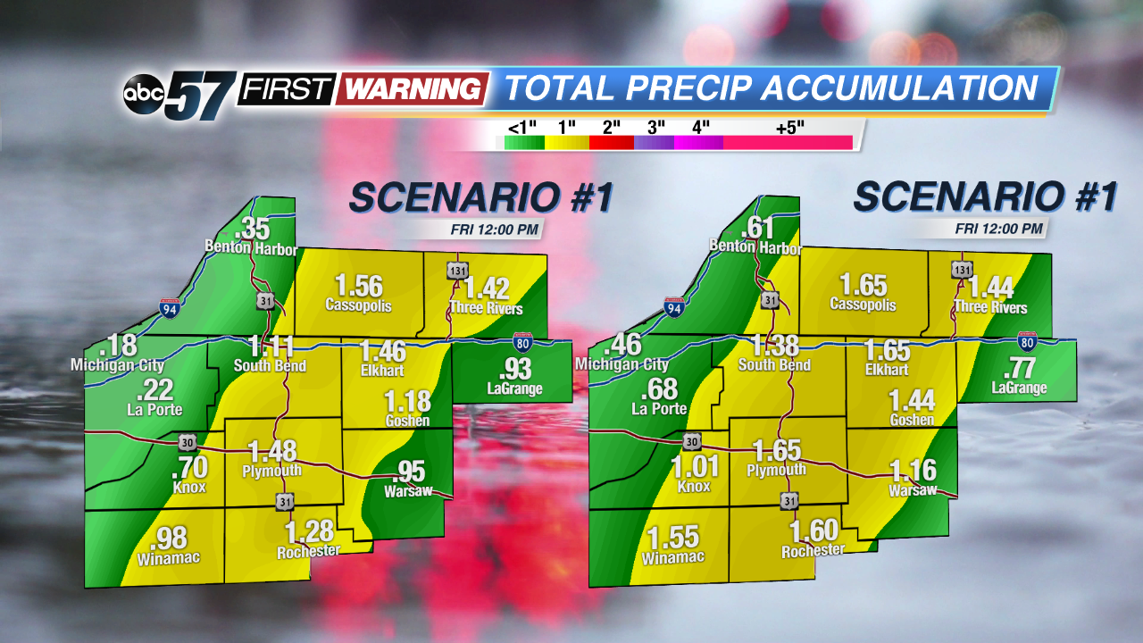 Potential rainfall thru Friday night.
Also separate from any severe threat is the sheer amount of rainfall expected. There will be quite a bit of moisture available with the system as it pushes through Thursday night. The result will be the potential for heavy rainfall for a window of a few to several hours. Upwards of 1-2" of rain could fall depending on just how heavy the rain is and how long it falls at any give location. Could this lead to a few instances of flash flooding? Yes. Are we expecting widespread flooding and high water concerns? Not at this juncture.
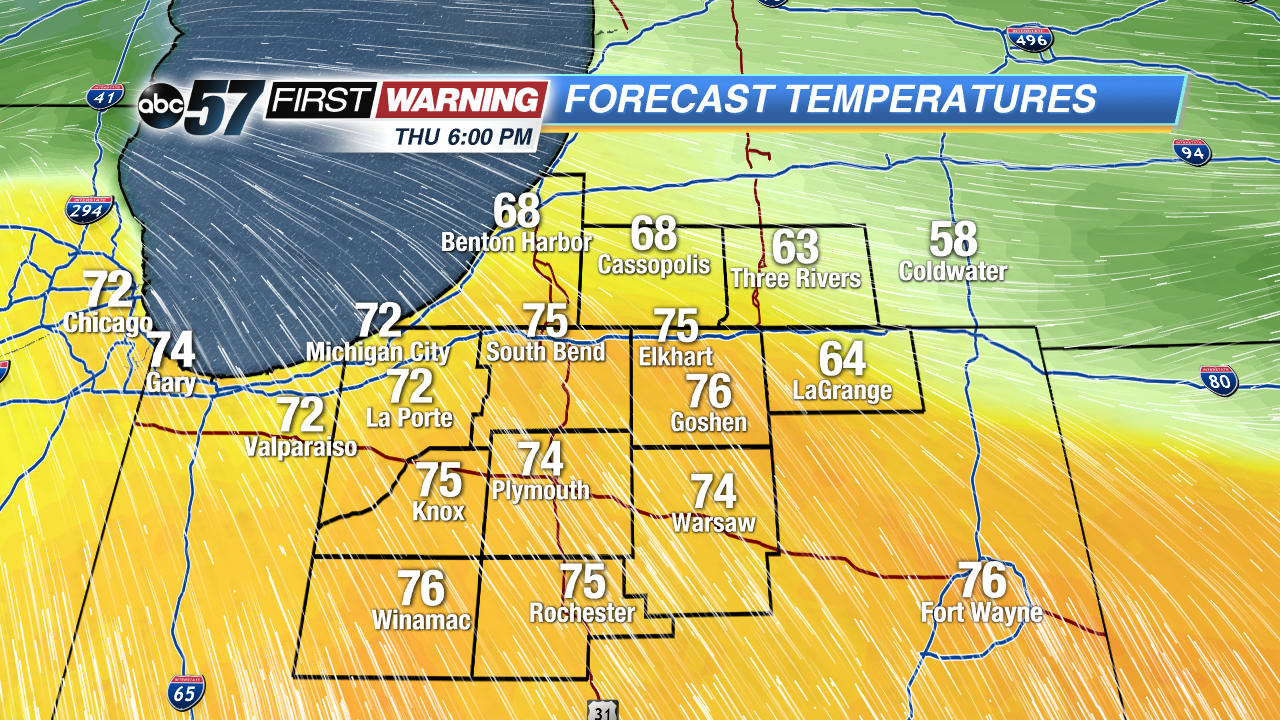 Potential high temperatures Thursday evening.
The good news with this powerful system is we will see a very warm day on Thursday. Once the warm front passes during the afternoon hours, temperatures will spike into the upper 60s in Michigan and 70s in Indiana. It is certainly possible that we surge into the middle or even upper 70s if we see any sunshine! Enjoy the warmth, though, because the weekend and early next week looks significantly cooler!
