
-
2:51

Governor Whitmer appeals FEMA federal aid denial for Southwest...
-
3:17

Benton Harbor leaders weigh Jean Klock Park upgrades amid debate...
-
1:40

Pollinator Playpath, a trail for kids, now open at Corson Riverwoods...
-
0:32

Ryan Newman racing Saturday at Plymouth Motor Speedway
-
3:08

Officials recover body of missing teenager in Lake Michigan off...
-
2:45

NCAA’s new eligibility rule could reshape Notre Dame roster...
-
1:08

Storms start this afternoon
-
0:56

Calm morning, storms tonight
-
2:43

South Bend residents see future plans for former Drewry’s Brewery
-
2:45

Damage assessment continues in Elkhart County following EF-2...
-
0:44

Indiana and Illinois set record for tornadoes
-
1:27

Community Build underway at Kathryn Park

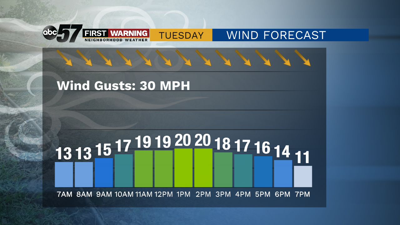
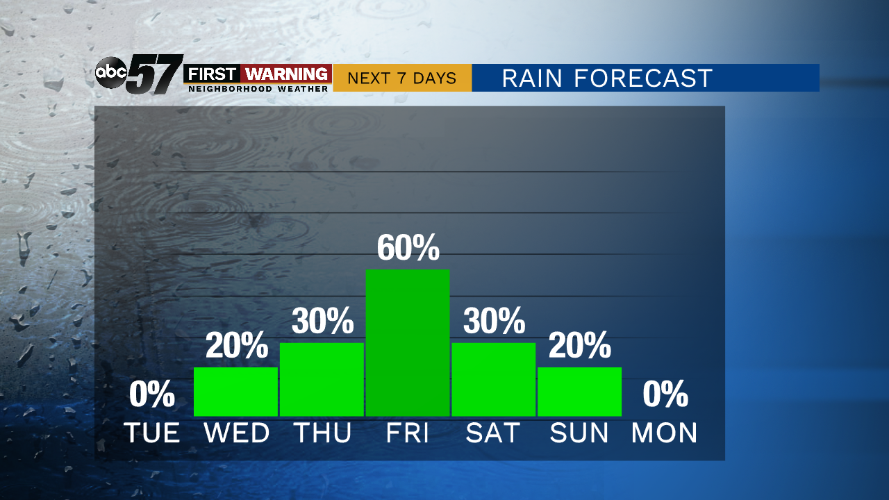
Tuesday snaps back to chilly and breezy but unlike last week it only one day. Temperatures struggle to reach 45 and the wind chill with be in the 30s with gusts topping 30 mph. The rest of the week feels more seasonal with highs near 60, before another dip this weekend, with highs near 50. The overall all trend is milder, with a few dips along the way. The end of the week also looks wet, chance of rain starts Wednesday evening and lasts through Saturday, Friday night is most likely for widespread rain.
Tonight: Showers after midnight. Low 36.
Tuesday: Mostly sunny, breezy. High 44.
Wednesday: Partly cloudy. High 62.
Thursday: Mostly cloudy, scattered showers. High of 60.
Sign up for the ABC 57 Newsletter