
-
1:43

Pleasant to start the weekend
-
3:06

Pulaski County weighs stricter solar rules amid resident concerns
-
0:40

Marian High School hosts World Down Syndrome Awareness Walk
-
2:33

South Bend leaders call for an end to gun violence
-
2:01

Tae Johnson, Notre Dame secondary stands out as Irish open spring...
-
2:21

Backup quarterback competition, position battles highlight Notre...
-
2:25

A new Pathway to the Golden Dome
-
2:33

Howard Park aims to install bandshell
-
1:37

March Madness and gambling responsibly
-
1:19

There are two big temperatures drops next week
-
1:48

Longer days for the first day of Spring
-
1:30

Country music star Jake Owen to play at Blue Gate Performing...

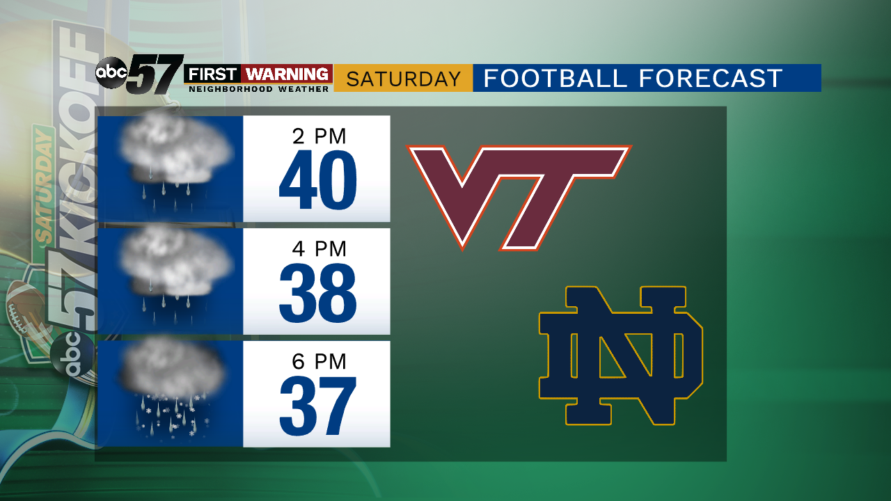
Another round of possibly messy weather Saturday. A front will bring rain/snow showers early Saturday and continued chilly and gloomy weather the rest of the day. With temps struggling to reach 40, lake effect precipitation is possible, rain and snow. Accumulation is unlikely but rain/snow showers continue through the evening. Sunday and Monday are a little drier and milder but the patter overall is chilly for early November.
Tonight: Mostly cloudy, rain/snow showers by morning. Low of 34.
Saturday: Cloudy, lake effect rain/snow showers. High of 41.
Sunday: Mostly cloudy. High of 45.
Monday: Mostly cloudy, rain late. High of 50.
Sign up for the ABC 57 Newsletter