


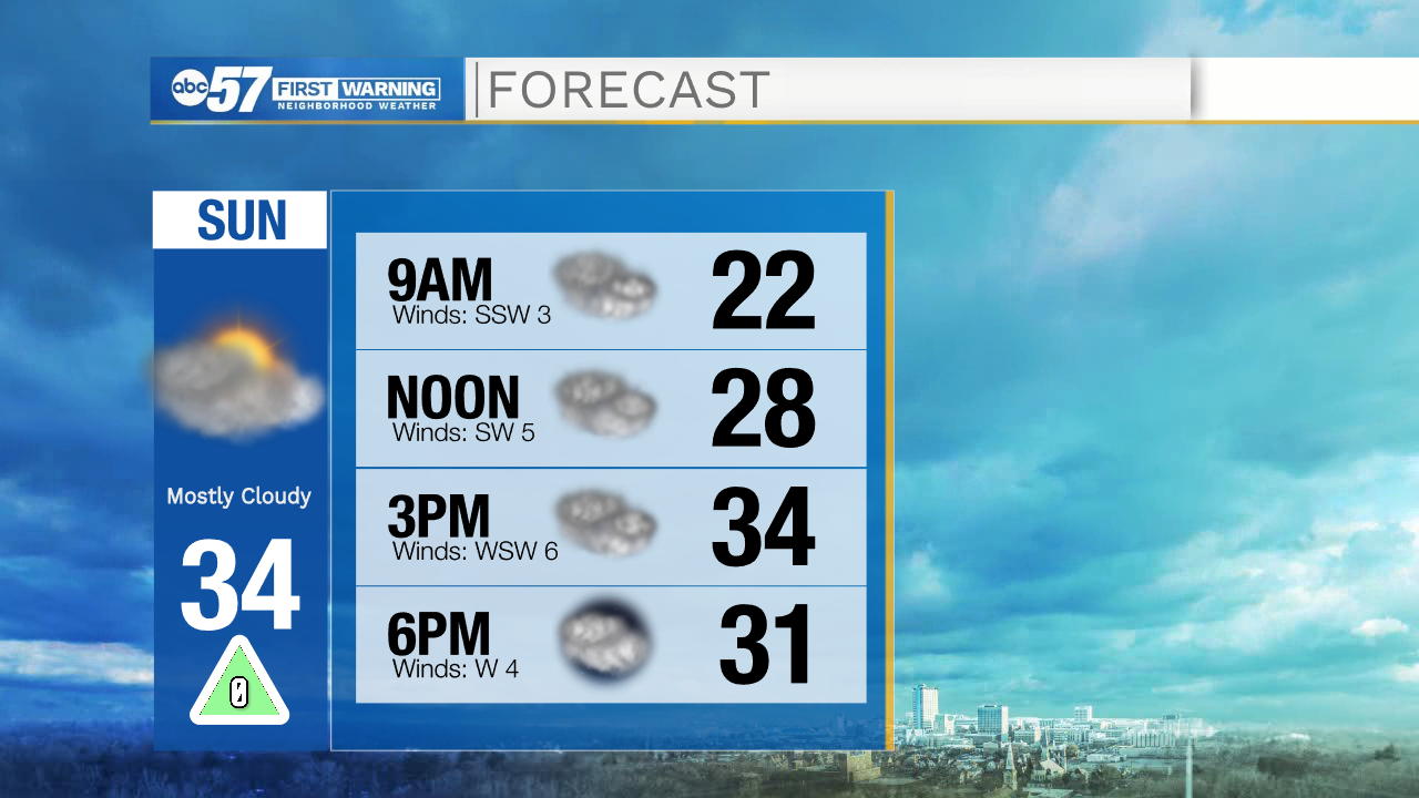
Expect a quiet end to the weekend. Early today there have been some reports of low visibility and patchy fog. Freezing fog could lead to a few slick spots on the roads this morning. Fog lifts late this morning.
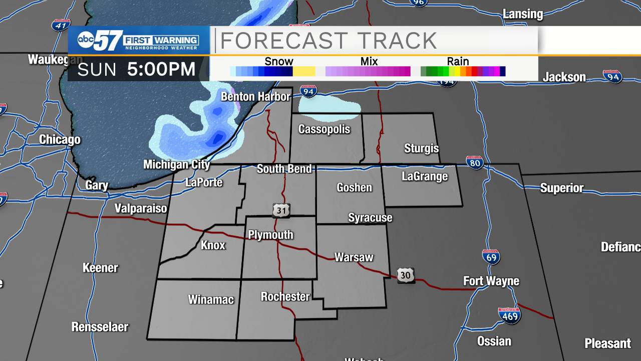
This afternoon and evening, there is a chance for some flurries or a brief snow shower off of Lake Michigan. Berrien or LaPorte Counties could see a light dusting of snow, while everyone else will stay dry but mostly cloudy today.
This morning is cool, with temperatures in the upper teens. We'll warm to the mid 30s this afternoon, so keep plenty of warm layers if you're planning on heading outdoors.
The week starts quiet Monday through Wednesday with a gradual warming trend each day. Thursday is the warmest, with a high around 40.
Thursday afternoon we'll see rain showers, gradually turning to rain / snow showers through the evening and snow showers overnight. The snow showers will likely continue into part of Friday. There is a chance for additional snow Saturday and Sunday.
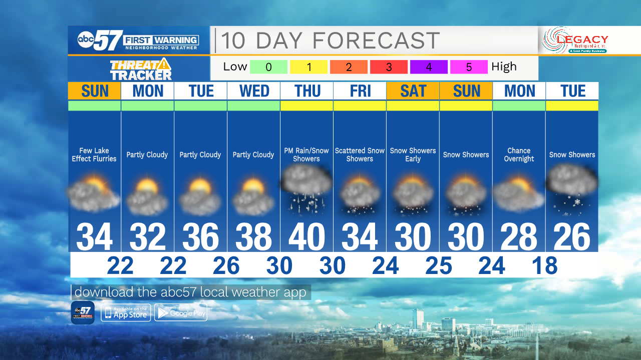
Today: Mostly cloudy. Few lake effect flurries. High 34.
Tonight: Mostly cloudy. Few lake effect flurries. Low 22.
Monday: Partly cloudy. High 32.
Tuesday: Partly cloudy. High 36.