


It's a cloudy start to Tuesday with a few stray showers off of the lake. There is still a little breeze today, so temperatures feel like the upper 20s this morning.
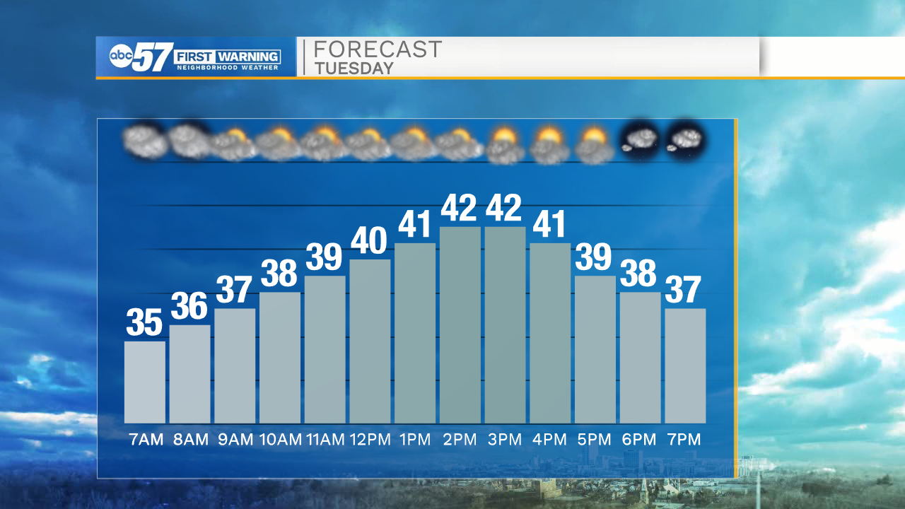
By afternoon we'll have a nice warm up and reach a high in the low 40s. Some clouds break by afternoon, and we'll have a chance to see some sunshine again today.
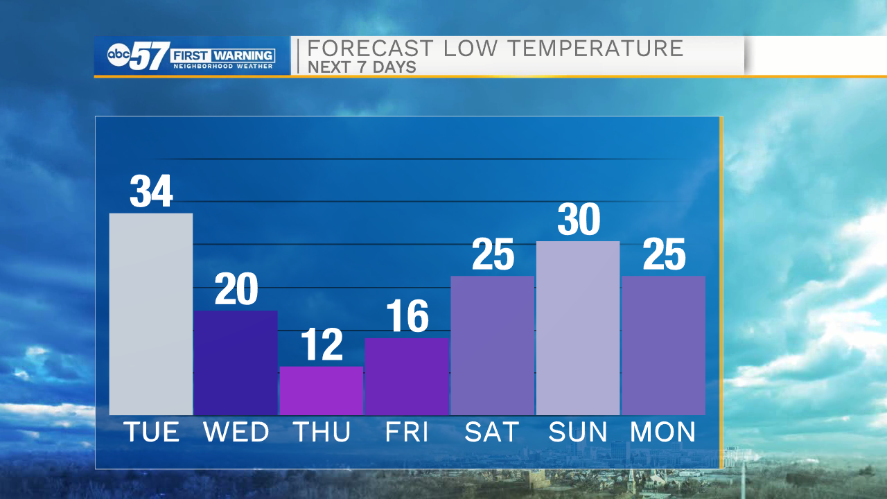
Clouds are back tonight with a low around 34.
Wednesday is the warmest day of the week, with a high in the upper 40s or possibly near 50 degrees. Enjoy the mild day- temperatures tank on Thursday.
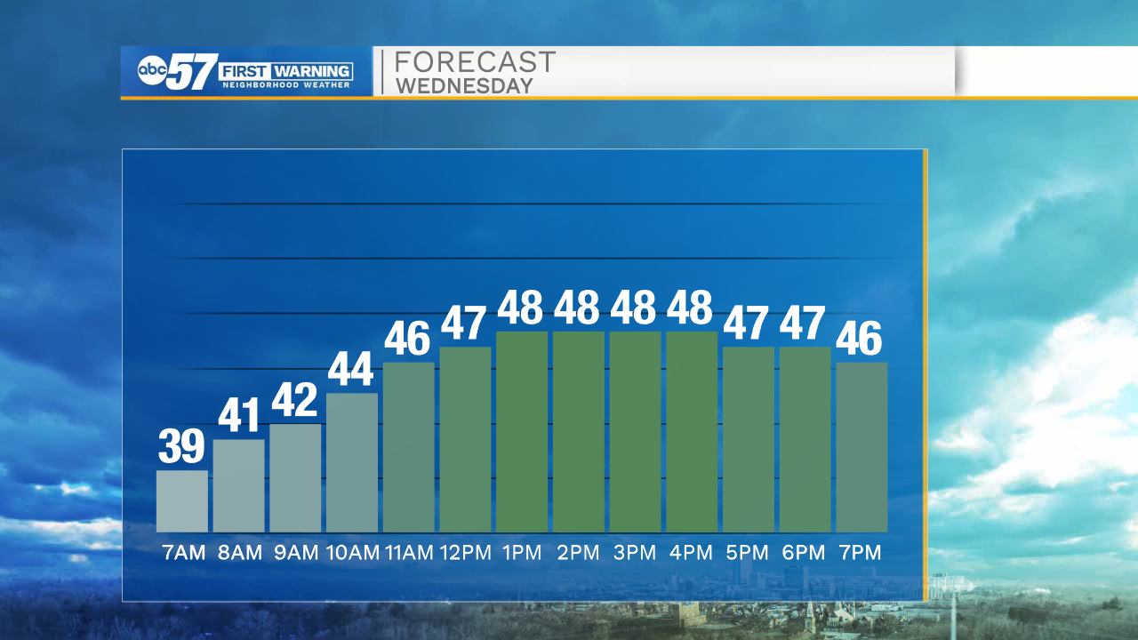
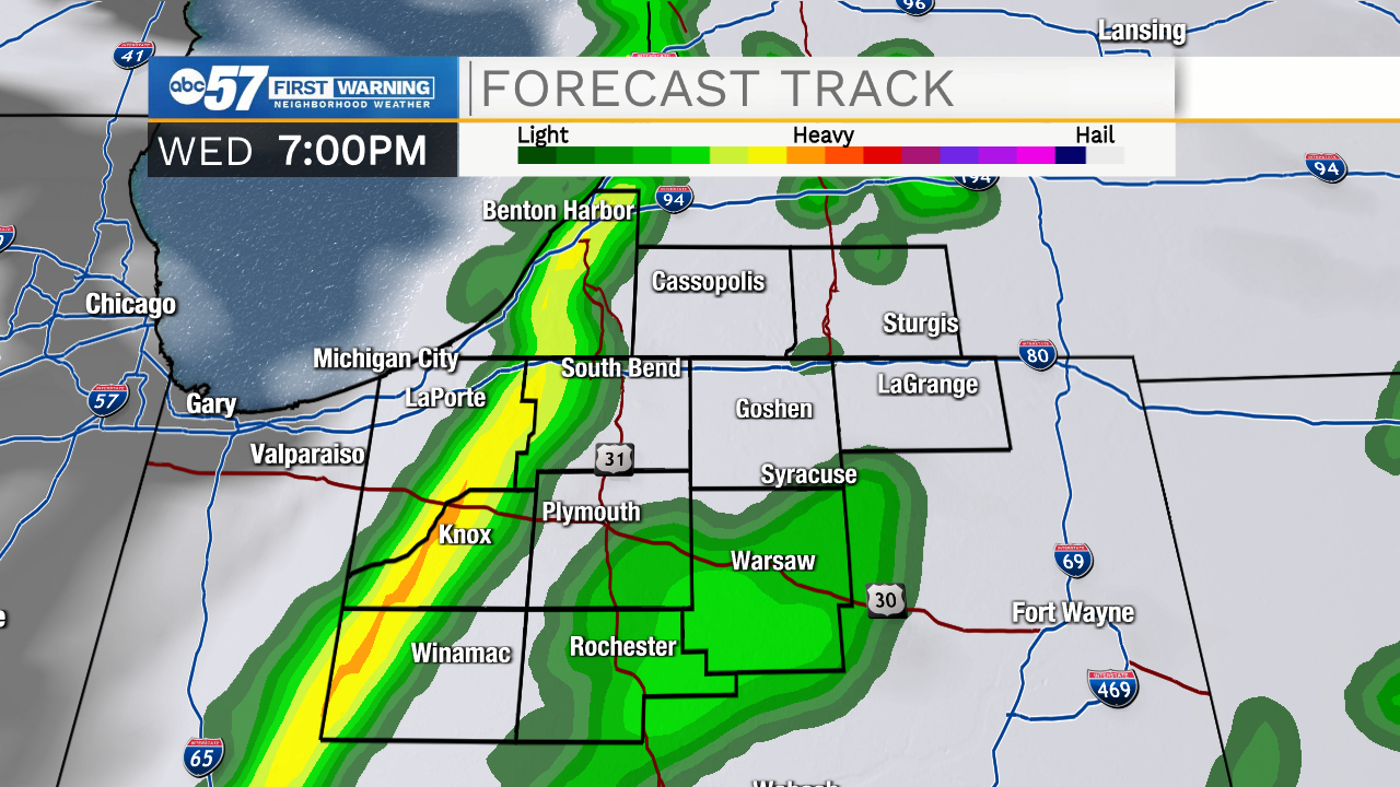
It gets windy with a few gusts 35 mph possible. Rain arrives Wednesday afternoon, and it will stay rainy throughout the evening and overnight hours.
Early Thursday morning, precipitation switches to snow with much cooler temperatures. Christmas Eve has a high of 24 degrees, which will seem cool to us after enjoying mostly mild temperatures this season. Most of the day Thursday is dry, but there are more lake effect snow showers Thursday overnight.
If you're heading out early Christmas morning, temperatures are around 12 degrees, but wind chill could be in the single digits.
Lake effect snow showers are in the Christmas morning forecast, but they might only impact our northern counties.
Slightly warmer temperatures and mostly dry weather are back for the weekend.
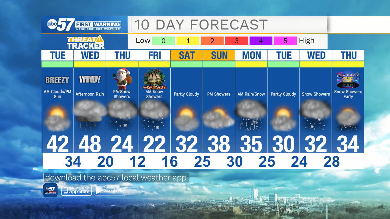
Today: Mostly cloudy to partly cloudy. High 42.
Tonight: Mostly cloudy. Low 34.
Wednesday: Rain starting in the afternoon. Windy. High 48.
Thursday: Cooler with PM snow showers. Breezy. High 24.