


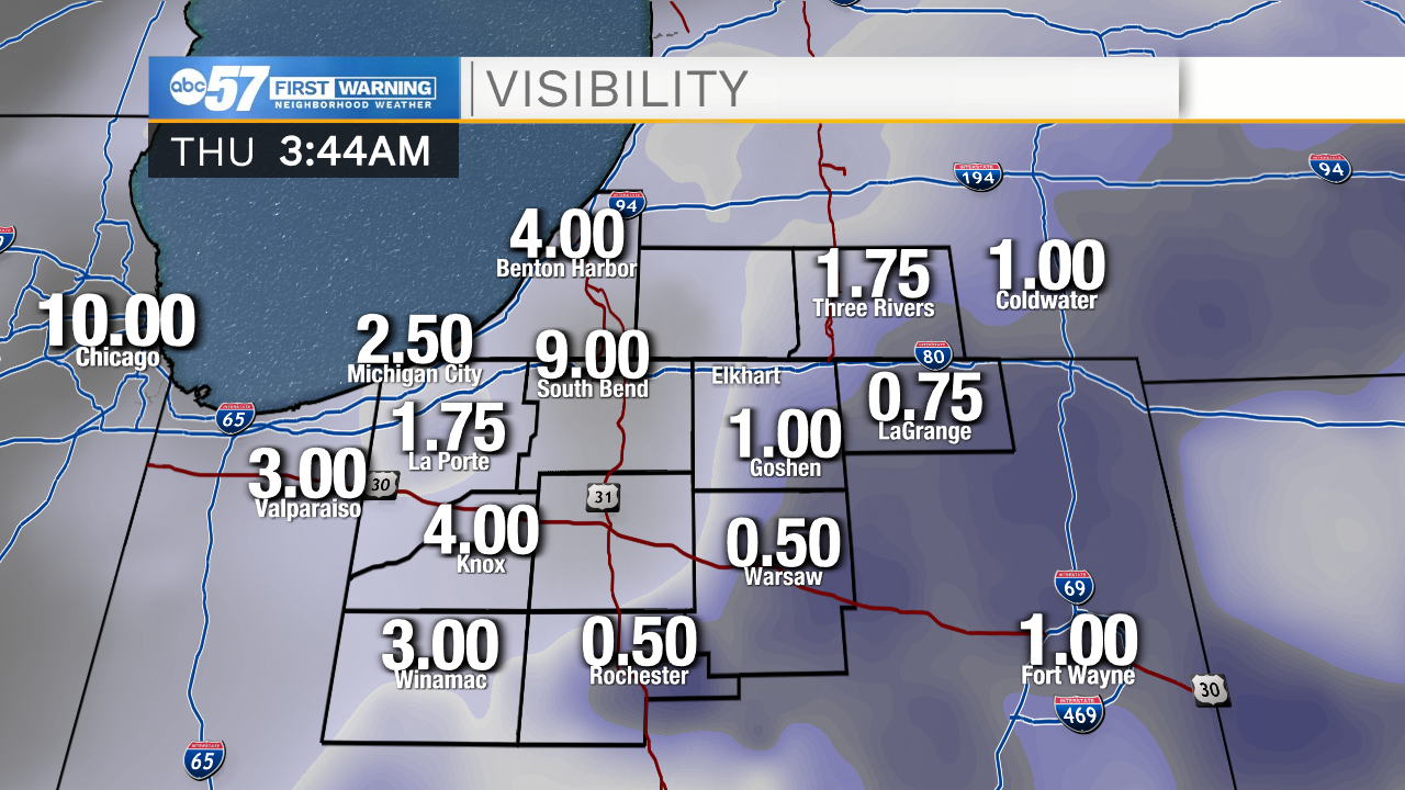
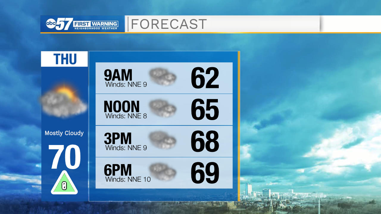
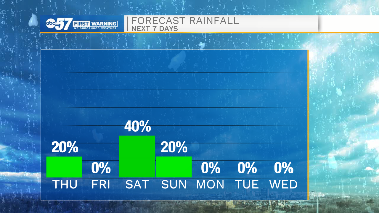
Patchy fog will begin to clear out around mid-morning. Cloudy conditions and isolated areas of patchy drizzle and light rain will stick around throughout the day. Counties along the Lake Michigan shore line will hold the best chances to see the rain activity later today. Highs this afternoon will be around 70, with a few areas likely to stay in the upper 60s. Tomorrow afternoon cloud cover will begin to clear, allowing for a few peaks of sunshine, which will help to warm temperatures into the lower 70s. Saturday, another cold front moves in giving way to rain and storm chances during the afternoon and evening. Rain activity should clear by Sunday morning.
Next week cloud cover clears, sunshine returns, and dryer conditions settle in. Expect lots of sunshine Monday through Wednesday with high temperatures in the mid to upper 70s. Thursday evening low rain chances return to the forecast, and stick around into Friday morning.
Today: Mostly cloudy, drizzle. High 70.
Tonight: Mostly cloudy. Low 55.
Tomorrow: Mostly to partly cloudy. High 72.
Saturday: Scattered rain and storms. High 78.