
-
2:37

Local Beef-A-Roo employees still owed paychecks as private equity...
-
1:42

More storms through 8:00 p.m.
-
1:06

2nd annual Inclusive Art Fair
-
2:20

Tracking severe weather through the mid-afternoon
-
3:17

Applications open for Fall Citizens Police Academy in South Bend
-
2:23

Elkhart County 4H Fair food vendors celebrate 50th year of business
-
2:16

Young football athletes learn about protecting their bodies,...
-
1:24

Storm track timing could be shifting
-
0:57

Unity Gardens brings music, food, and crafts for Westside BBQ...
-
1:50

Quiet evening, Storms after Midnight
-
0:57

Deer Creek Hunt Club throws a skeet shoot event for Deputy Jon...
-
1:44

Two rounds of storms Monday

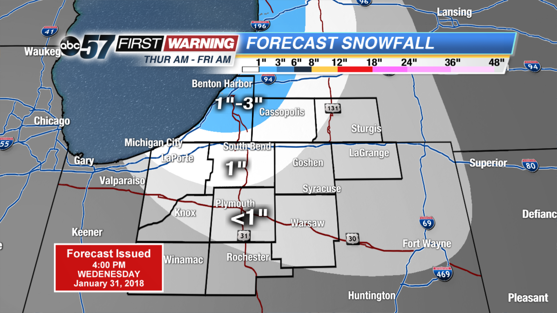
Temperatures fall through Friday, as bitter cold returns to start February. Highs are unlikely to break the freezing mark for at least the next week. An active pattern will bring a chance of snow about every other day. The quick moving systems may not bring a lot of snow individually but will add to the snowfall as a whole. The best chance for widespread accumulation is Friday.
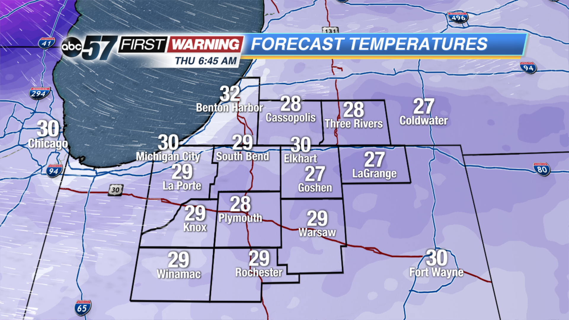 Temperatures Thursday Morning
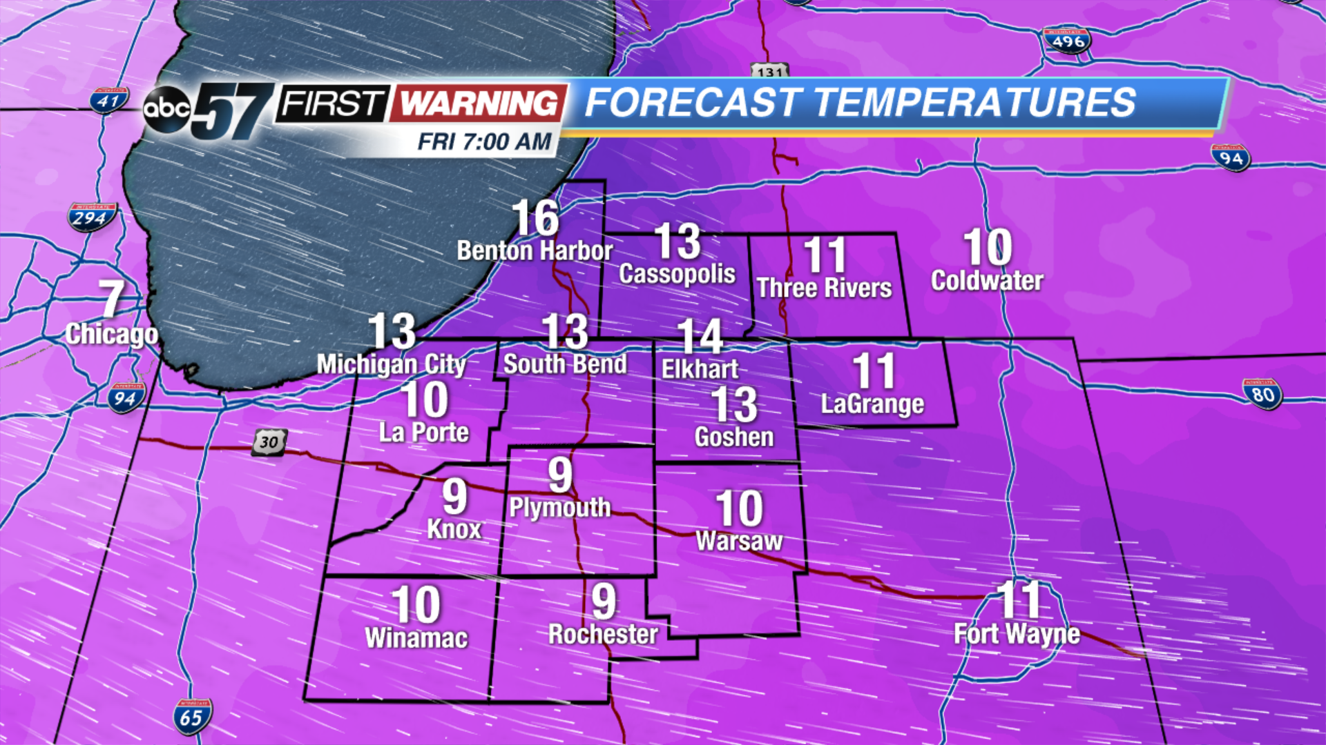 Temperatures Friday Morning
Tonight: Mostly cloudy, low of 30.
Thursday: Mostly cloudy with lake effect snow developing, temperatures fall from 32.
Friday: Partly cloudy, chance of snow early, highs in the teens.
Saturday: Snow by the afternoon, highs near 30.
Sign up for the ABC 57 Newsletter