
-
1:00

NIPSCO workers rally in South Bend for new contract
-
1:53

Severe weather threat is over, MUCH colder Friday
-
3:43

South Bend Mayor James Mueller delivers 2026 State of the City...
-
0:52

Family and friends of Adrian Cruz voice frustration in sentencing...
-
2:13

Potawatomi Zoo prepares for opening day with new attractions
-
2:54

Local expert weighs in on landmark social media decisions
-
1:33

Round one of storms moving east, Round two arriving soon
-
2:38

Bourbon residents recall tornado as severe weather strikes again
-
1:34

Tornado threat decreasing, but severe weather still expected...
-
1:42

Damaging winds and hail move in this evening
-
2:51

Severe weather expected in Michiana later today
-
2:15

Severe weather likely for portions of Michiana later today

Cool and sunny Wednesday, and chilly again Wednesday night. A clipper system will bring a blast of cold air Thursday night into Friday and that could be a few snow flurries. Snow is not expected to be significant but with lows in the 20s Friday morning, flakes off the lake are possible. The pattern remains cold through the weekend, a chance of snow changing to all rain Sunday.
Tonight: Partly to mostly clear, low 30.
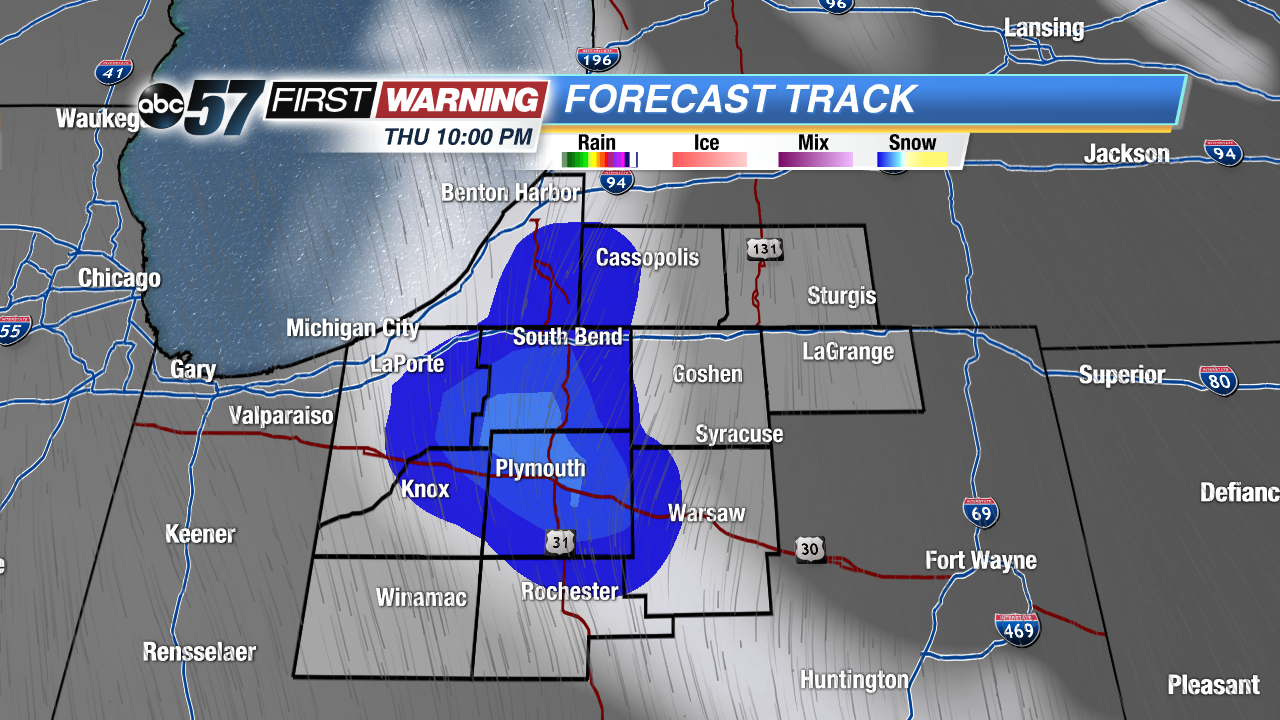 Lake effect flurries are possible Thursday night
Wednesday: Sunny, highs of 46.
Thursday: Partly cloudy, chance of mix/snow late, high 42.
Friday: Morning flurries, highs in the mid-30s.
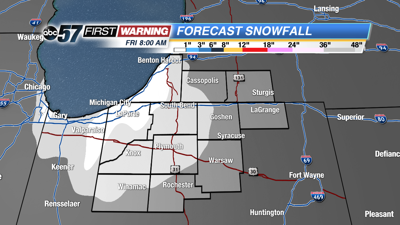 Early snowfall estimates are minimal, little if any accumulation.
Sign up for the ABC 57 Newsletter