


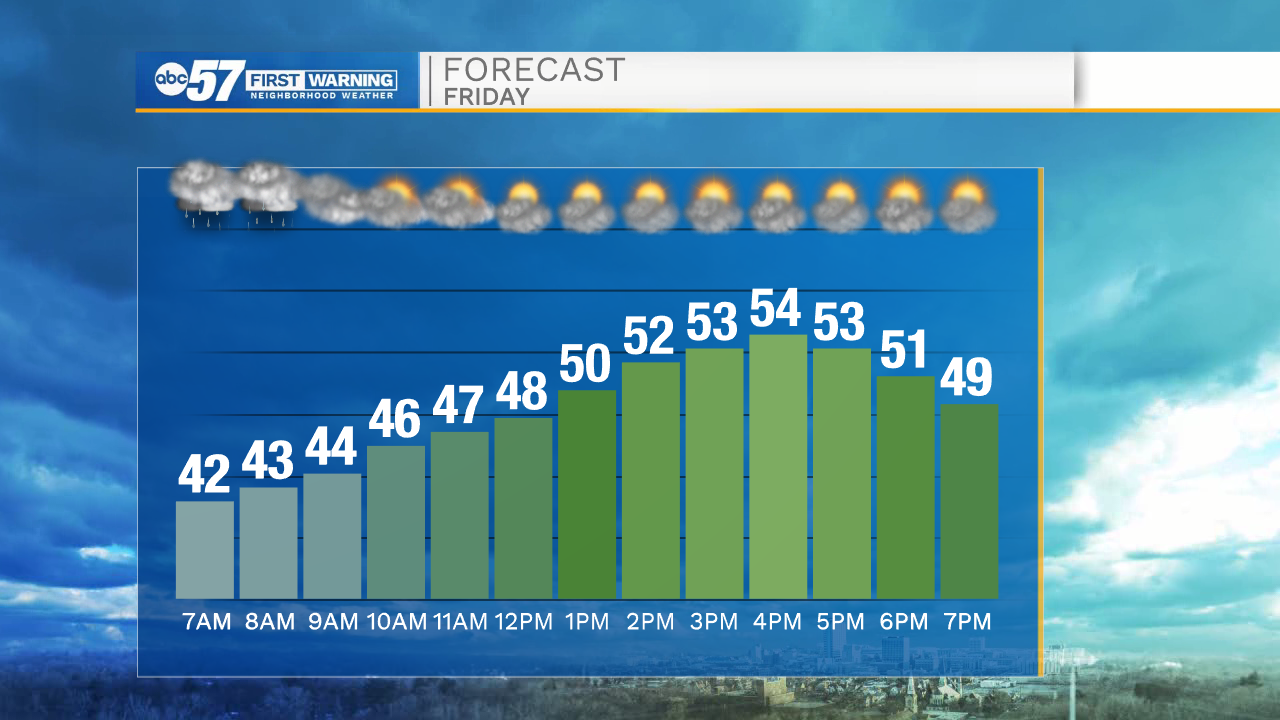
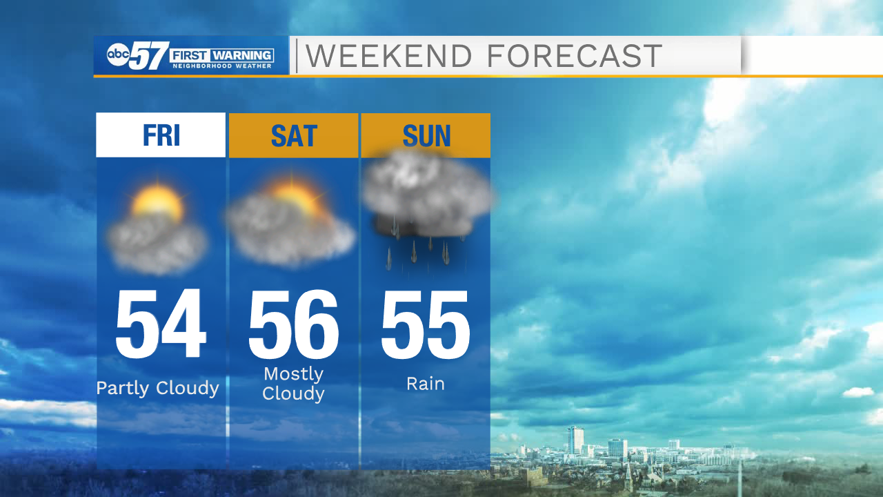
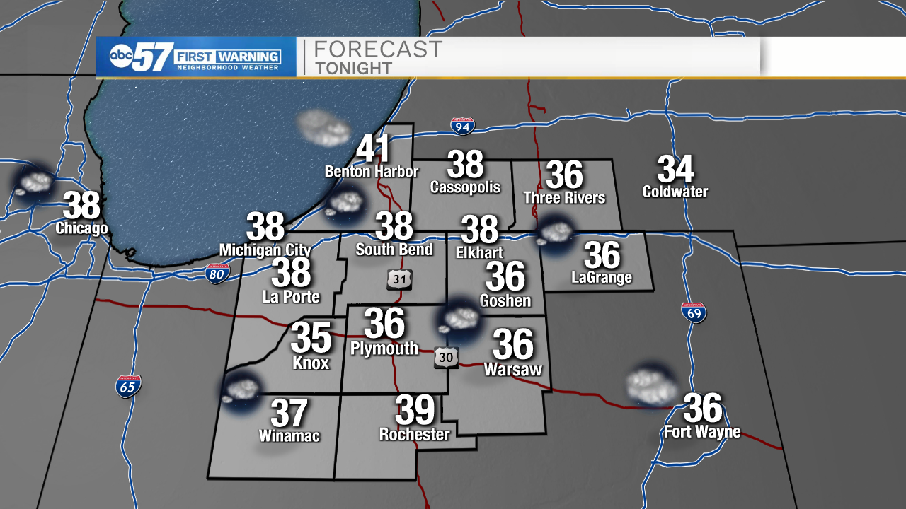
A few isolated lake effect rain showers will stick with us through the rest of the morning hours. Those will clear out and partly cloudy skies will remain for the afternoon. High temperatures today will only top out in the mid 50s. Tomorrow morning, temperatures will drop into the mid to upper 30s. This could produce a few areas of frost for portions of Michiana. Make sure to move temperature sensitive plants indoors, or cover up plants outside. Tomorrow afternoon high temperatures will be in the mid 50s. Tomorrow evening a few isolated showers are possible, with increasing chances as we head into the overnight hours. Scattered rain showers will stick around throughout most of Sunday morning and afternoon.
Dry weather looks more prominent next week. We will get some sunshine to return on Monday with highs in the lower 60s. Tuesday into Wednesday morning there are low rain chances, but overall most look to stay dry. Highs will slowly warm into the upper 60s on Tuesday. Highs for next weekend look to hit the low to mid 70s.
Today: Partly cloudy. High 54.
Tonight: Partly cloudy. Low 38.
Tomorrow: Mostly cloudy. High 56.
Sunday: Scattered showers. High 55.