


ABC 57 First Warning Neighborhood Weather
Monday May 11th, 2020
Morning clouds and isolated lake effect rain/mix will break up this afternoon. Daytime highs remain cold in the mid-40s and breezy conditions. Sunshine sticks around for Tuesday and Wednesday with temperatures starting to warm up. We top out in the mid-60s by Wednesday and low 70s on Thursday.
It does turn active towards the end of the week. Scattered showers and storms move through Thursday with lingering showers into Friday morning. Saturday looks drier with just a chance of isolated thunderstorms before more widespread thunderstorms are possible on Sunday. Thankfully temperatures look to remain warm through the middle of next week!
Today: Cloudy morning to partly sunny afternoon. High 47.
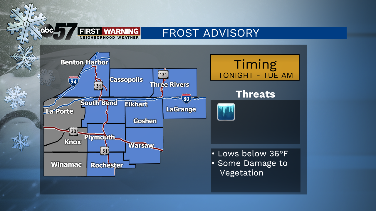
Tonight: Mostly clear. Low of 34.
Tuesday: Mostly sunny. High 57.
Wednesday: Mostly to partly sunny. High 64.