


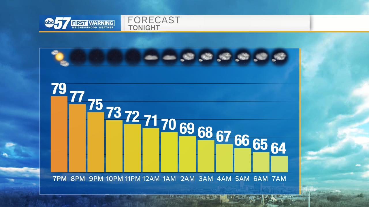
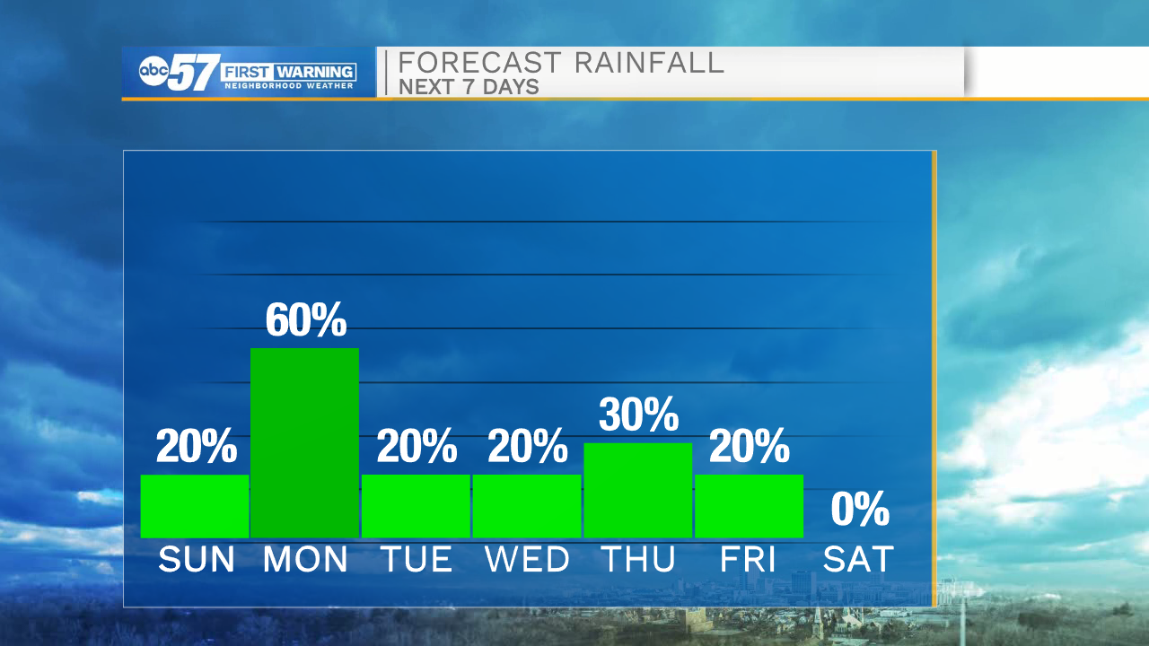
Clear skies will remain in the forecast for this evening until midnight. After midnight clouds will start to move in, which will help keep temperatures into the mid 60s tomorrow morning. Tomorrow afternoon cloud cover will continue to increase as a cold front approaches out of the northwest. Highs tomorrow will top out in the mid to upper 70s. Rain showers will move in out of the northwest as well by late afternoon and evening. A line of heavy downpours will move through during the overnight hours into the early morning Monday. Monday afternoon showers will turn isolated, and high temperatures will only hit the mid 60s.
Tuesday and Wednesday, isolated showers are possible. A secondary round of scattered showers look to move in on Thursday. High temperatures will drop all the way into the lower 40s by Friday afternoon. Next weekend looks dry for the most part, but a few isolated showers are possible late Saturday night into Sunday.
Tonight: Partly cloudy. Low 74.
Tomorrow: Mostly cloudy/isolated showers. High 78.
Monday: Scattered showers in the morning. High 64.
Tuesday: Isolated showers. High 62.