
-
1:33

Cool out the door, Mild by afternoon
-
1:50

Top Ten Snow Year 2025-26
-
1:17

South Bend Cubs unveil fan-focused upgrades ahead of Opening...
-
2:21

Notre Dame Fighting Irish ready for spring football
-
2:06

Fighting Irish using time off to refocus ahead of spring practice
-
2:35

What are the privacy implications of SBPD’s ’Drone as First...
-
1:22

Expert discusses Wednesday’s Fed decision
-
3:19

New legislation could make Michigan the 30th constitutional carry...
-
2:15

SBPD using drones to help improve response time
-
1:20

The March roller coaster ride continues
-
1:52

Snow today, rain tomorrow, and warm this weekend
-
0:49

Celebrating St. Patrick’s Day at Corby’s Irish Pub

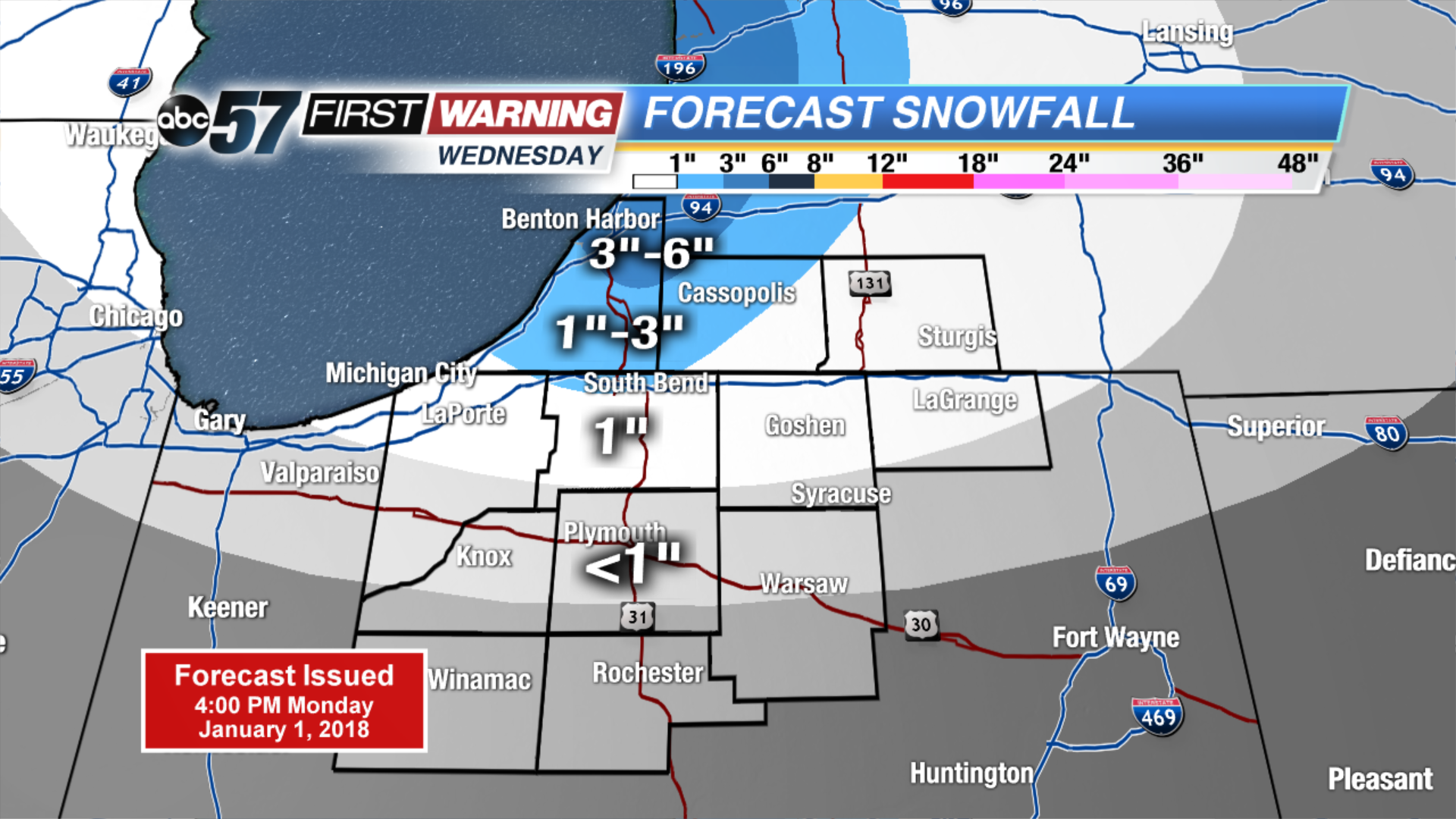
Tuesday may be the coldest day so far in the Frigid holiday season, temps start well below zero and highs will not break into the double digits. The wind chill will also be a factor staying mostly subzero. There is a short break from snow with mostly sunny skies. The next round of snow will be Wednesday – Thursday with another clipper, plus lake effect. Amounts will not be extreme but some areas could see another three to six by Friday morning.
Tonight: Partly to mostly clear, low of -8.
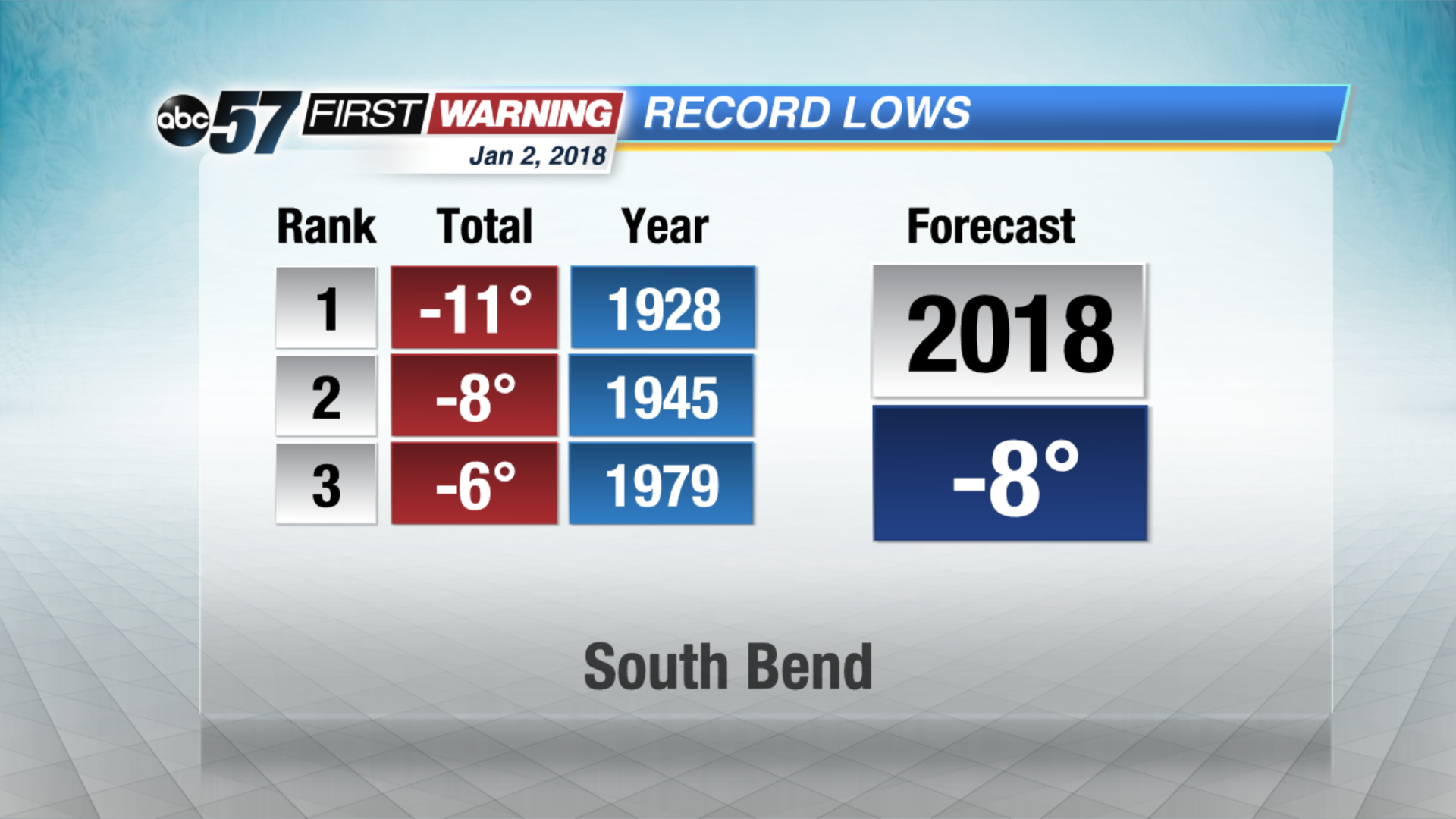 Forecast nearing record lows Tuesday morning
Tuesday: Mostly sunny. Highs near 6.
Wednesday: Mostly cloudy, afternoon and evening snow showers, high of 14.
Thursday: Lake effect snow showers, highs in the lower teens.
Sign up for the ABC 57 Newsletter