


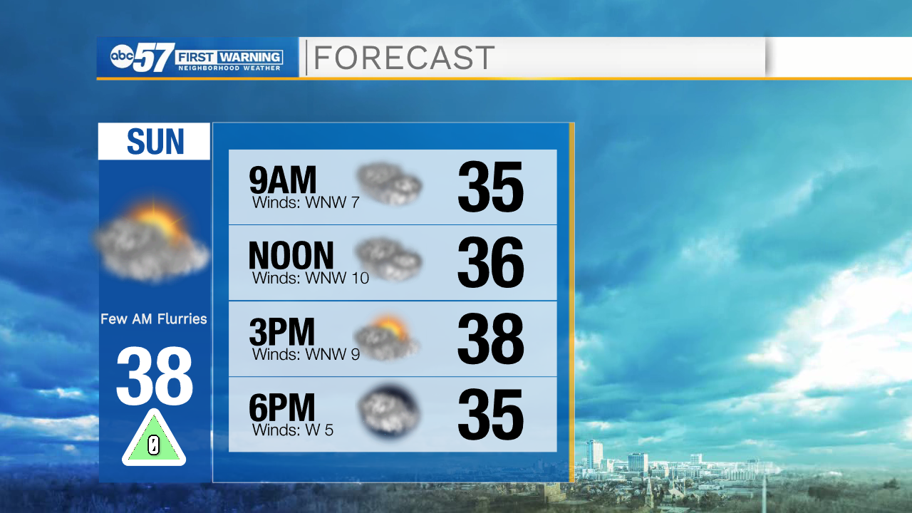
Other than a few scattered snow flurries early this morning, Sunday should stay dry but cool.
Temperatures are starting in the low to mid 30s this morning, and because of cloud cover, won't warm up much. The high will be in the upper 30s. Running errands or going Christmas shopping this afternoon will feel chilly, but at least you'll stay dry.
The cool conditions will carry over into the start of the work week. Monday morning temperatures are in the upper 20s, with an afternoon high of just 34 degrees. It will feel a little breezy Monday afternoon. The work week should stay dry, although there is a chance for precipitation Tuesday night into early Wednesday morning- this system looks to stay south of Michiana but the southeastern part of the viewing area could see a few showers. The end of the work week will be back to seasonable temperatures, with daytime highs in the mid to upper 30s Thursday and Friday.
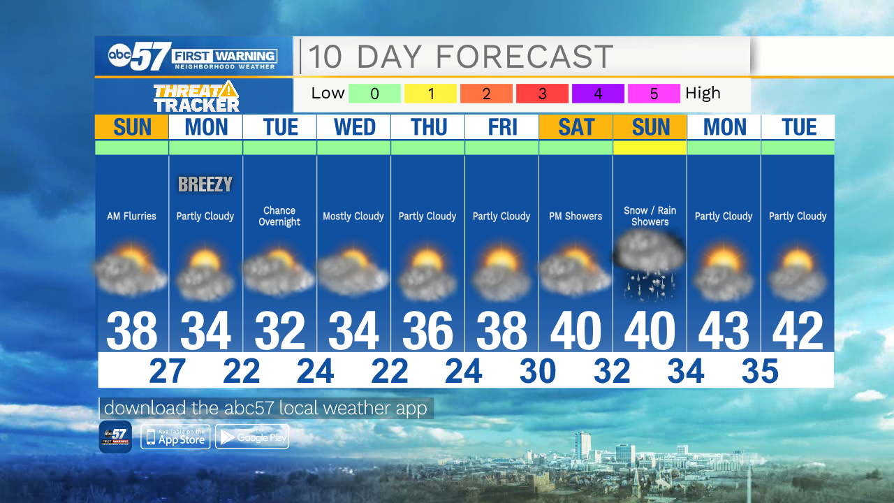
Today: Mostly cloudy. High 38.
Tonight: Partly cloudy and cool. Low 27.
Monday: Partly cloudy. Breezy and cool. High 34.
Tuesday: Mostly cloudy and cool. High 32.