
-
0:58

Goshen City Council amends DORA rules amid community concerns
-
1:20

SB Common Council adopts Downtown 2045 Plan
-
2:39

Friends and family celebrate life of Jamecia Moffitt
-
1:15

St. Joseph County Council updates residents on Affordability...
-
0:51

Locals gather to recognize farmworkers across Northern Indiana
-
2:07

Impact of higher gas prices for delivery drivers
-
3:43

ND Eviction Clinic exposes ’shameful’ living conditions at...
-
3:59

Neighbors share traffic, noise concerns about proposed Capital...
-
1:50

Leaf pick up resumes in South Bend after weather postpones service...
-
1:02

Another rollercoaster ride to end the week
-
3:41

Present Pillars to host “Dad Strong 5K“ to support fathers...
-
1:44

Warming up through Wednesday

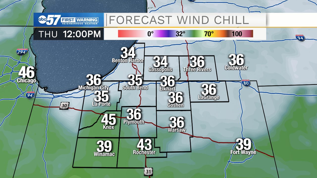
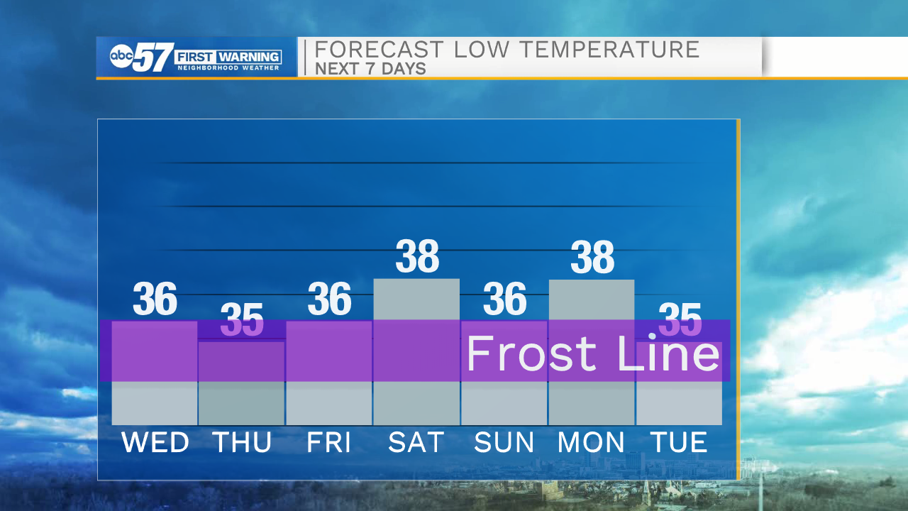
Thursday is the most unpleasant weather day this week, as high temperatures struggle to reach 50 and the wind chill in the upper 30s. A brief sprinkle off the lake is also possible. The weather improves for the weekend but there is not a big warm-up, has highs stay below seasonal normal, ranging 55 to 60. The forecast is dry until at least Tuesday of next week. The greatest threat of frost is Friday morning, especially if clouds break.
Tonight: Partly cloudy. Frost possible. Low 36.
Thursday: Mostly cloudy, isolated shower possible, breezy. High 48.
Friday: Mostly sunny. High 55.
Saturday: Mostly cloudy. High 56
Sign up for the ABC 57 Newsletter