


After temperatures started chilly (in the low 30s) this morning, we are on the rebound now. Temperatures reach a high this afternoon around 62.
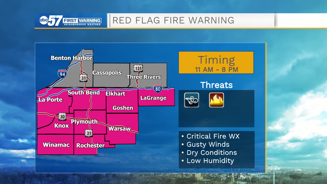
Skies are mostly cloudy today, but it should stay dry. The bigger weather threat today is wind. Wind picks up this afternoon, blowing 20-30 miles per hour by the afternoon. A few wind gusts could be up to 40 miles per hour. Because of the windy and dry conditions, there is a red flag warning for fire weather. There shouldn't be any outdoor fires during these hours-- including no burning leaves, or bonfires. Additionally, be sure any outdoor decorations are secure before it gets windy this afternoon.
Overnight temperatures fall into the upper 40s under mostly cloudy skies. It is still windy overnight. Sunday is another mostly cloudy day, and we’ll see a round of showers during the afternoon and evening. After the showers, wind starts to calm heading into Monday.
The work week has additional rain chances Monday, Tuesday evening, and Thursday night/Friday morning. Temperatures gradually warm each day through Thursday (high 66F) before cooling into the 50s again for next weekend.
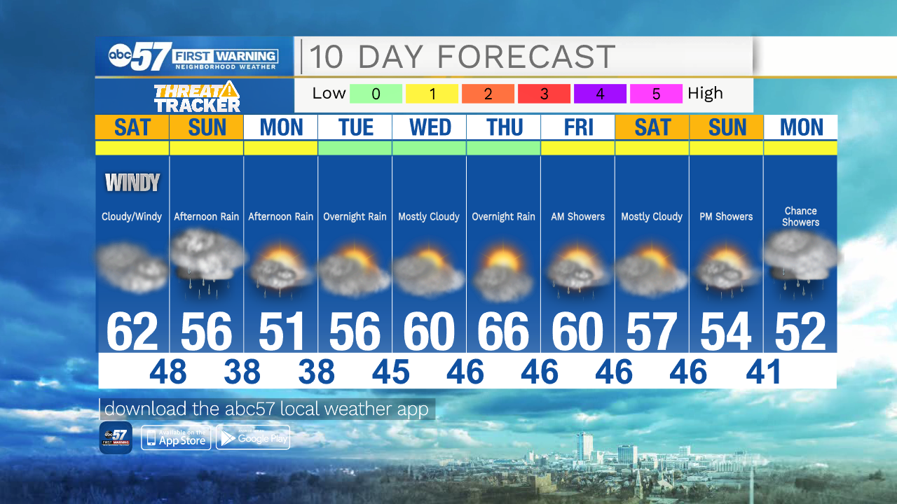
Today: Mostly cloudy. Windy afternoon (20-30 mph). High 62.
Tonight: Mostly cloudy. Windy. Low 48.
Sunday: Cloudy. Afternoon rain showers. High 56.
Monday: Mostly cloudy. Afternoon rain showers. High 51.